Latest news about
Carmenta Engine, Carmenta Server, Carmenta Server Core, Geospatial Technologies

Geospatial Technologies
April 13, 2021
A virtual event with Geoawesomeness
A successful virtual event with Geoawesomeness: “Location Intelligence and the Counter-Drone use case. Innovation and cutting-edge technology in the Counter Unmanned Aerial Systems (C-UAS) market”. Did you miss the event? …

Geospatial Technologies
March 23, 2021
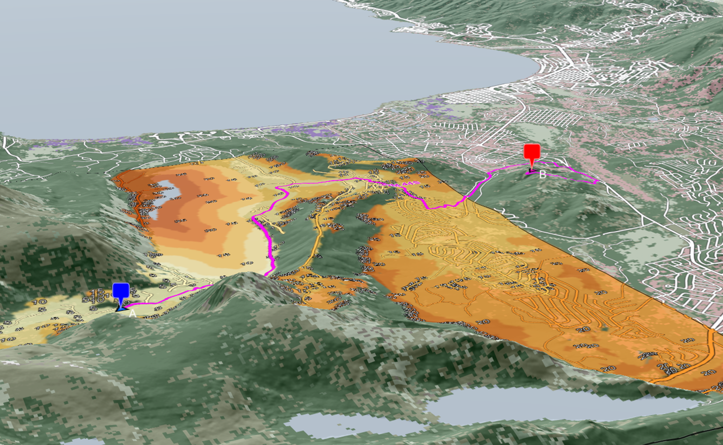
On the right track: Leveraging terrain data for next-level vehicle routing
Solutions for navigating vehicle routes through the leveraging of road data have become more widely available in the last decades, and today most of us have this functionality at our …

Geospatial Technologies
February 26, 2021
SURVEY Copter, using Carmenta Geospatial Technologies, selected by the French Navy
SURVEY Copter is a subsidiary of the AIRBUS Group and a global pioneer in the design, production and customer operational support of mini UAVs. The company recently signed a contract …
Geospatial Technologies
December 18, 2020
Carmenta Server 4.7 and Carmenta Server Core 2020.0 released
Carmenta is pleased to announce the release of Carmenta Server 4.7 and Carmenta Server Core 2020.0, our web map server targeting Windows Server and the Docker container platform. The new …
Geospatial Technologies
November 26, 2020
Carmenta Engine 5.14 released
Carmenta is pleased to announce the release of Carmenta Engine 5.14, our powerful geospatial software development kit for Windows, Linux and Android. The new release introduces the ability to display …
Geospatial Technologies
November 9, 2020
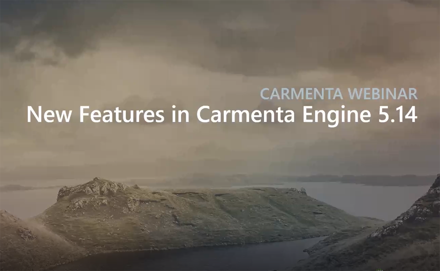
A successful webinar about our upcoming release Carmenta Engine 5.14
Join our experienced engineers to get a hands-on look at what’s new in the upcoming Carmenta Engine 5.14. We will demonstrate features such as volumetric line-of-sight, 3D full-motion video and …

Geospatial Technologies
October 5, 2020
Carmenta Geospatial Technologies is thrilled to announce partnership with MBDA to develop innovative solutions for EDIDP project LynkEUs
Image: © MBDA / Adrien Daste The EDIDP (European Defence Industrial Development Programme) project LynkEUs is the first technological and industrial contribution to the objectives of the Permanent Structured Cooperation …

Geospatial Technologies
June 26, 2020
A successful webinar about taking your UAS missions to a higher level using real-time geospatial analysis
This webinar presents the advantages of using Carmenta Engine combined with High Resolution data in a UAS mission planning, operation and debriefing, see the webinar:

Geospatial Technologies
June 2, 2020
Carmenta Server 4.6 SP2 released
Carmenta is pleased to announce the release of Carmenta Server 4.6 SP2, a service pack for Carmenta’s powerful web map server for Windows Server. The service pack contains bug fixes …
Geospatial Technologies
May 20, 2020
Carmenta Engine 5.13.1 released
Carmenta is pleased to announce a service release (version 5.13.1) of Carmenta Engine, the powerful map engine for Windows, Linux and Android. The service release contains various stability improvements. For …
Geospatial Technologies
May 8, 2020
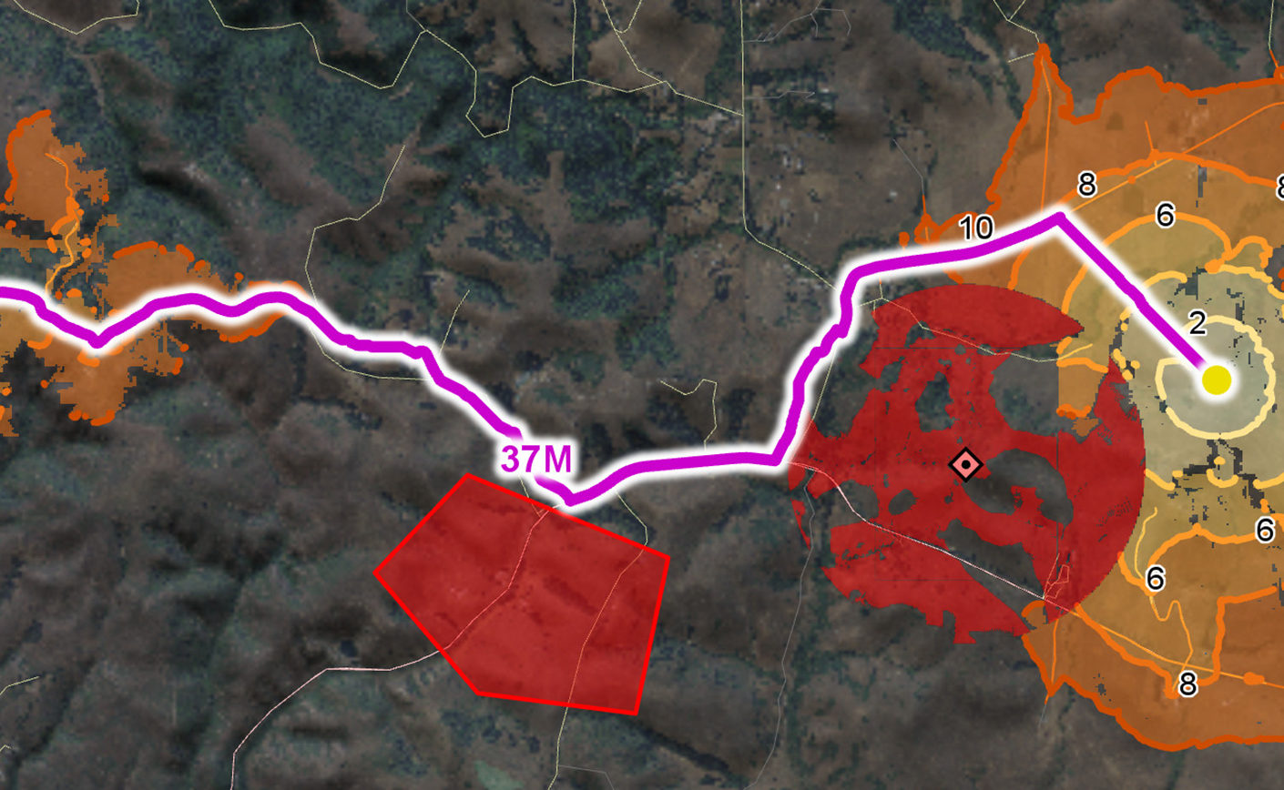
Taking UAS intelligence to a higher level
Carmenta Engine is a powerful situational-awareness platform for designers of UAS applications. Integrated into your system, Carmenta Engine brings a higher level of intelligence to both remotely controlled and fully …

Geospatial Technologies
March 17, 2020
Carmenta welcomes the Defence Science and Technology Laboratory (Dstl) in UK as a new customer
Carmenta Geospatial Technologies is proud to announce that Dstl, UK MOD’s innovative science and technology contributor to the defence and security, has selected Carmenta Engine as one of its suppliers …