Error Correction of Georeferenced Photos
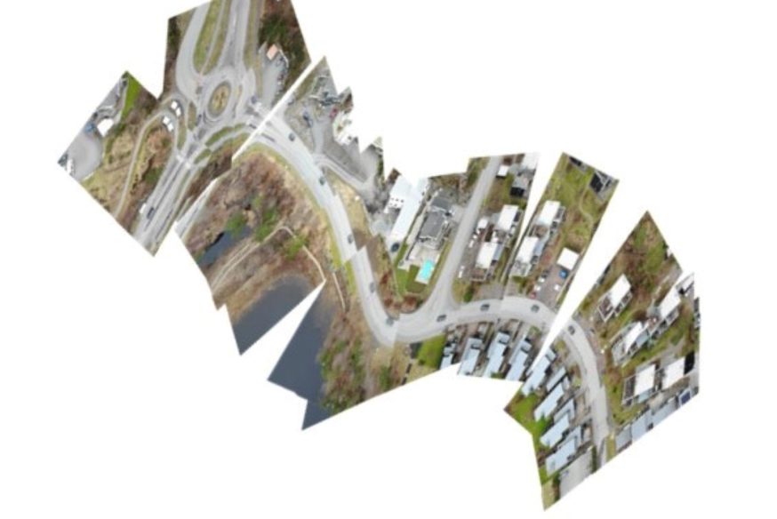
A series of aerial photographs of terrain, such as frames from a video captured by a drone, can be composed together and rendered on the ground as one complete image.
Errors in recording the exact placement for these photographs can cause visible seams between them when laid out on the terrain.
The work consists of finding algorithms suitable for adjusting the placement of such photographs to make them fit together as seamlessly as possible.
The thesis should include a prototype error correction implementation in Carmenta’s geospatial technology.
It is suitable for students interested in computer vision
and feature detection.