Carmenta UAS Mission Planning Package
Kick-start Development with Carmenta Technology
Accelerate development of UAS Mission Planning Systems
Carmenta UAS Mission Planning Package provides the development team with a comprehensive set of proven and reliable tools, training, and services designed to expedite the creation of UAS applications tailored to your needs.
Why choose Carmenta UAS Mission Planning Package
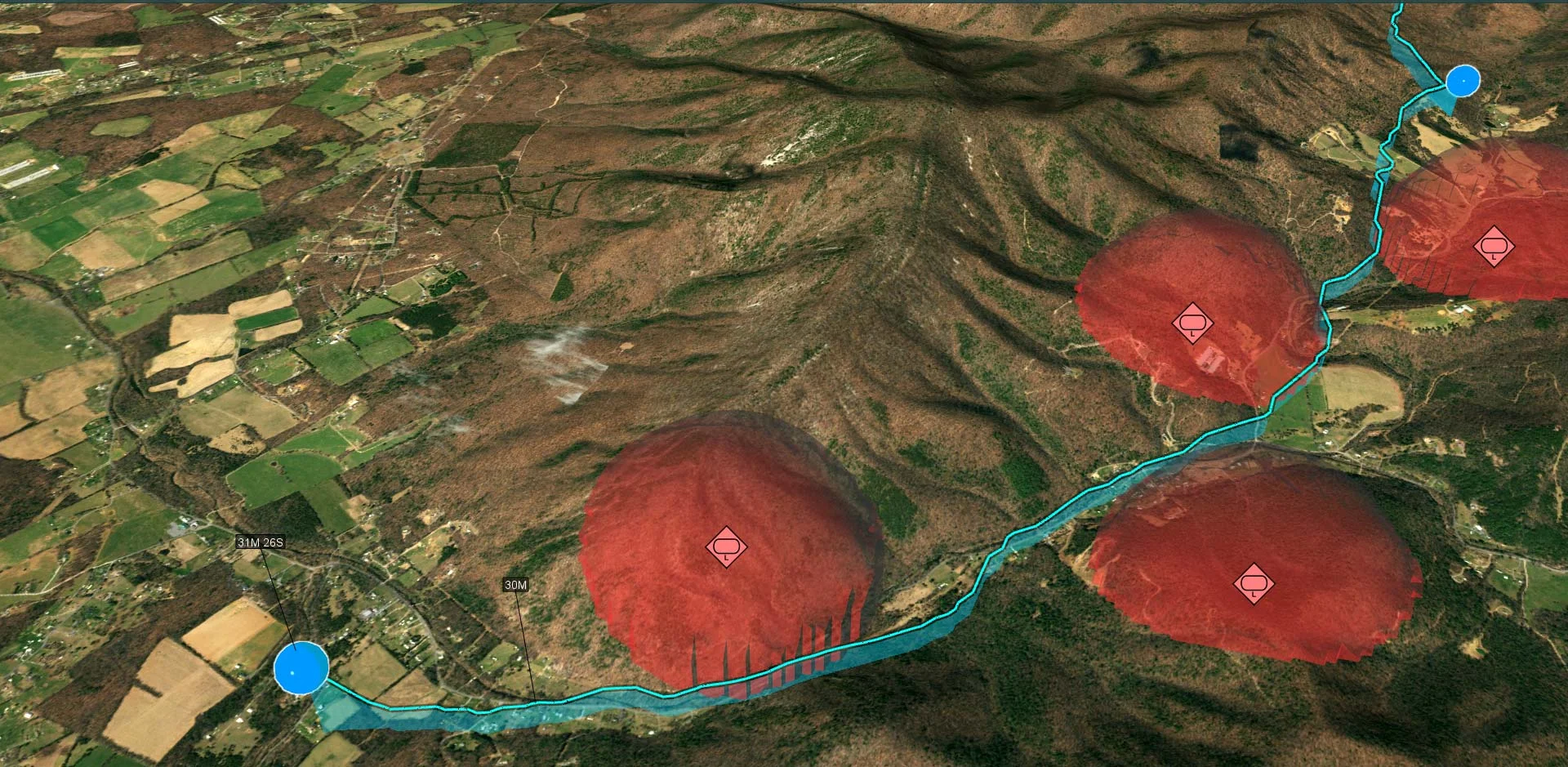
Plan Tactical Stealthy UAS Routes.
Find Optimal Observation Points.
Overlay Live Georeferenced Video.
Ensure Continuous Radio Communication.
Support Reconnaissance, Target tracking, and Resupply missions – just to name a few
In UAS Mission Planning Systems Carmenta’s real-time geospatial analysis and routing capabilities can cope with dynamic challenges, enhance situational awareness and support both human and autonomous decision-making. This will improve the predictability and reliability of UAS missions, and therefore the probability of mission success.
The Carmenta UAS Mission Planning Package enables risk-mitigated and efficient development of custom high-demand UAS Mission Planning systems for military or high-end civil use.
A solid base architecture and a tailored training give your development team the best possible starting conditions for the project. With proven UAS Mission Planning functionalities and expert knowledge of developing geospatial applications for UAS, you can develop your project with low risk.
The development team can utilize the Carmenta Engine SDK to further tailor and customize the developed application.
Key Features
Architecture and Modules
Carmenta UAS Mission Planning Package provides a base architecture for UAS mission planning applications based on Carmenta technology. It consists of a set of modules that provides common functionalities for UAS applications. These include various routing calculations, functionalities to decode and display georeferenced videos, and methods to export generated routes in standardized formats.
UAS route planning typically requires several user interactions. The following UI components are provided for this process:
- Management of route waypoints and mission parameters.
- Task planning and rehearsal, including simulated camera view and coverage on a 3D model of the environment.
- Playback with STANAG 4609 georeferenced video.
Tactical Stealthy UAS Routing
Calculate tactical deconflicted flight paths for various mission requirements. Optimized routes are generated in real-time based on mission parameters and are deconflicted towards terrain, buildings, airspaces, static and dynamic hazards, and other routes.
Other parameters include balancing constraints such as time, energy consumption, radio coverage, stealth, camera path, reachable emergency landing zones, synchronization with other moving vehicles, etc.
Placement and Mobility of Observers
Identify optimal observation positions for drone surveillance of an area, while also considering inputs such as radio coverage.
These could be either static observer points or a set of waypoints along an observation line. The objective is to ensure good coverage of the target area while simultaneously keeping within radio coverage of the ground station.
Standard Compliance
- MAVLink-compatible JSON mission plans.
- STANAG 4609 for georeferenced video.
- Export according to STANAG 4586.
- Package Contents.
- UAS library & components.
- Sample application to use as starting point.
- Workshop analyzing customer needs to kick-start project.
- Training on best usage of Carmenta technology for UAS.
- Support during development.
Technical Benefits
- The UAS library is available on several different platforms, including Windows and Linux on both x86 and arm64 architectures.
- Sample code is provided in C++ and designed to use Carmenta Engine SDK 5.16.1 and Qt 6.2.
Extend your horizons
Geospatial technology that empowers you to see more, know more, and make better decisions – in real time.