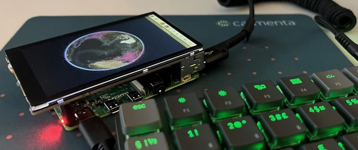
Carmenta Engine on Linux/ARM
Build and deploy Carmenta Engine applications to Linux/ARM (Raspberry Pi) in C++, .NET Core, or Java, with sample setup and run instructions.
Read moreBuild and deploy Carmenta Engine applications to Linux/ARM (Raspberry Pi) in C++, .NET Core, or Java, with sample setup and run instructions.
Read more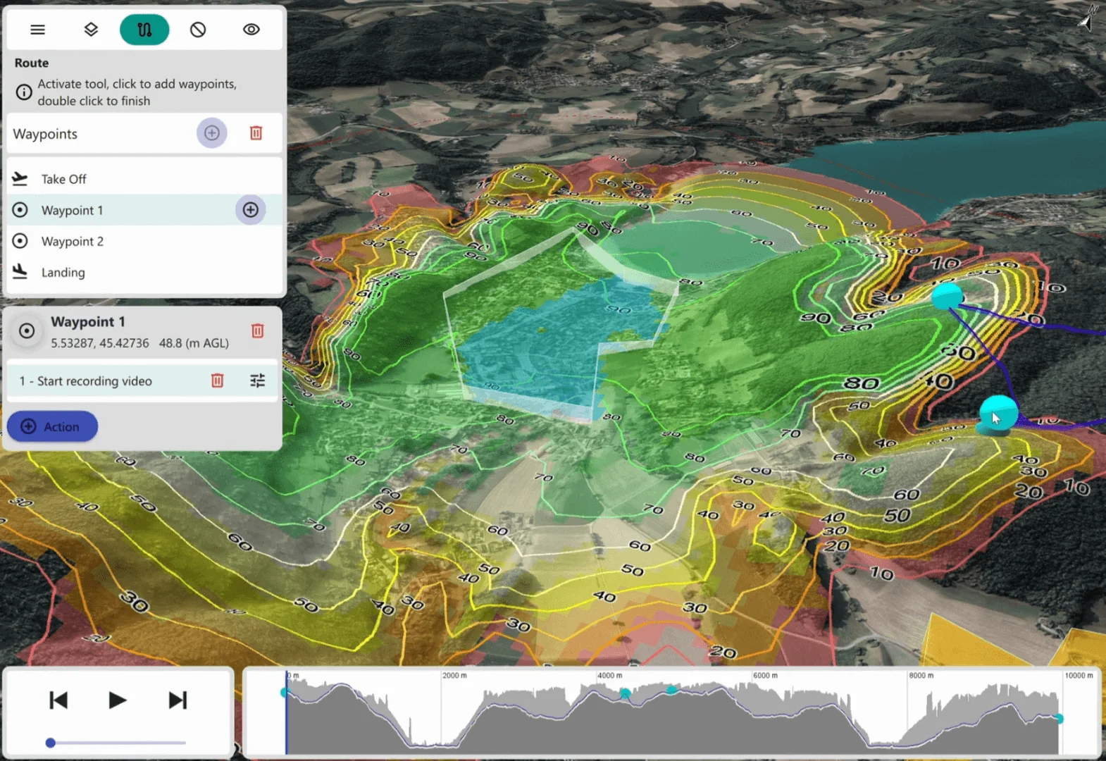
Discover Carmenta Engine's advanced routing capabilities for UAV and UGV mission planning, through the AirRouteOperator and TerrainRouteOperator. The article introduces concepts used in Carmenta UAS Mission Kit.
Read more
Learn how to call GetFeatures on Carmenta Engine operators to retrieve processed feature data directly in your application code using C#.
Read more
Learn how to create a custom tool in Carmenta Engine to decluster overlapping features. Step-by-step C# tutorial with code examples.
Read more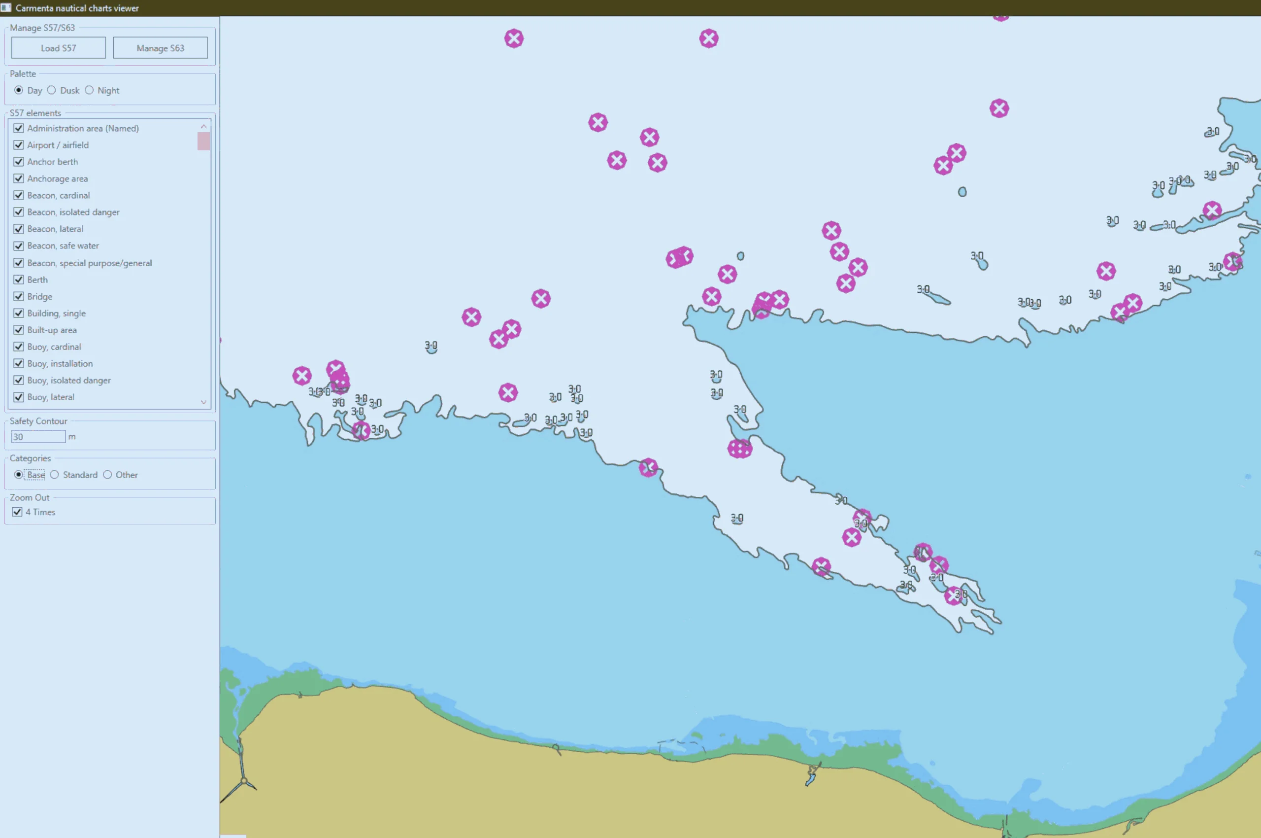
Learn how to set up S-63 encrypted nautical charts in Carmenta Engine. Step-by-step guide covering user permits, database creation, and visualization.
Read more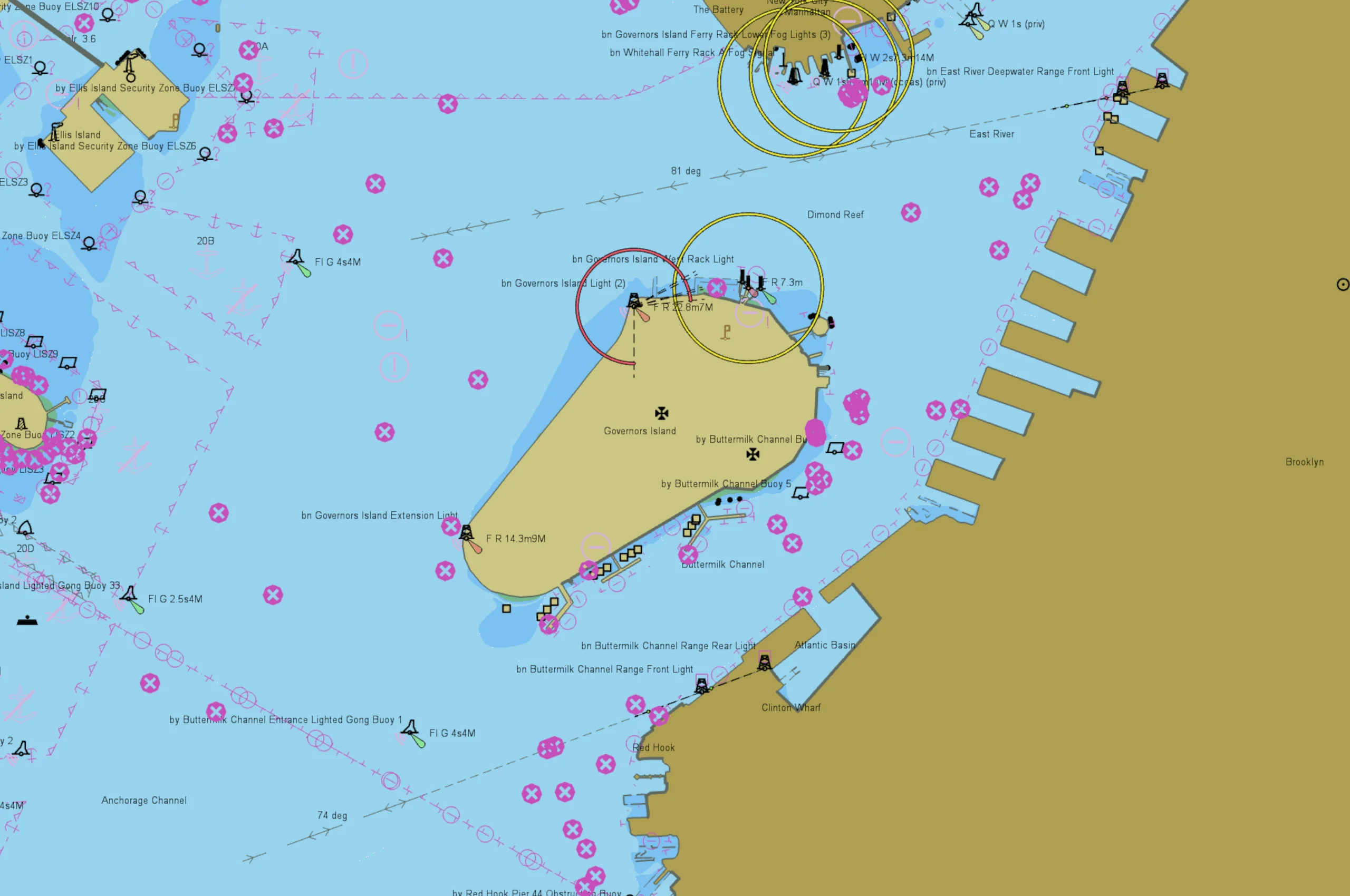
Learn how to interact with nautical charts in Carmenta Engine: query S57DataSet features, filter visualizations, and update S52Visualizer properties.
Read more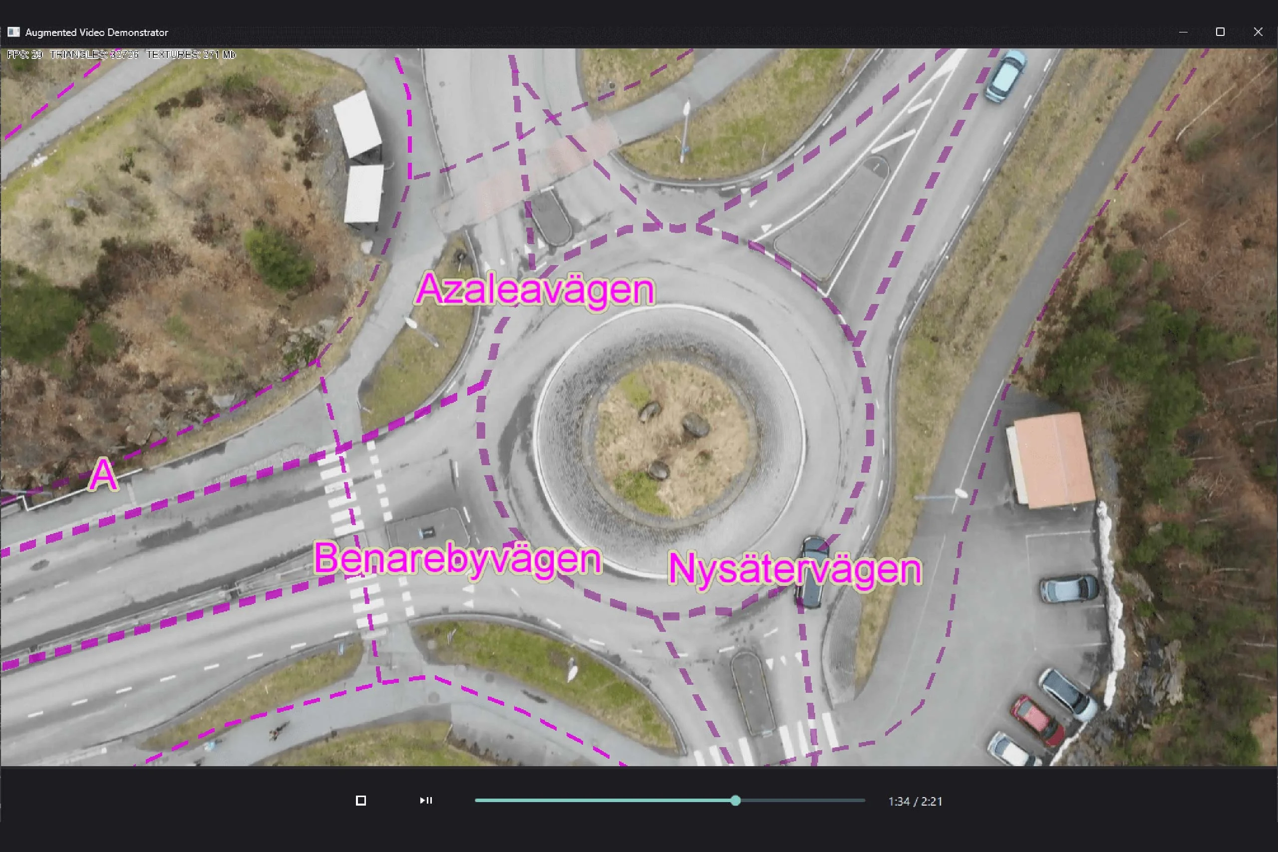
Explore how augmented video applications allow developers to overlay geospatial information on video feeds, enhancing the user's understanding of the environment.
Read more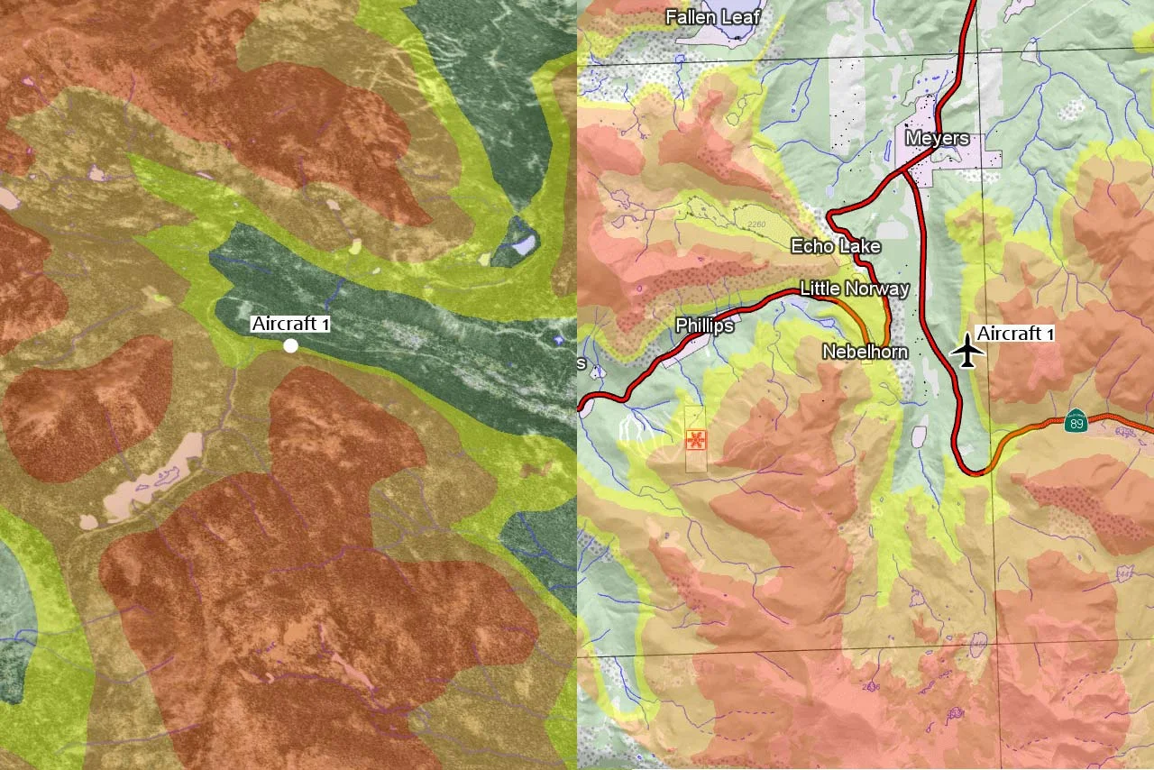
Learn how to configure terrain warning in 2D and 3D with Carmenta Engine using TerrainWarningOverlay and TerrainWarningOperator.
Read more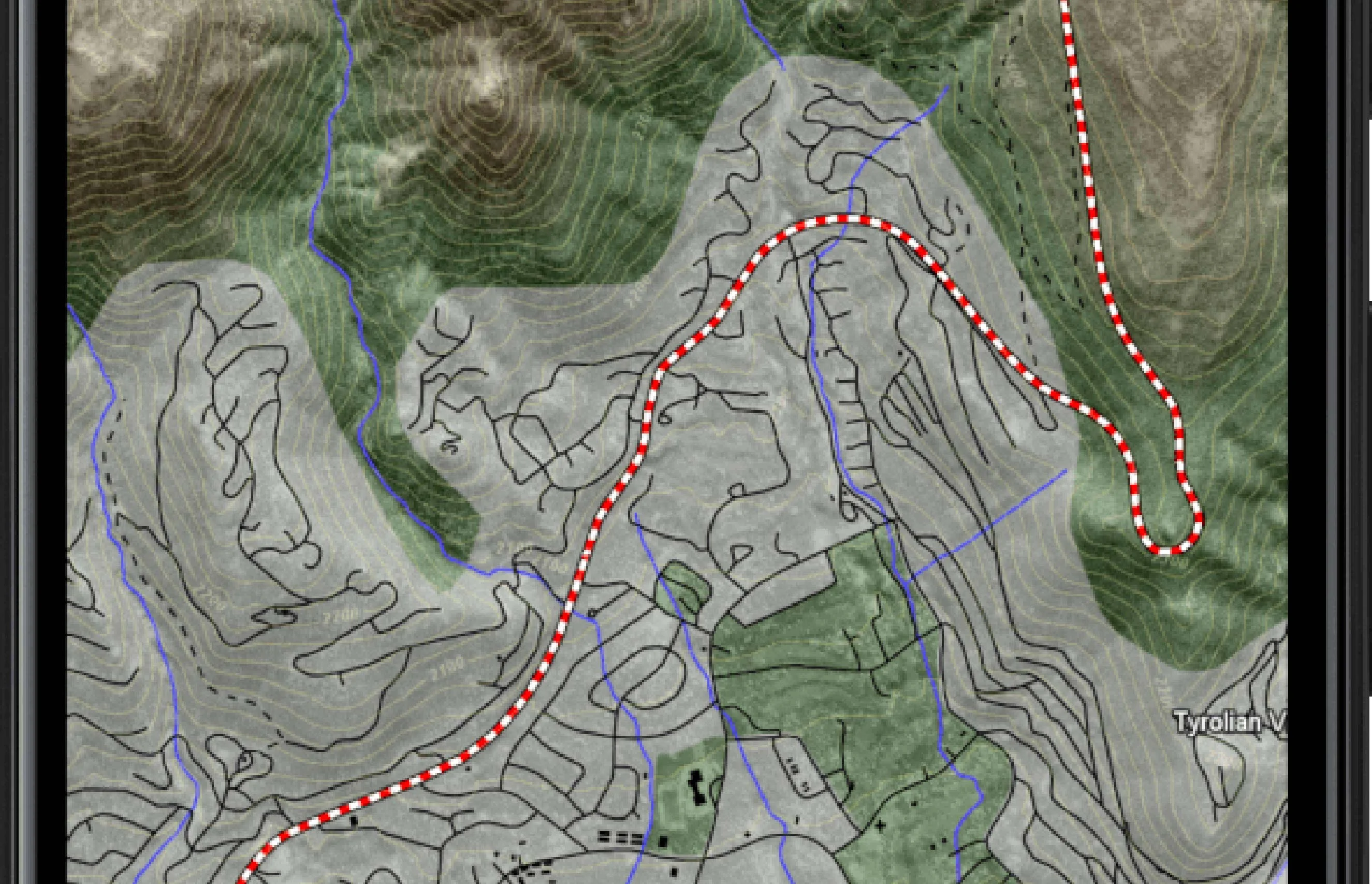
In this guide, we explore the process of building a basic application using Android Studio and Kotlin, specifically targeting Android 9 (API 28, Pie).
Read more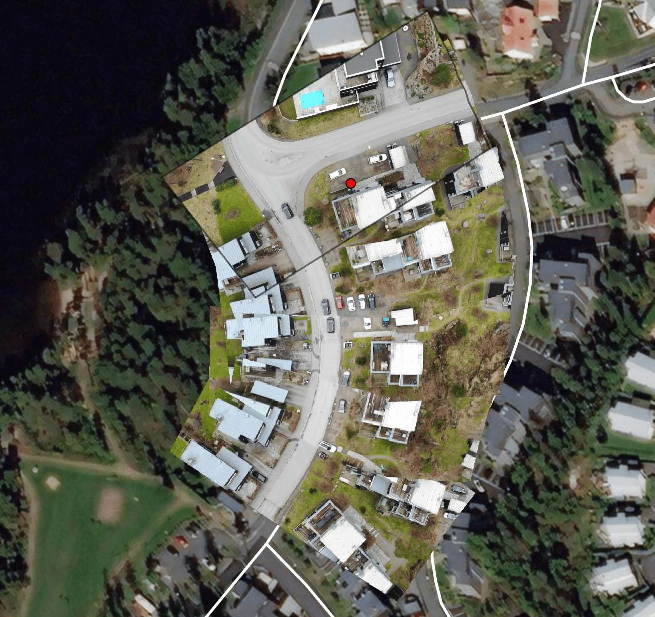
Learn how to use Carmenta Engine 5.17's MosaicWriter to stitch georeferenced drone video frames into GeoPackage mosaics for real-time mapping applications.
Read more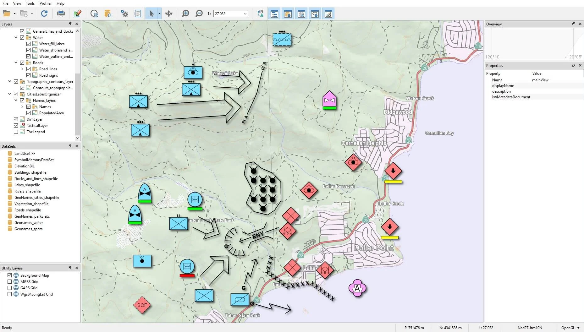
Following on from the article Getting started with the tactical symbology in Carmenta Engine, we will explore how to set up your application to support tactical graphics.
Read more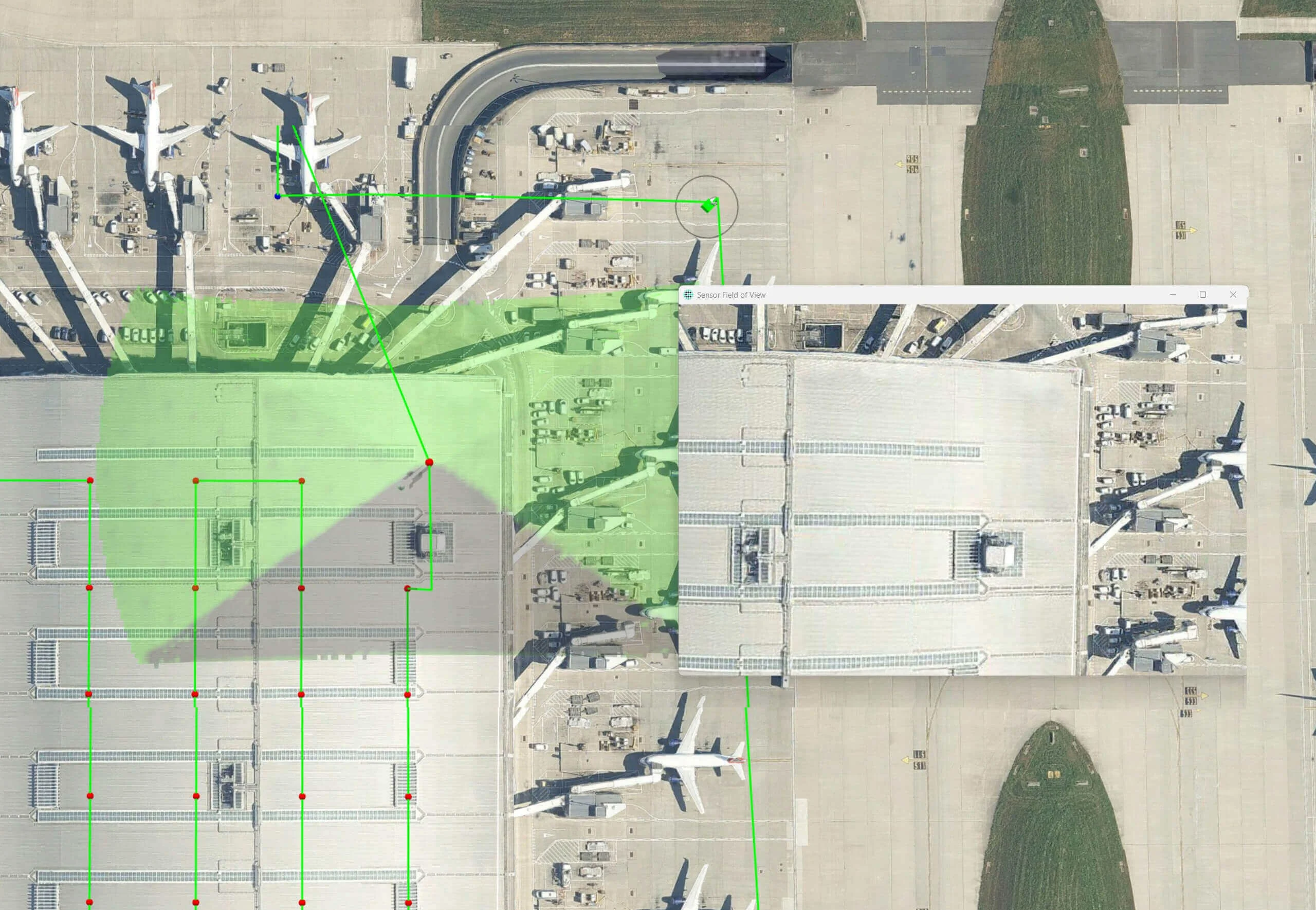
Line of Sight (LOS) analysis is critical for effective drone operations, particularly when capturing imagery for inspection or mapping.
Read more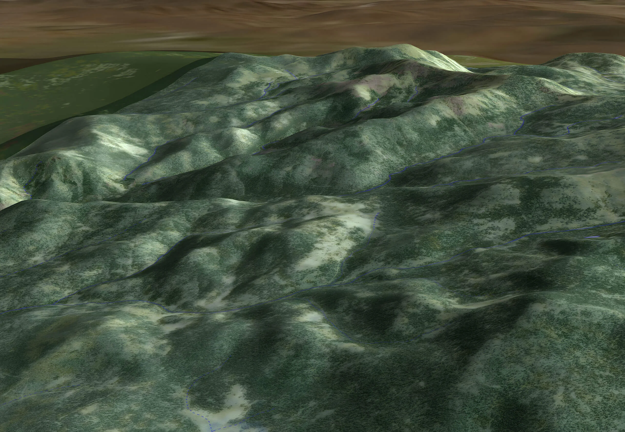
Explore various methods to handle object altitudes in Carmenta Engine, including GlobeView.GroundAt, ElevationOperator, and OffsetOperator, with best-use scenarios.
Read more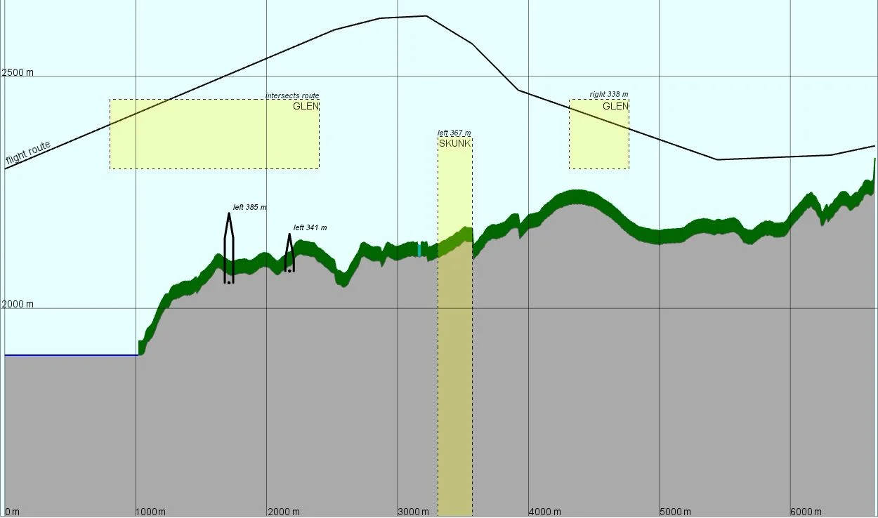
Learn how the VerticalProfileOperator in Carmenta Engine can be applied to provide new perspectives to strengthen situational awareness.
Read more
In the last part, in our series of articles on Carmenta Engine in .NET, WPF, we go through how to connect multiple instances of our client to the service set up in the previous article.
Read moreForth part in our series of articles on Carmenta Engine in .NET, WPF. Here we set up a service as a first step to synchronize features between multiple clients.
Read more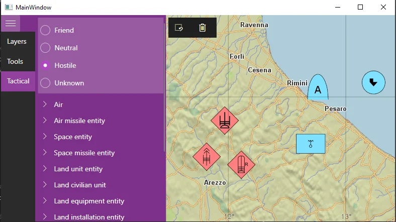
Learn how to add support for tactical symbols in our series on MVVM (Model-View-ViewModel) and Carmenta Engine in C#.
Read more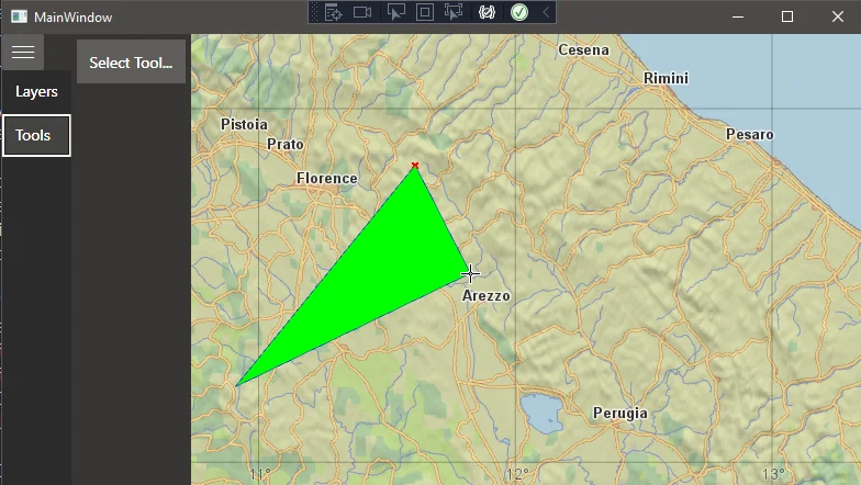
Second article in our series on building a WPF client with Carmenta Engine. How to add application logic to support editing geographical features in the map.
Read more
This tutorial covers the basics for creating a WPF client with the Carmenta Engine .NET Standard API, using the Model-View-ViewModel (MVVM) pattern.
Read more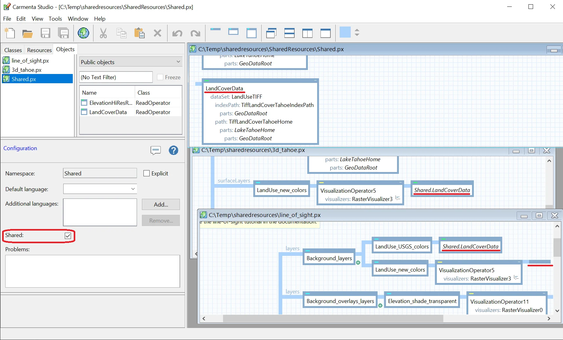
A presention of tools to create shared public objects that can be used by multiple different configuration files and only exist as a single instance in memory.
Read more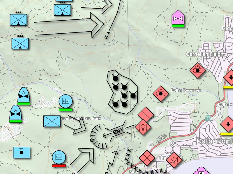
Learn how to automate map image exports using Carmenta Engine. This tutorial shows how to script efficient workflows for saving geospatial map snapshots.
Read more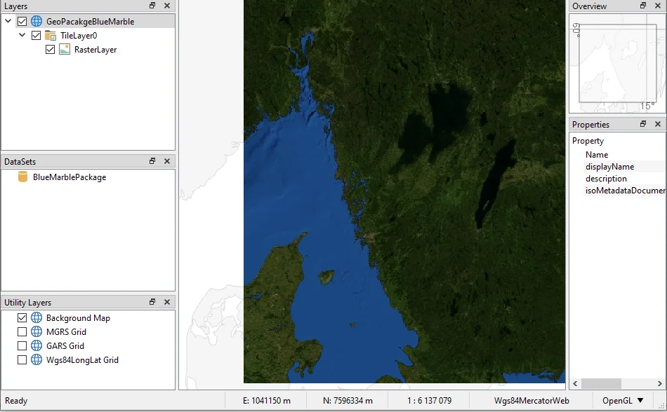
Guide on how to generate OGC GeoPackages using Carmenta Explorer. Step-by-step guide for developers working with geospatial data and open standards.
Read more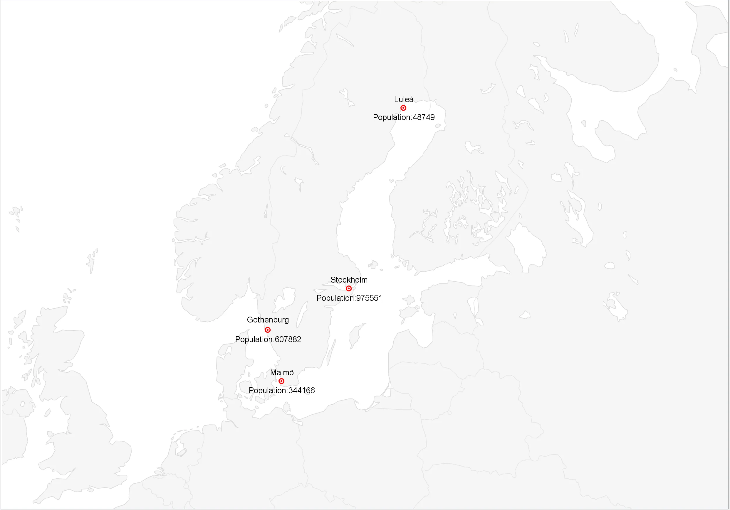
Learn how to add data overlays to a Carmenta Engine application. This guide covers adding spatial objects from application code, databases and proprietary data sources.
Read more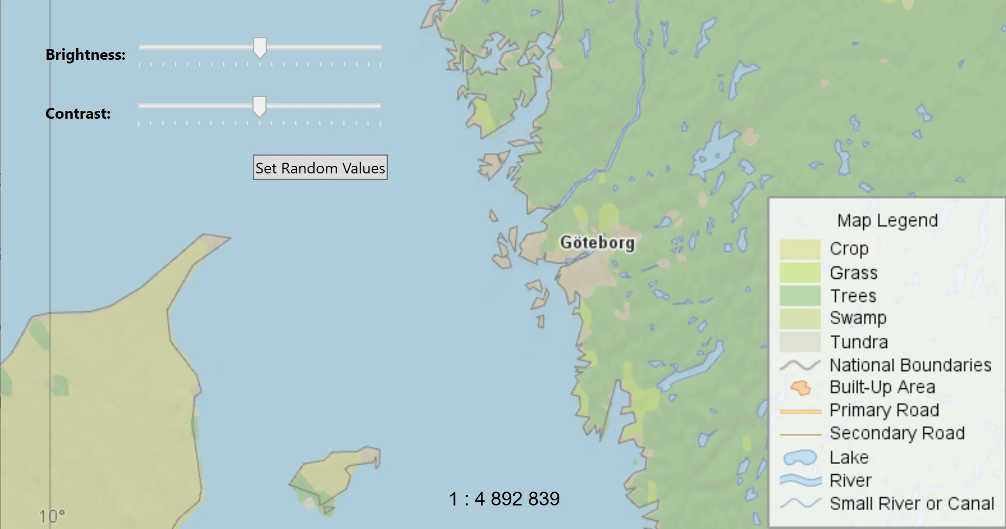
Explore how to apply the MVVM pattern in Carmenta Engine WPF apps. This guide walks through refactoring a sample project for better structure and maintainability.
Read more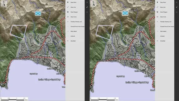
In this article, our basic QtQuick application will be extended with a service component to share a common feature overlay with other clients, synchronized in real-time.
Read more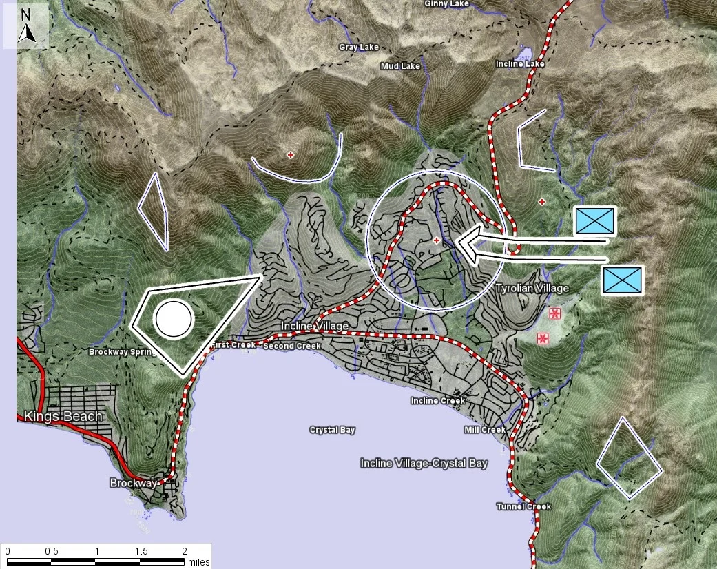
In this tutorial, we will add a DrawControl to the application allowing users to add tactical symbols as well as basic shapes to the map.
Read more
In this tutorial, the first part in a series of three, you will learn how to modify the existing QtQuick sample and add a LayerControl to it.
Read more
Learn how to use dynamic runtime condition variables in Carmenta Engine to control map behavior and styling based on real-time application parameters.
Read more
Find out how to develop OGC-compliant map services with Carmenta Server Core and deploy them on Microsoft Azure App Service using containerized workflows.
Read more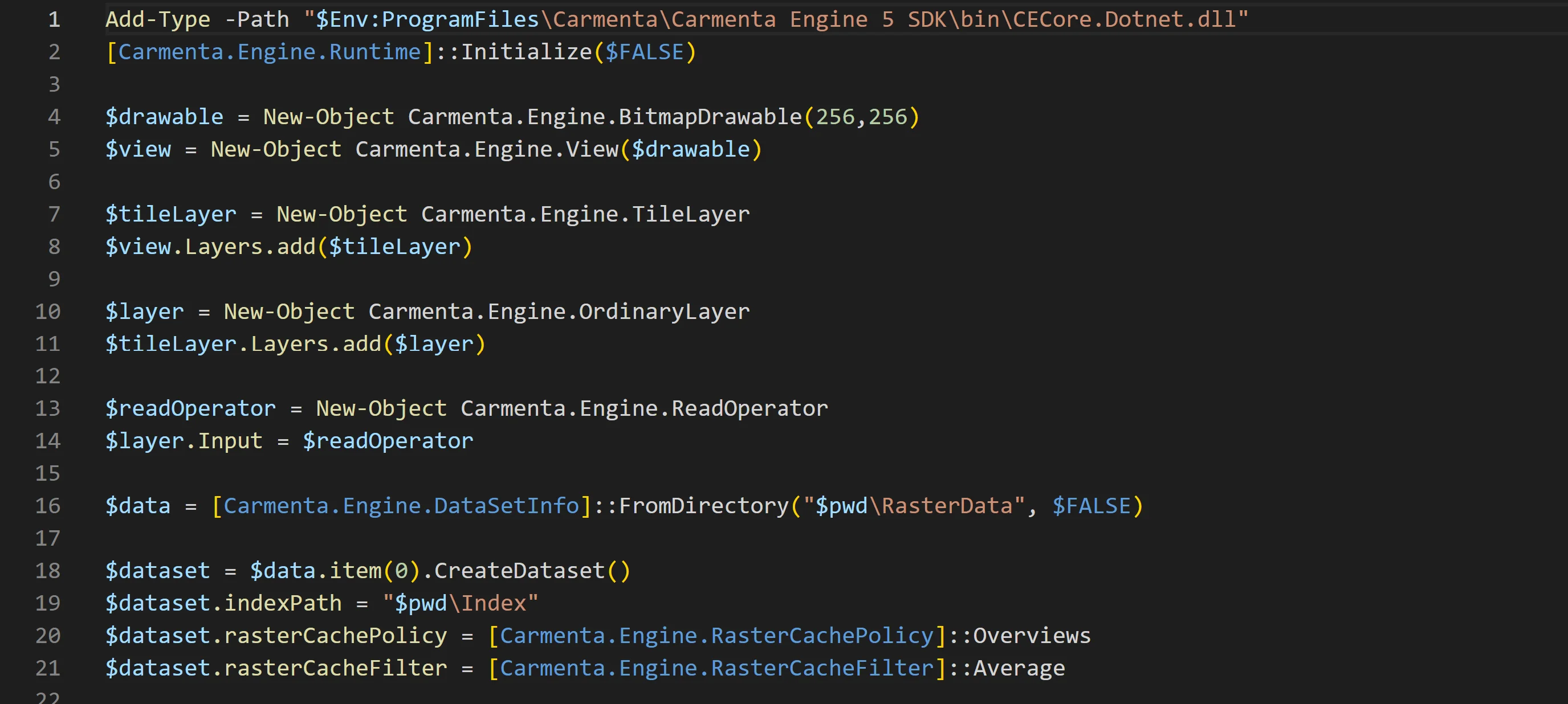
Learn how to automate your workflow, creating map configurations using Carmenta Engine’s .NET API from PowerShell.
Read more
Learn about screen and CRS coordinates in Carmenta Engine. This guide explains how to manage coordinates when handling map representations of geographical objects.
Read more
Create and register custom datasets. Learn how to integrate your own proprietary data reader in Carmenta Engine.
Read more
Use this tutorial to build custom data flows in Carmenta Engine and access processed features in code. A guide to using operators for advanced data handling.
Read more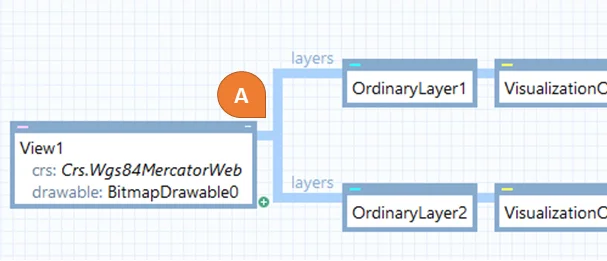
Explore how Carmenta Engine manages geographical coordinates with efficient CRS transformations. Includes advanced use cases and best practice guidance.
Read more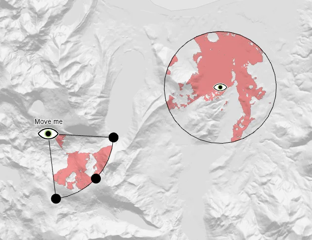
Learn how to configure dynamic visibility analysis in Carmenta Engine. This guide covers line-of-sight setup for sensors, cameras, and moving observers.
Read more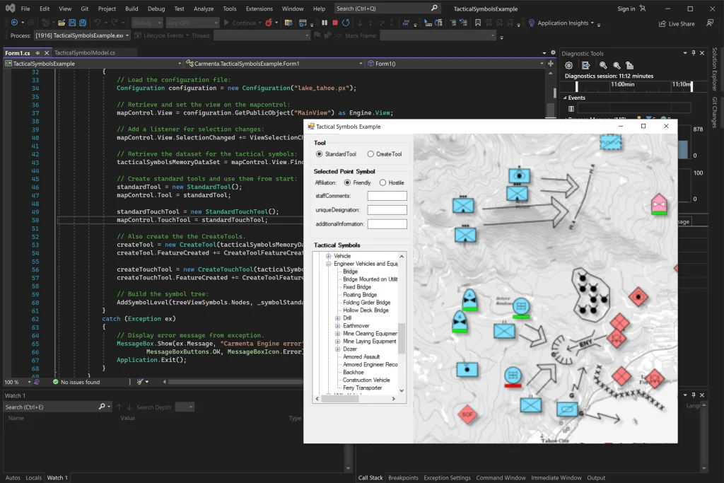
Get started with how to display and edit tactical symbols in Carmenta Engine using MIL-STD-2525 and NATO App-6 standards.
Read more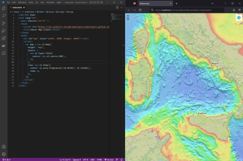
Learn how to consume Carmenta Server map services using OpenLayers. Step-by-step guide for integrating OGC-compliant layers into web mapping applications.
Read more