Mission-critical mapping
Geospatial technology that empowers you to see more, know more, and make better decisions – in real time.
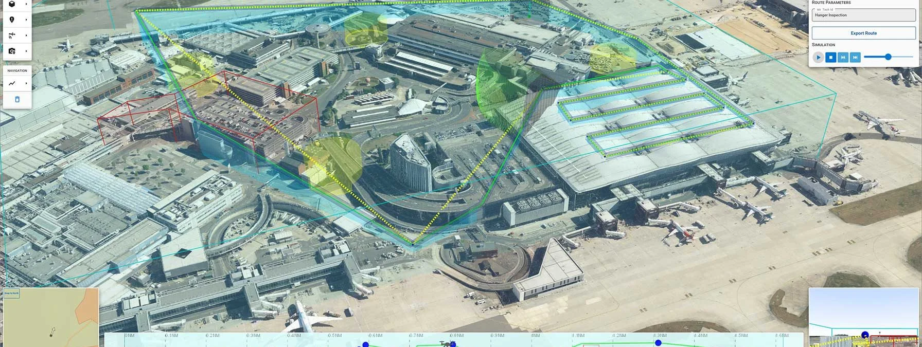
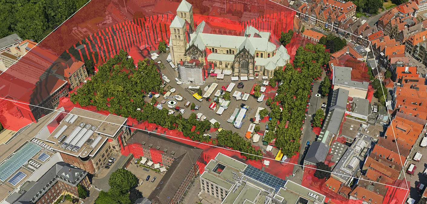
Our software development kit (SDK) offers the freedom and flexibility to create powerful geospatial applications to efficiently visualize and analyze geospatial information.
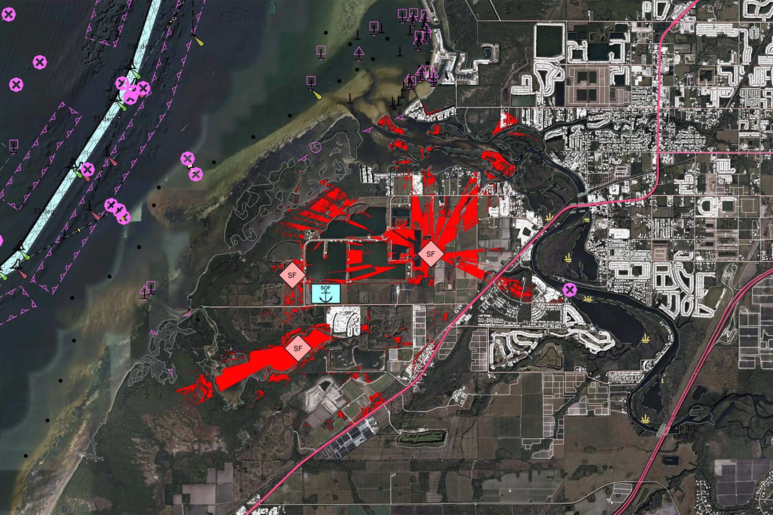
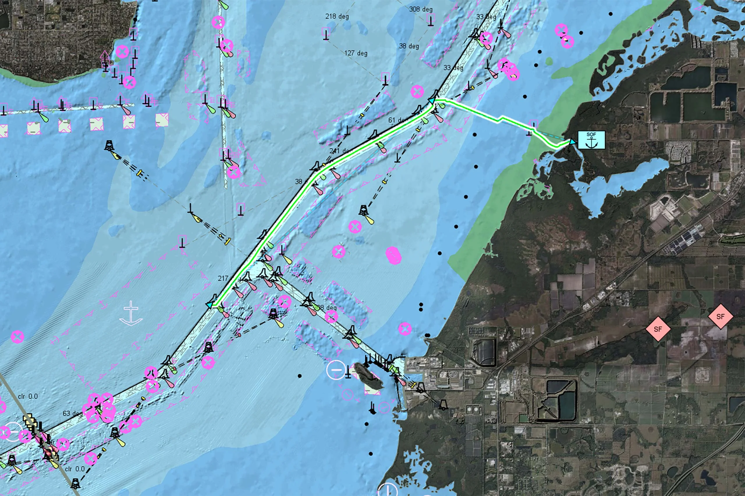
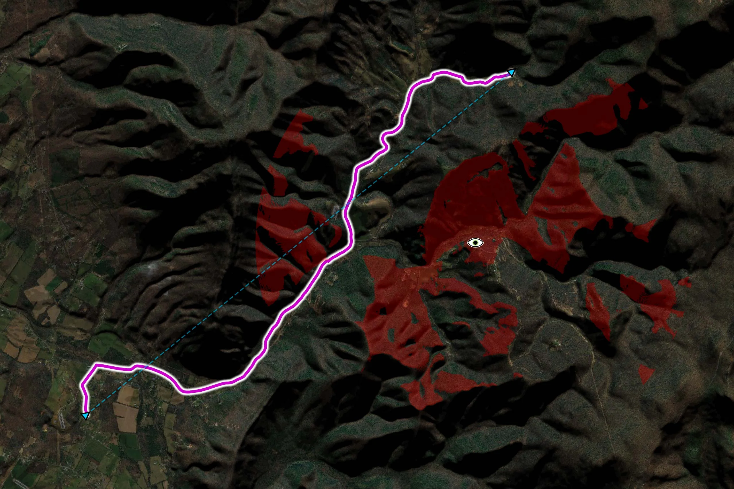
Whether you are developing solutions for air, sea, or land – Carmenta technology is deployed and trusted in systems across the world.
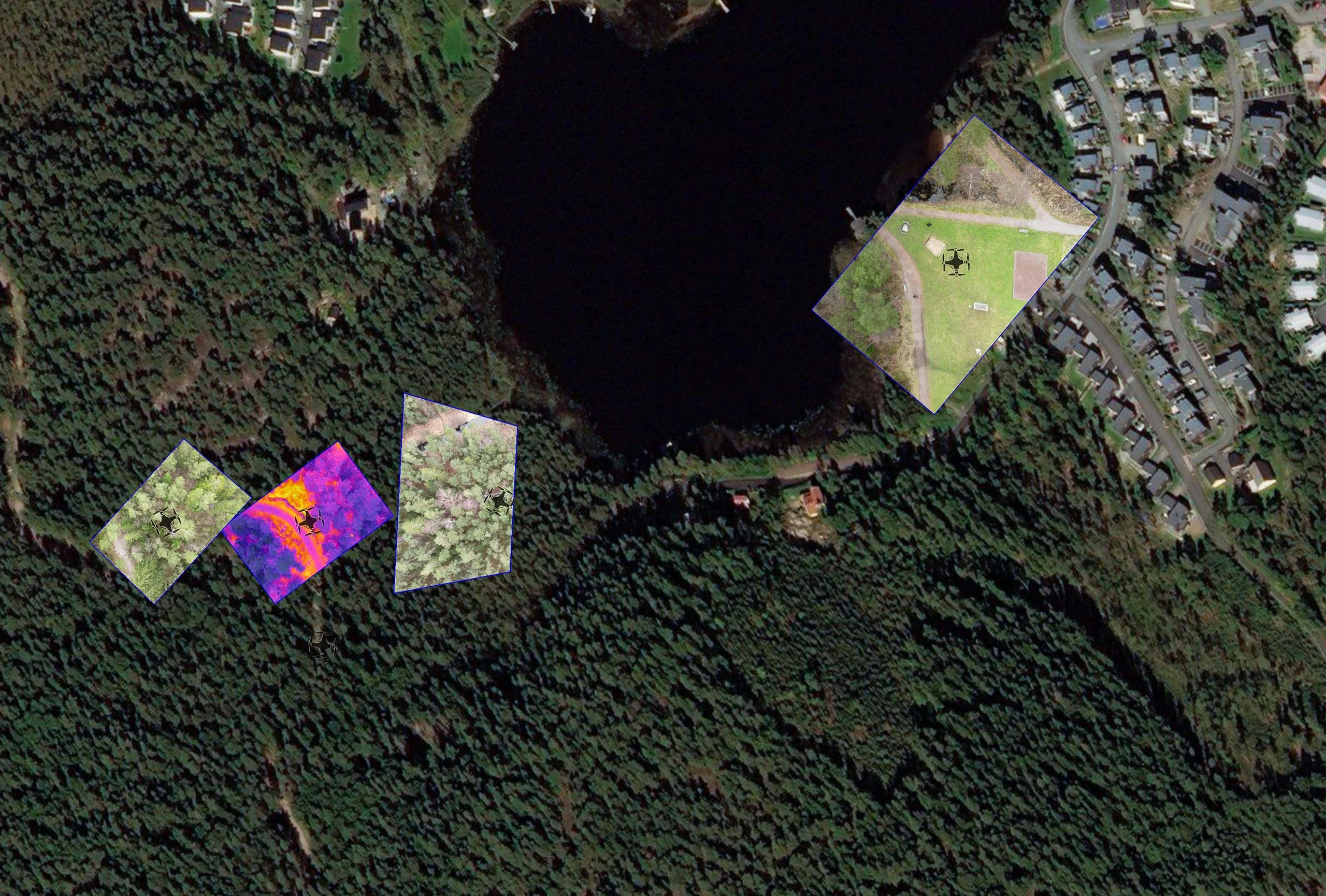
Deployed in some of the most demanding environments across the world.
Trusted and long-term partner to world-leading system integrators and system providers.
Unwavering dependability and cutting-edge analysis in our customers’ most critical systems and operations.
Outstanding flexibility with cross-platform support and support for 100+ data formats.
Carmenta is pleased to announce Carmenta Engine 5.17.2, the second service release for the latest version of our geospatial SDK for Windows, Linux and Android. The service release contains various stability and performance improvements.
Read more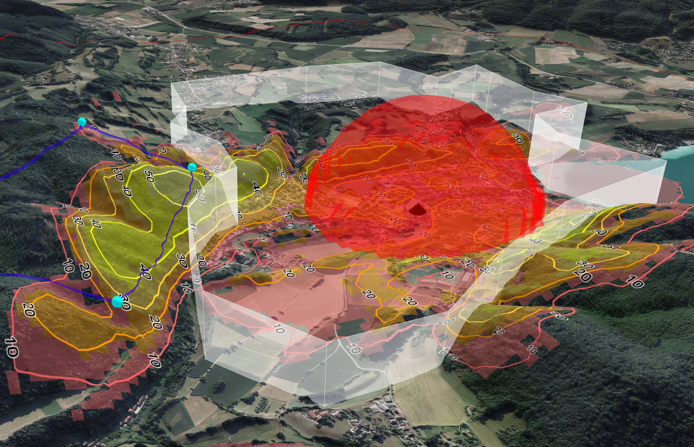
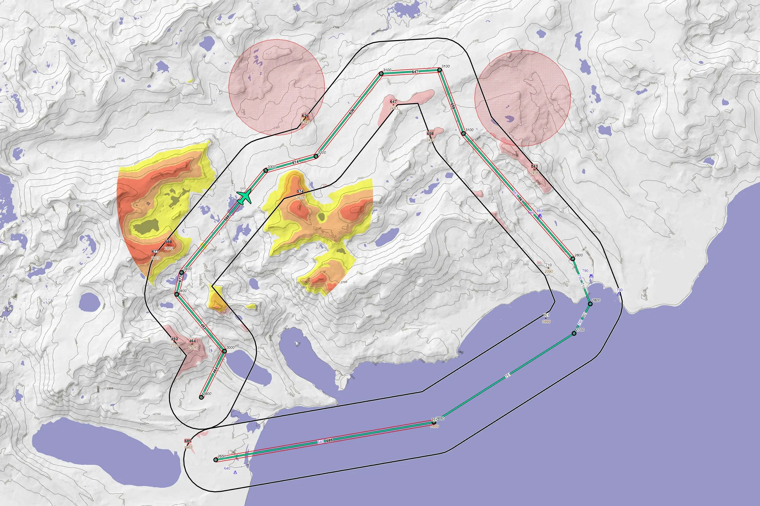
TRL Accel are currently developing a lightweight, modular UAS demonstrator that requires a high-performance C2 software solution. To solve several technical challenges and keep ambitious timelines on track, they turned to Carmenta UAS Mission Kit.
Read moreGERMANY: We will demonstrate how our software enhances the ability of defence organisations to achieve rapid, reliable and highly precise situational awareness.
Read more


Designed for web-based solutions, mobile apps and traditional applications.
Subscribe to our newsletter to receive:
Sign up today to get the latest geospatial technology updates and insights!
We’d love to hear from you! Whether you have questions, need support, or want to learn more about our solutions, our team is here to help.