Aeronautical Charts
Executing an aeronautical mission demands a detailed understanding of the geospatial situation involved, which can vary dramatically depending on the operational environment. Diverse information sources must be consolidated for the area where the mission will be conducted. Additionally, it is fundamental to clearly present how the mission itself interacts with the operational environment. With more than 35 years in the defense industry, Carmenta technologies provide your application with proven analysis and display tools, ensuring success at all stages of the mission.
Aeronautical missions require data about airspace regulations, traffic management, and flight-restricted zones to ensure operational compliance and safety. Over land, elevation information is essential for navigation and safety. In coastal regions, understanding maritime conditions becomes significant. Additionally, having updated weather forecasts can play an important role in all scenarios.
By integrating these elements, you pave the way for mission success. With Carmenta’s technology you can read more than 100 data formats out-of-the-box, and its versatile plugin mechanism allows you to extend that support to any data source.
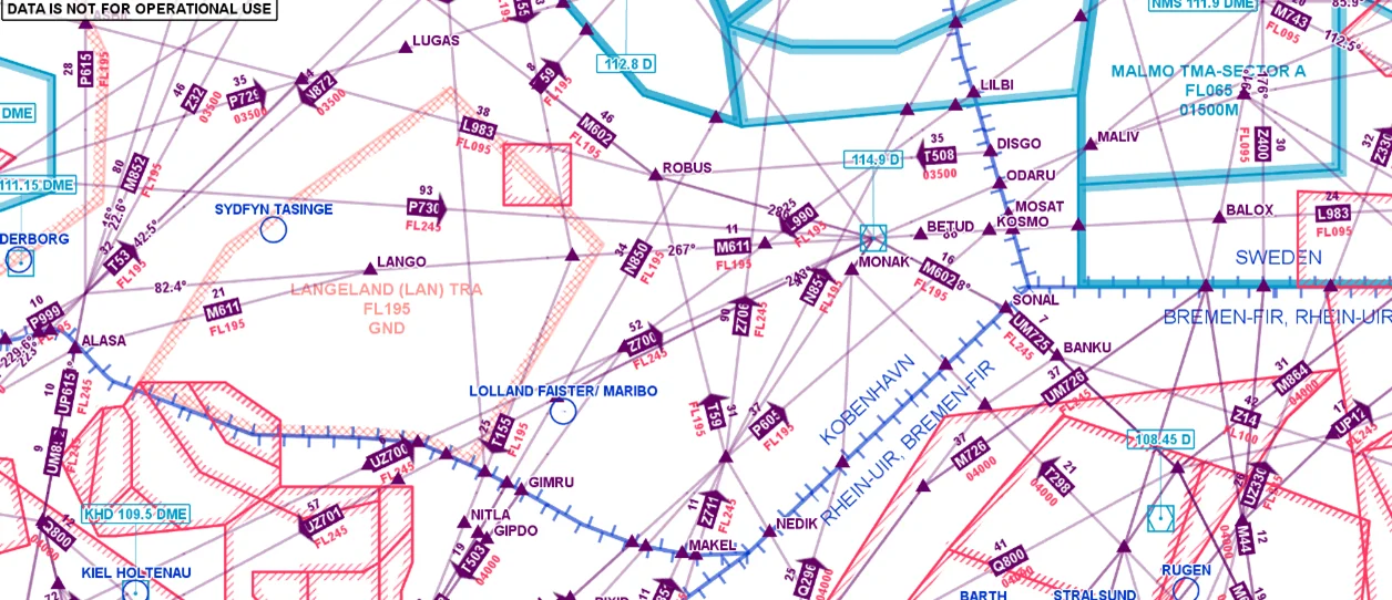
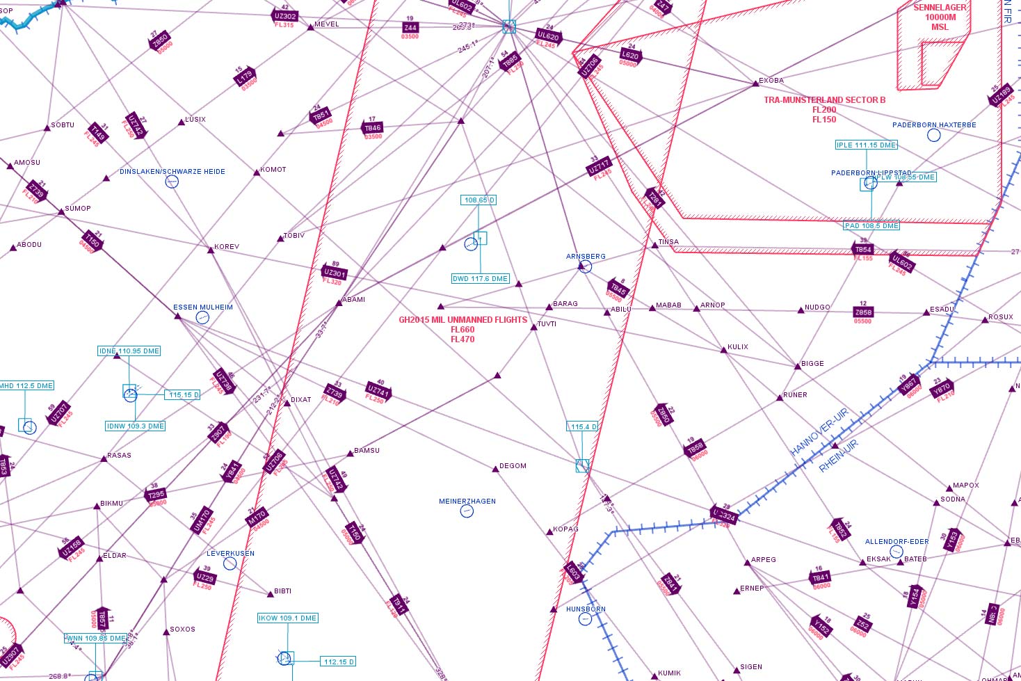
With built-in support for aeronautical data formats such as ARINC 424, AIXM 5.1/5.1.1, and AV-DAFIF, you can seamlessly integrate aeronautical information into your system. This functionality allows you to not only display the data but also utilize features like areas or corridors to assist your interactions, enhancing the system’s utility and support.
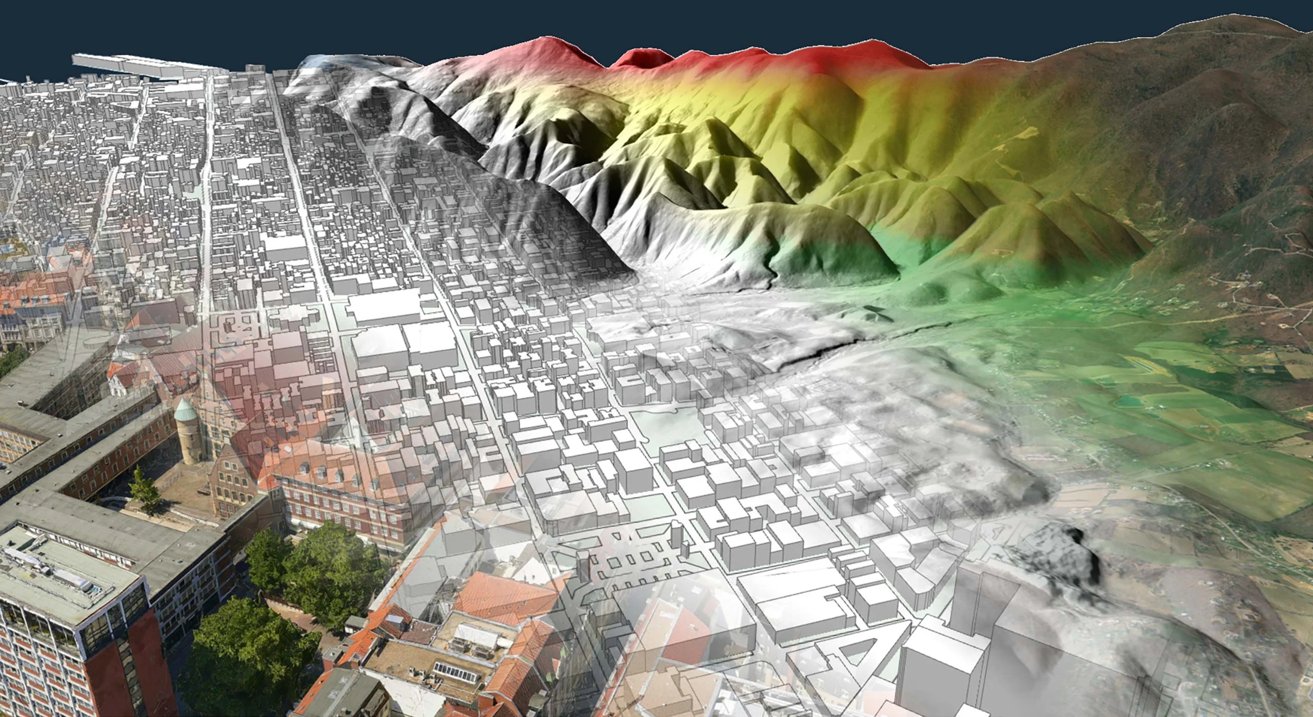
With robust support for incorporating terrain data from a wide range of formats, our technology ensures seamless integration of topographical details into your planning and operational processes. You can visualize complex landscapes in various ways, such as through elevation color-ramps, shading algorithms, or contour lines. This provides terrain insights that allow for optimizing route planning and enhancing situational awareness.

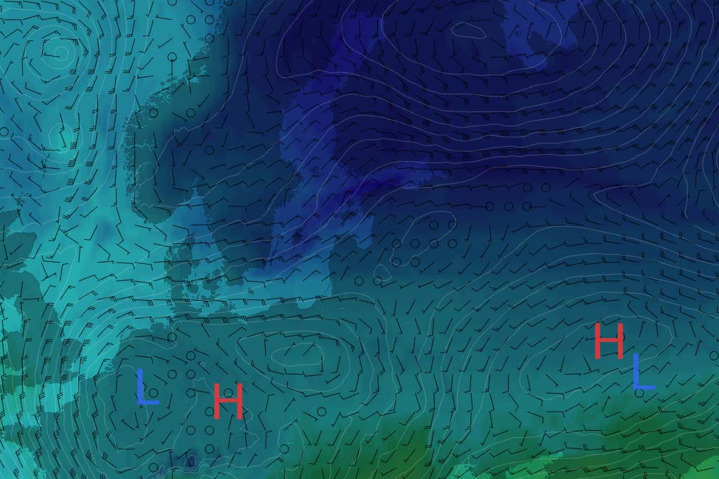
Our technology offers support for integrating weather forecasts, enabling you to incorporate meteorological information into your operational strategies. You can visualize forecasted weather patterns using overlays such as precipitation maps, wind speed charts, and temperature gradients. This forward-looking capability allows for proactive adaptation to anticipated conditions, providing insights that enhance operational safety and efficiency.
Gaining insights on your mission environment will make your operations run safer and more efficient. Leveraging environmental data together with your mission scenario will make planning, support and debriefing better. This deep dive into geospatial analysis not only predicts potential challenges but also offers strategies to mitigate them, ensuring a proactive approach to mission management.
Carmenta’s technology provides you with real-time geospatial data insights. With powerful analysis tools that analyze the environment based on a planned scenario or live operation, you gain knowledge on how your mission is best carried out and what actions to take next.
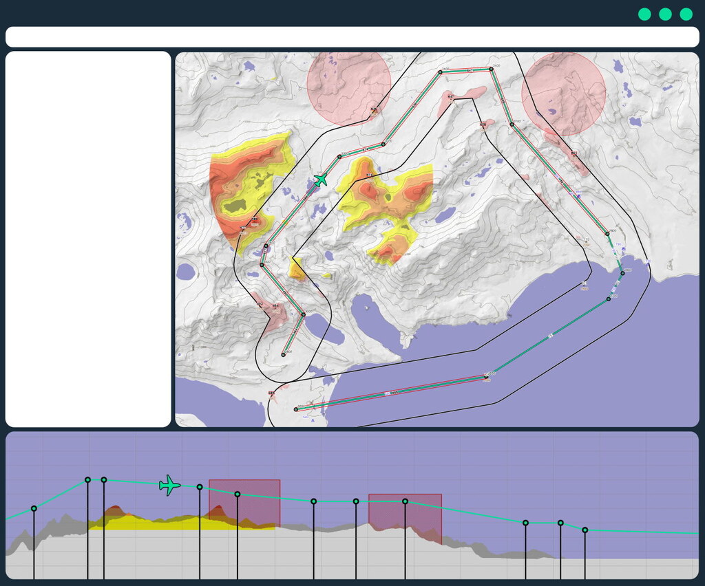
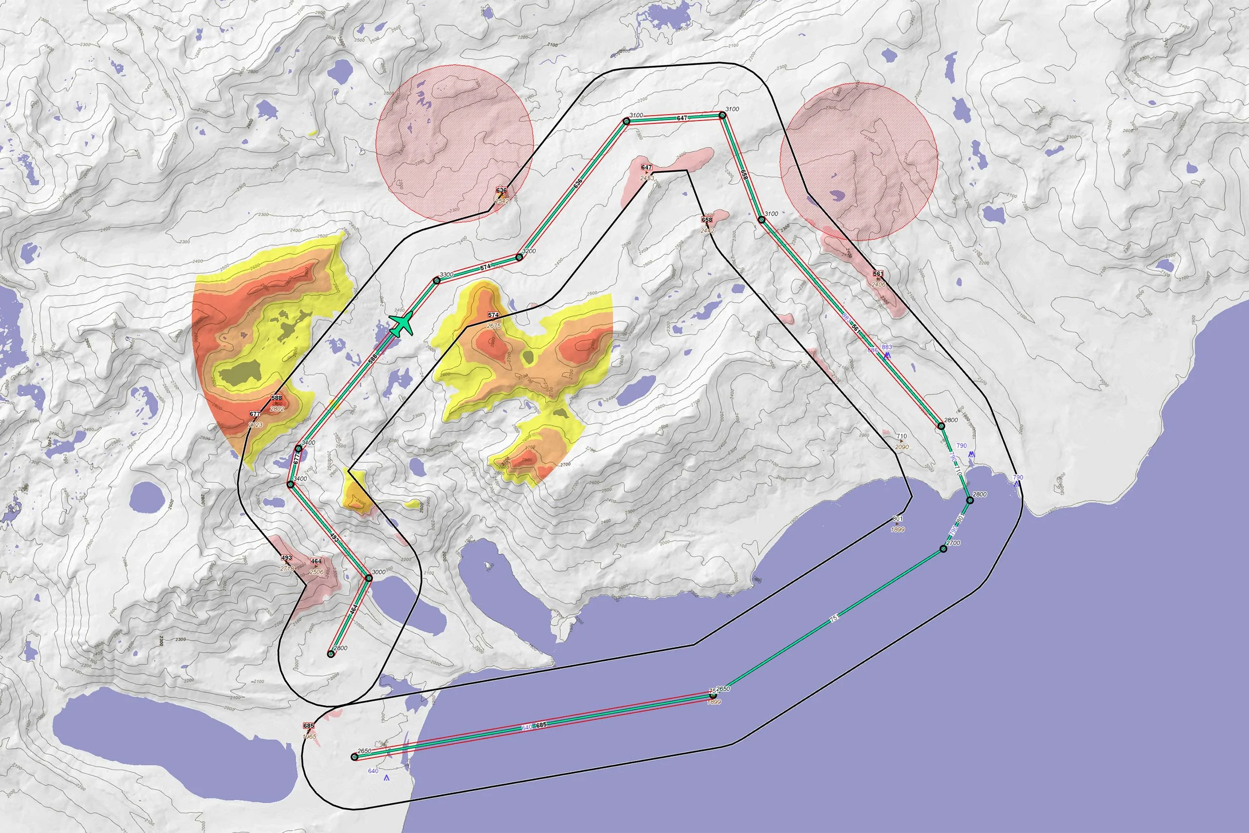
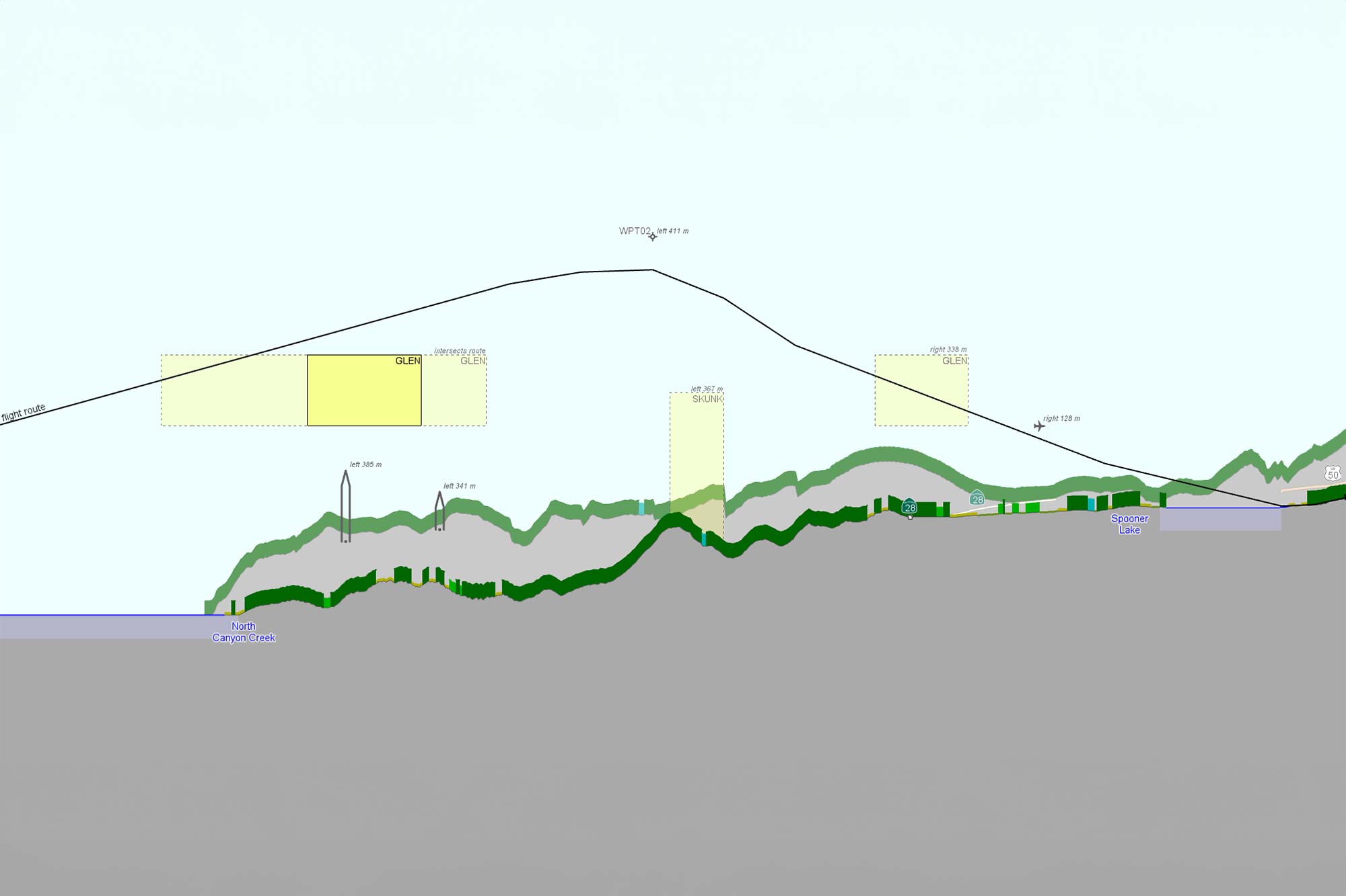
When planning a route over hilly terrain, the vertical clearance functionality provides critical information on obstacle clearance. It highlights areas near the flight path where the difference between terrain elevation and flight altitude is below a specified threshold. Peaks along the route are emphasized, particularly those whose elevation closely approaches the route altitude.
![]()
Changing perspectives lead to new insights. A vertical profile allows you to illustrate how flight altitude and terrain elevation vary along a route, providing a multidimensional view of the mission. But the visualization offers more than just terrain interaction; it also displays environmental features such as roads and lakes, as well as airspaces—whether defined by an aeronautical agency or derived from threat analysis. This enriched view helps in planning safer and more efficient routes.
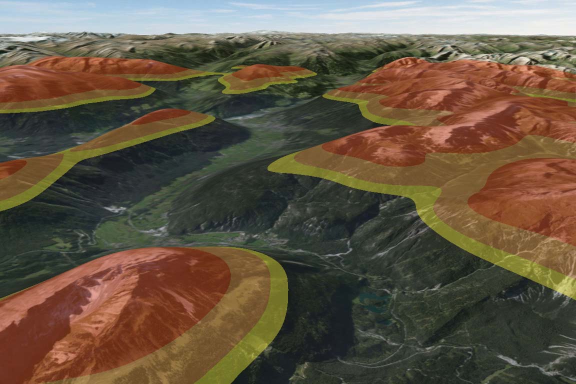
While tracking aircraft, the difference between altitude and terrain elevation often holds more significance than either parameter alone. Our terrain warning functionality provides a detailed presentation of the terrain, highlighting areas based on the altitude elevation difference.
Combining diverse data sources and analytical results into a cohesive operational picture is crucial for making informed decisions that are greater than the sum of their parts. This approach allows decision-makers to perceive hidden patterns, anticipate potential challenges, and synchronize efforts across multiple dimensions of an operation. By viewing all relevant data in a single, unified dashboard, teams can harness a deeper, more comprehensive understanding of the mission environment.
Carmenta’s technology is specifically designed to facilitate this level of integration, seamlessly merging disparate data and analyses into an intuitive, user-friendly interface. With advanced data fusion capabilities and real-time updating, our system ensures that all stakeholders have access to the most current and relevant insights needed to guide strategic and tactical decision-making.
By leveraging Carmenta’s technology, you can merge data from various domains, along with analysis results, into a single, unified map view. It lets you to efficiently combine essential information – whether aeronautical or environmental – to present a comprehensive picture of the operational landscape. The alternative perspective provided by a vertical profile offers a detailed cross-section of the mission environment, highlighting critical vertical elements such as terrain elevation changes, obstacles, and airspace layers. This integrative presentation not only deepens the understanding of the operational environment but also enhances decision-making across all mission phases.