UAS Routing
Whether the mission is in reconnaissance, target tracking, intelligence gathering, perimeter surveillance, transportation, or resupply – for military or high-end civil use – Carmenta’s technologies for uncrewed systems improves the predictability and reliability of missions.
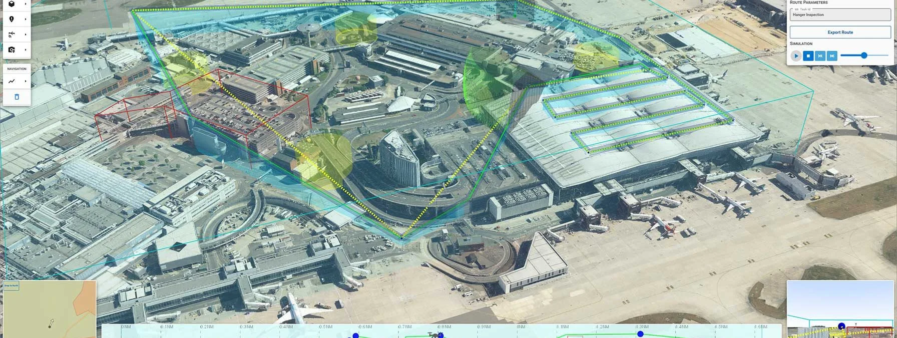
Carmenta UAS Services enables software developers to rapidly add routing and geospatial analysis capabilities for autonomous flights to a range of different applications, in the cloud, or on-site for secure environments.
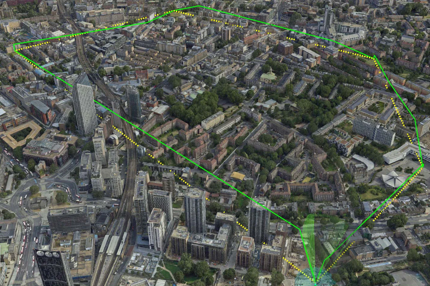
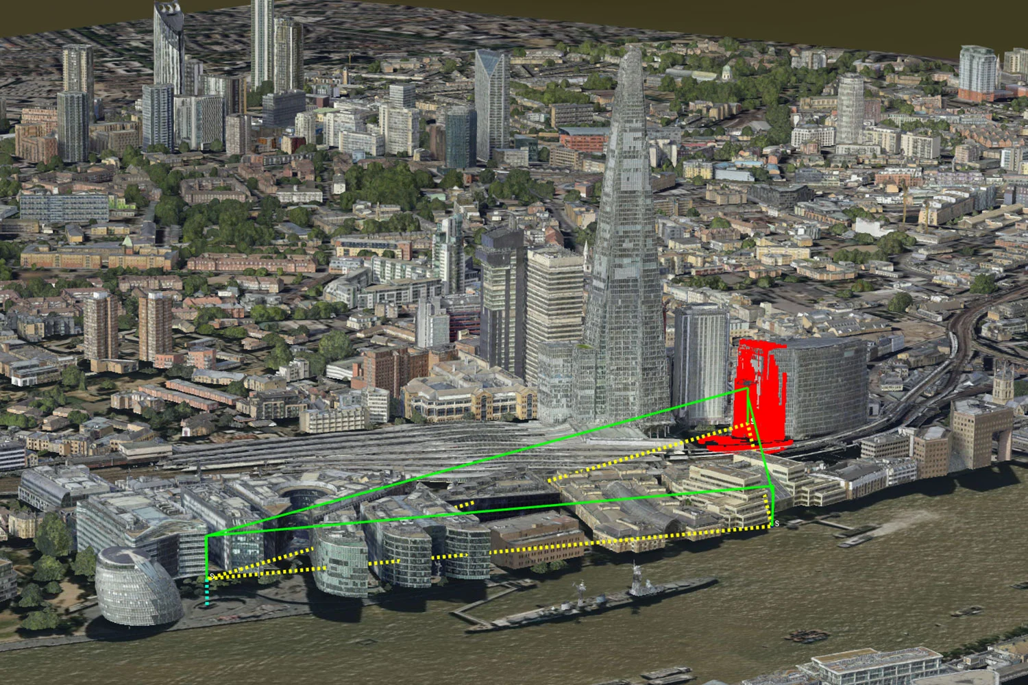
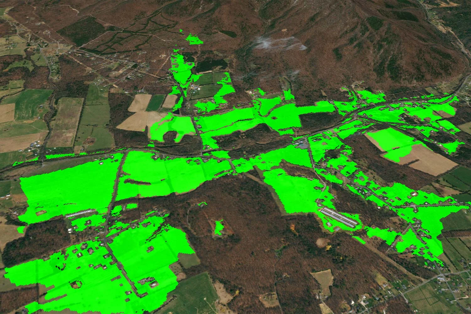
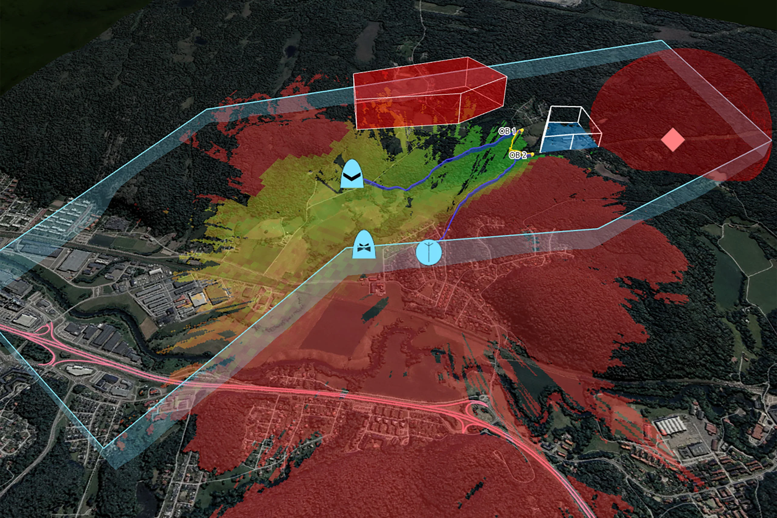
Mission parameters and input factors include safe flight zones, restricted airspace, sensor coverage, and deconfliction of overlapping UAS flight corridors.

Register for our free on-demand webinar that tackles some of the pressing issues faced by UAS service providers, from technical hurdles and regulatory compliance to airspace integration and Beyond Visual Line of Sight (BVLOS) operations.
Carmenta UAS Services builds on proven Carmenta technology for geospatial visualization and analysis to create advanced route planning. It can be used for operating one or multiple drones autonomously and simultaneously, either VLOS or BVLOS.
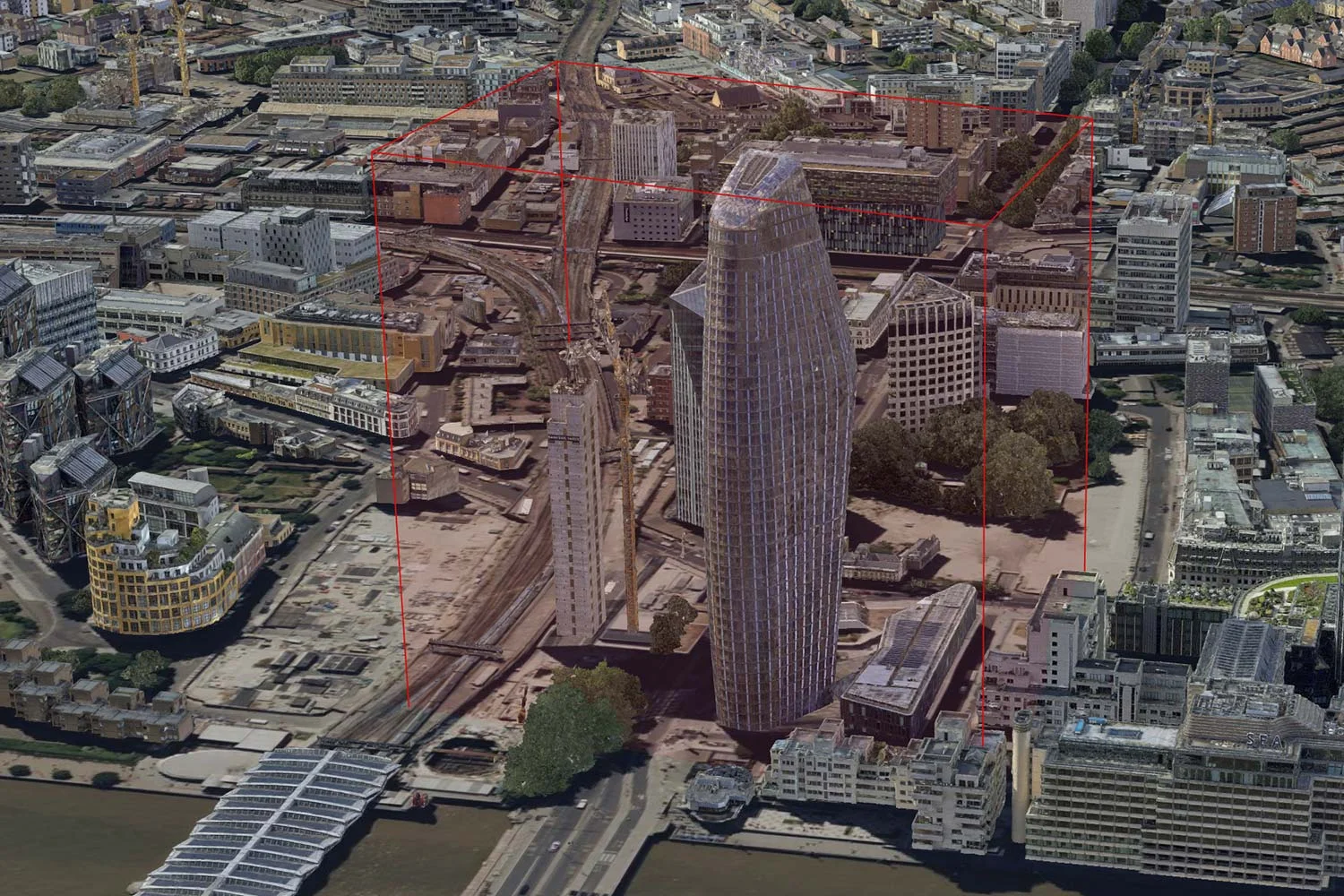
Utilizing a high-resolution 3D-model or a digital surface model, Carmenta technology generates an optimal deconflicted route considering mission parameters, restriction areas, and other factors in real-time operations.
The beta version of Carmenta UAS Services has UK data pre-integrated. If you are interested in using Carmenta UAS Services with other data, please reach out to us.
Supports both human and autonomous decision-making.
Please note: Carmenta UAS Services – Beta Version is to be used for test and evaluation purposes only.


Are you interested in Carmenta UAS Services?
Fill out the form and we will be in contact shortly.