Military Tactical Overlays
Carmenta technology, with its powerful map engine, provides a decisive advantage in ground operations and enables real-time data integration and analysis for comprehensive situational awareness. It runs on a variety of platforms, from high-end PCs to rugged tablets and cell phones, ensuring versatility and reliability.
Carmenta technology is able to read various data formats directly, making the information easily accessible to the application. It also facilitates seamless data extraction between CMS and BMS, ensuring efficient interoperability and data flow. These functions enable the emergency services to achieve their goals effectively.
Carmenta technology offers seamless integration of the NATO APP-6 and DoD MIL-STD-2525 standards for tactical symbols, providing intuitive use and easy editing of symbols. This functionality ensures that tactical symbols are accurately and efficiently represented on interactive maps, enhancing operational planning and situational awareness.

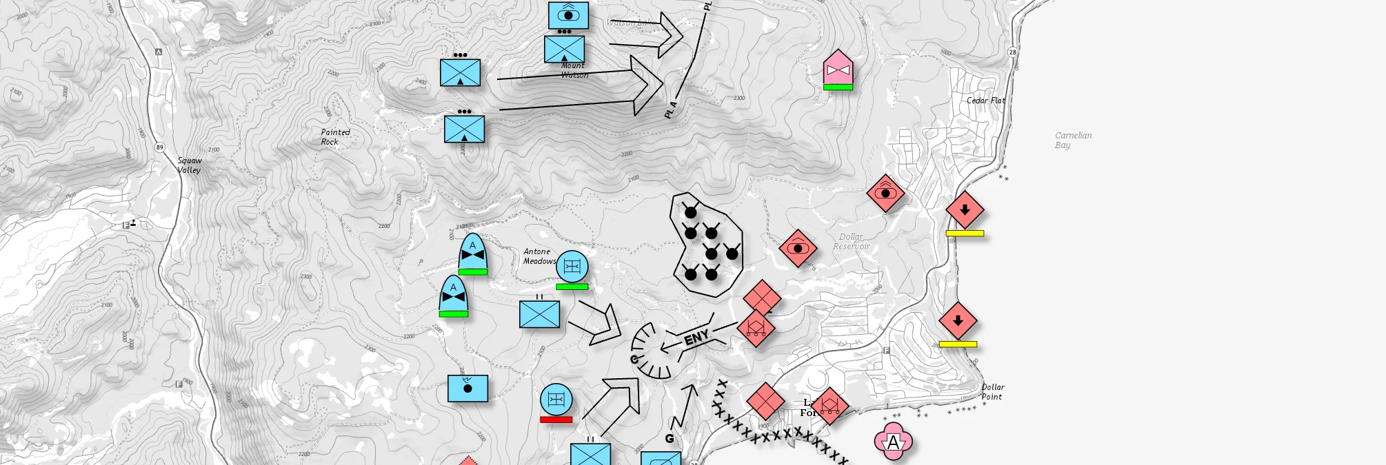
An example tactical overlay using MIL-STD-2525D symbology on top of a topographic map.
Maps are kept up to date by using the latest data for visualization and analysis, incorporating information from radar, radio, blue force tracking, red force marking, and custom datasets. Carmenta Engine supports video streams, including STANAG 4609 for platform metadata, and overlays them directly on the map. This can be used to generate updated maps of areas of interest.
Additionally, powerful terrain analyses can be applied to the integrated data. For example, Carmenta technology can automatically estimate how far an enemy can travel in the next critical few minutes based on the latest detected or marked positions, significantly improving real-time situational awareness and decision-making.
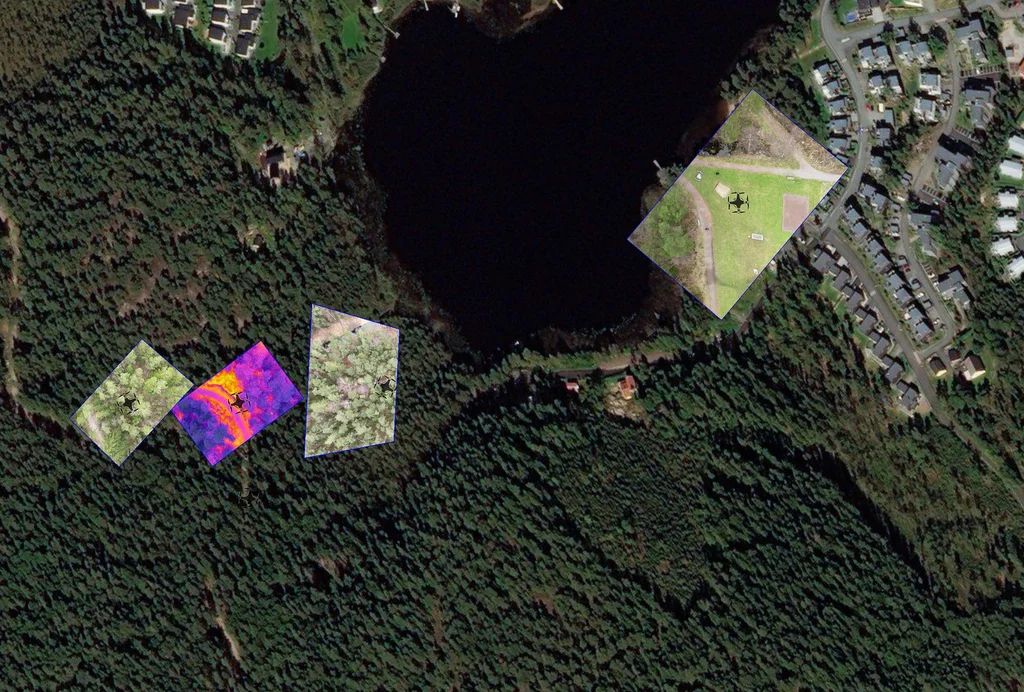
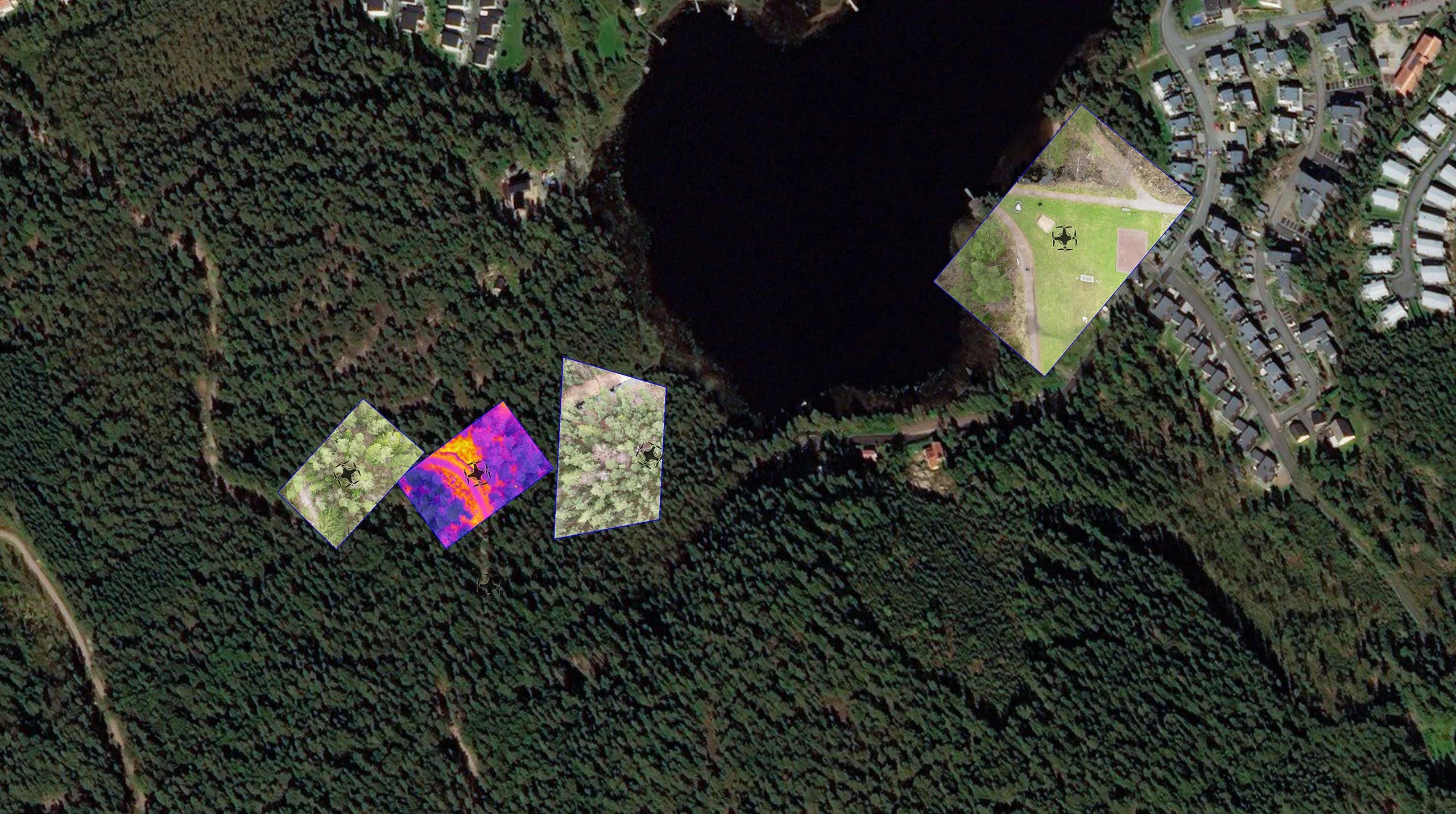
Video feeds from several drones overlayed in real time on a high-resolution satellite image.
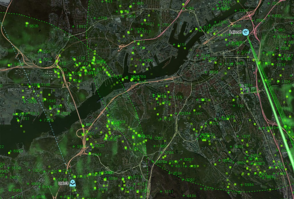
Simulated radar plots, radar tracks and raw radar video on top of a satellite image.
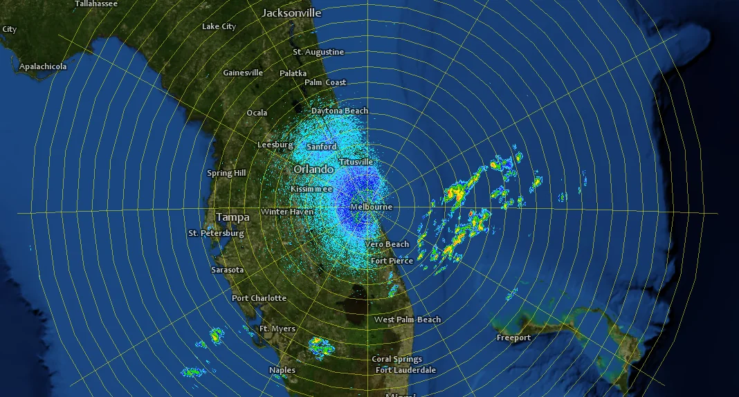
Carmenta’s meteorological data feature can read meteorological data in GRIB format directly, enabling the integration of forecasts to derive future ground conditions. This capability includes the use of mission-critical weather parameters such as fog, humidity, temperature, and rain for analysis like line of sight or radar propagation. By leveraging this functionality, users can make informed decisions across various sectors, ensuring optimal operational efficiency and safety in dynamic environmental conditions.
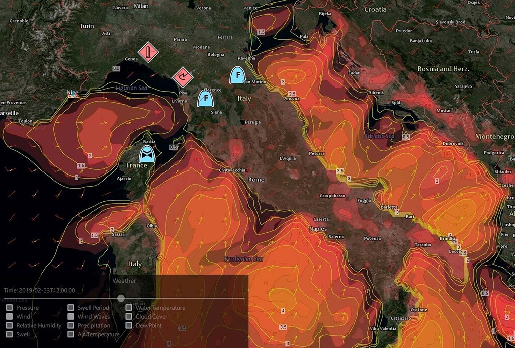
Wind and wind wave forecast from GRIB files overlayed on top of a Carmenta map.
Optimizing and accelerating the sensor-effector chain is crucial for enhancing situational awareness and providing timely decision support in dynamic environments. This optimization ensures that data from sensors is rapidly processed and transmitted to effectors, enabling swift and informed responses to evolving situations.
Carmenta technology aids in analyzing terrain to identify optimal locations for tactical planning, thereby enhancing the operational efficiency of ground forces. By providing detailed environmental insights, Carmenta ensures that ground forces can effectively navigate and utilize their surroundings to their advantage.
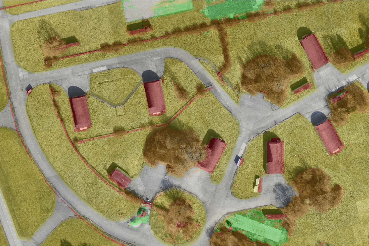
Using AI-assisted computer vision, robust, near-live navigability maps and terrain analyses – continuously adapted to any detected changes – are created using 3D reconstruction, object recognition and scene-based analysis.
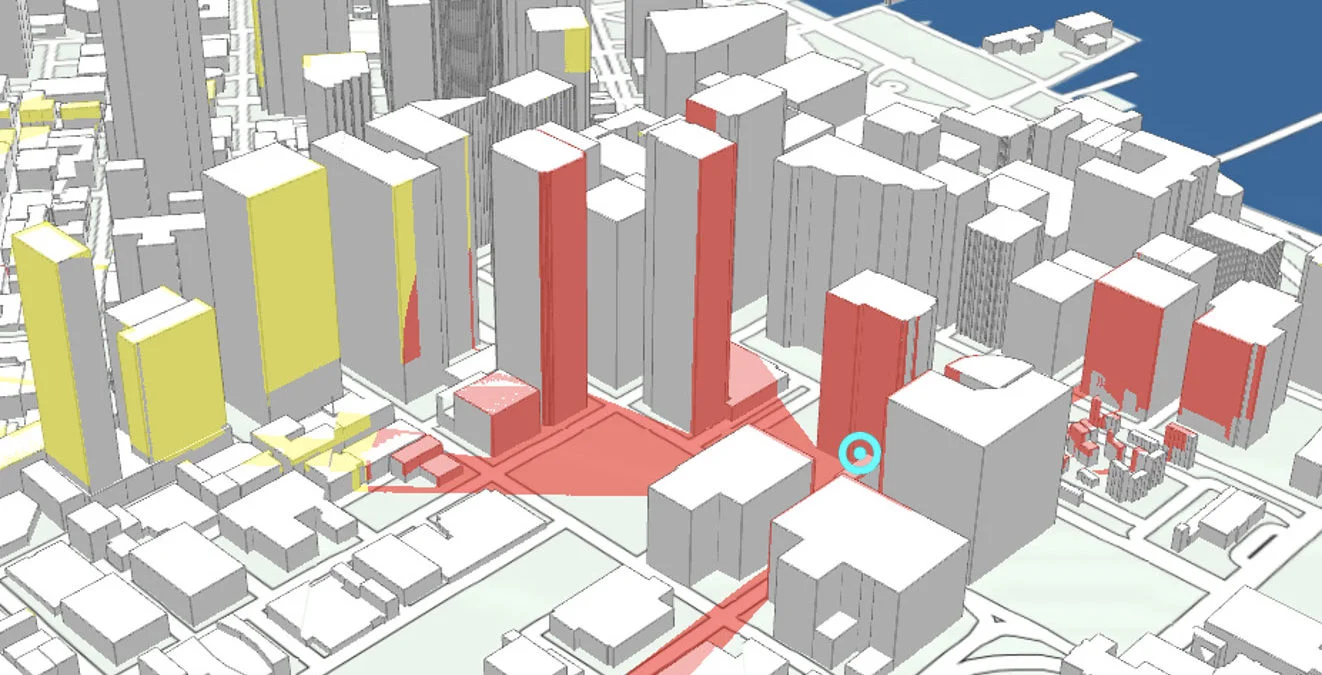
The visibility analysis package facilitates the calculation of exposure levels, identification of blind spots, and evaluation of detection rates for existing sensors and cameras. It allows for the seamless addition and optimization of sensor and camera placements, ensuring comprehensive coverage and enhanced situational awareness. By predicting potential enemy positions based on favorable terrain features, it supports pre-emptive strategic decisions and actions. The insights derived from this analysis can be integrated into tactical or constructive simulation frameworks, improving the precision and effectiveness of operational planning and execution.
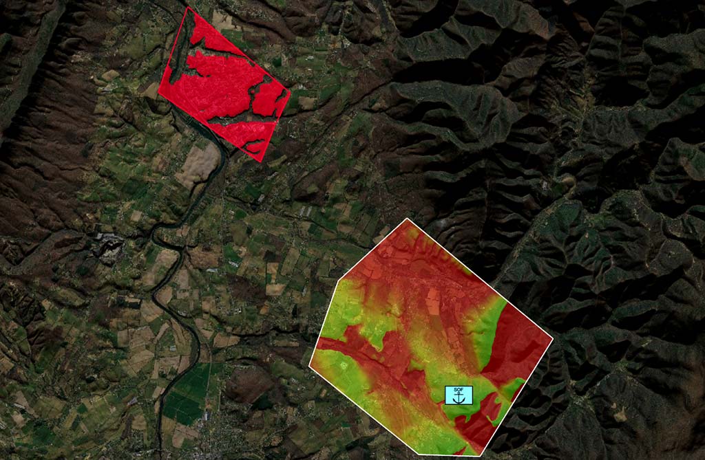
Carmenta’s visibility index analysis in action. The coloring indicates how much of the top left target area can be seen from different locations in the bottom right observation area.
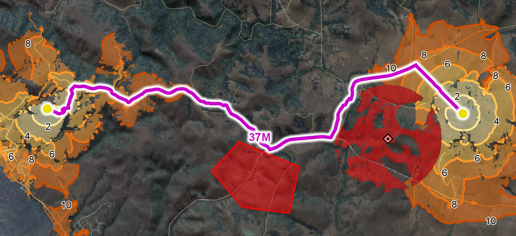
Carmenta’s mobility analysis is highly configurable and can be optimized for various characteristics to determine optimal routes for different mission scenarios. Routes can be tailored to be the fastest, shortest, most stealthy, most robust or a combination of all. The analysis supports route calculation for different types of platforms and ground entities, as well as for predicting potential enemy routes. Utilizing isochrones, it identifies impact areas for both friendly and enemy forces and determines optimal positions for shoot-and-scoot capabilities.
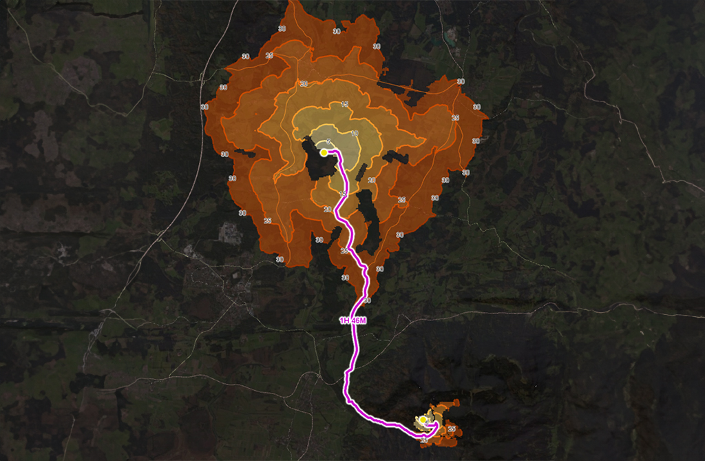
Off-road routing isochrones. The different shades of orange indicate how far from the start and end point of the route the vehicle can get in a certain amount of time. (The labels are minutes.)
Use the extensibility of Carmenta technology and unleash the processing power of Carmenta technology with your own propagation. Carmenta’s custom propagation can be used to calculate ranges for ballistic and kinetic weapons to determine optimal weapon placement or identify areas susceptible to enemy fire. When combined with routing isochrones, this analysis extends the operational range of ballistic weapons, determining impact areas and ideal combat positions. In terms of signal propagation, the ideal locations for mobile sensors such as radar and cameras can be determined and the effective range and area of effect of laser systems can be calculated.
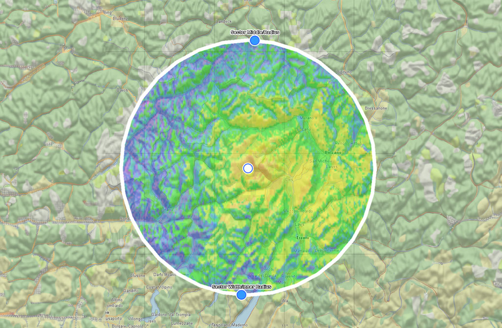
Radio propagation analysis. The coloring indicates the signal strength around the observer calculated using the Longley-Rice propagation model.
Integrating unmanned systems (UXS) with manned ground systems enhances interoperability and extends operational capabilities. Unmanned systems can increase sensor range, function as effectors, and enable beyond-line-of-sight (BLOS) operations. By incorporating live data from UXS, such as camera feeds, situational awareness is enriched and immediate analytics can be performed. Additionally, the integration supports the use of unmanned aerial systems (UAS) or unmanned ground vehicles (UGV) for advanced routing and mission planning, further enhancing operational effectiveness and decision-making.
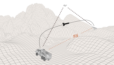
BLOS missile firing – drone used for targeting.
Integrating AI into operational systems offers transformative capabilities, leveraging custom algorithms through Carmenta Engines open APIs for Python, C++, and C#. This allows to provide advanced solutions such as automated target recognition, threat evaluation, red force analysis, and tactical recommendations to decision makers. Python scripts can be integrated directly into Carmenta Engine objects, streamlining the process. Additionally, AI-processed photo and video material can be mapped directly onto geospatial data as georeferenced video.
Read more about AI-Powered Geospatial Intelligence in our Knowledge Hub.

AI based target recognition combined with Carmenta’s support for georeferencing drone video feeds.


Geospatial technology that empowers you to see more, know more, and make better decisions – in real time.
Are you ready to see how our products can transform your work? Request a free trial today and explore the full potential of our geospatial technology.
Please specify which product/products you are interested in.
This form can be used to request a trial for: