Tactical Drone Routing
Optimized Routing for Operational Success
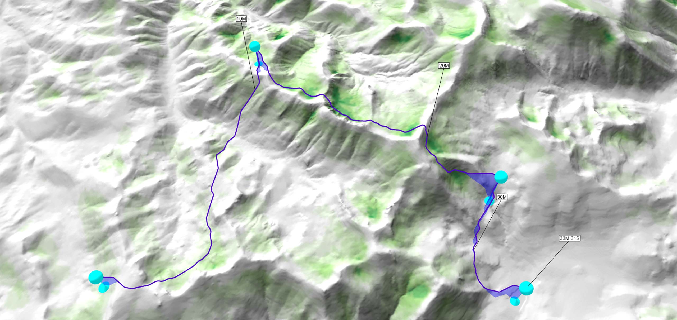
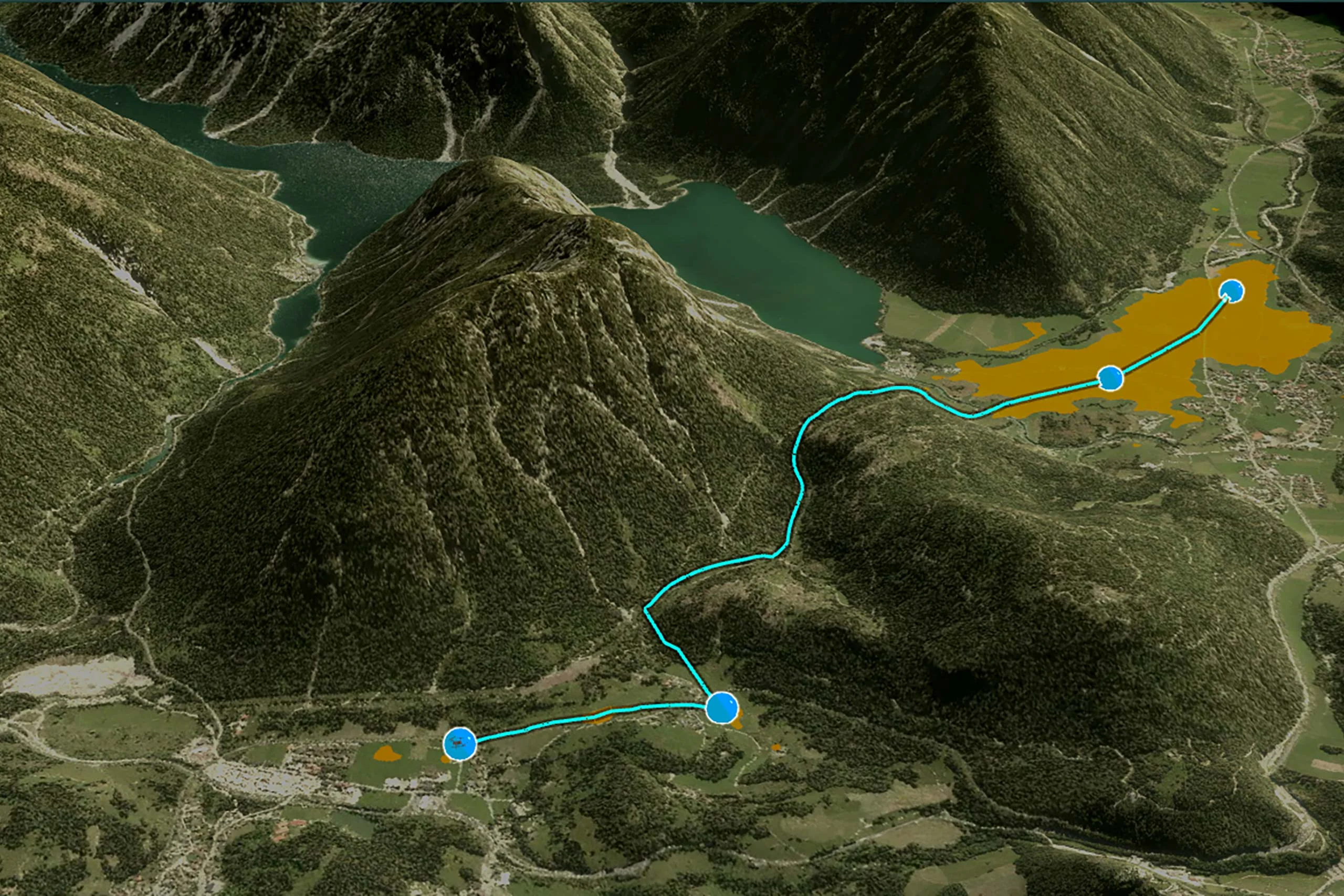
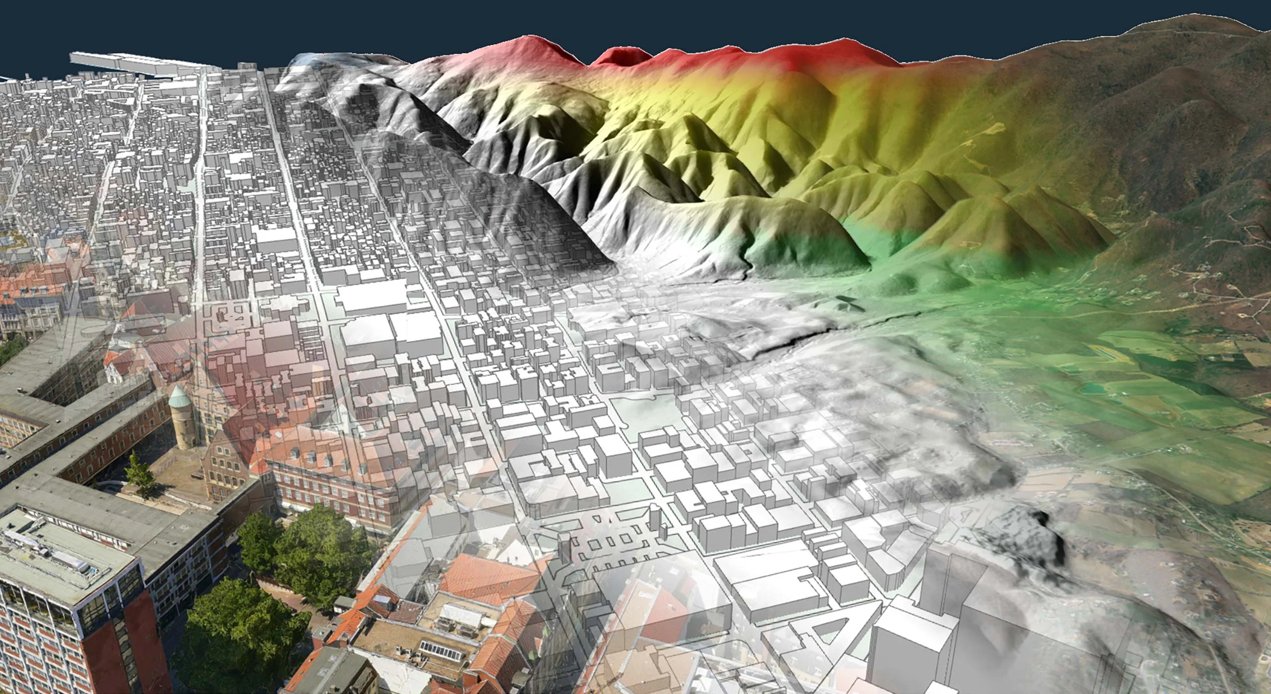
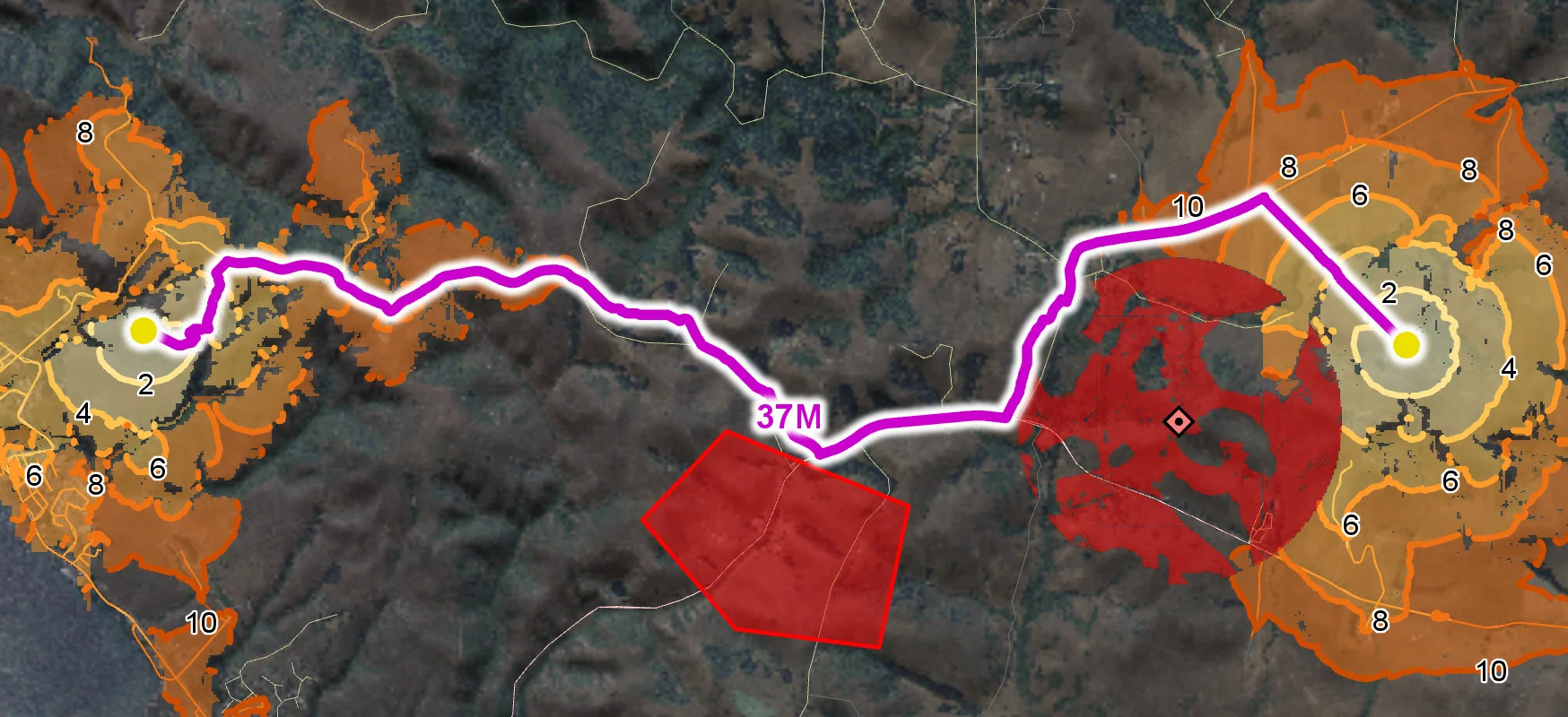
Uncrewed Aerial Vehicle (UAV) routing is a fundamental component of mission planning. This involves calculating safe and efficient nap-of-the-earth (NOE) flight paths that take into account the UAV’s flight characteristics, the terrain, the level of threat exposure and other mission-critical factors.
In tactical environments, routing must go beyond basic navigation to ensure survivability, precise timing, and operational success.
Real-Time Tactical Routing
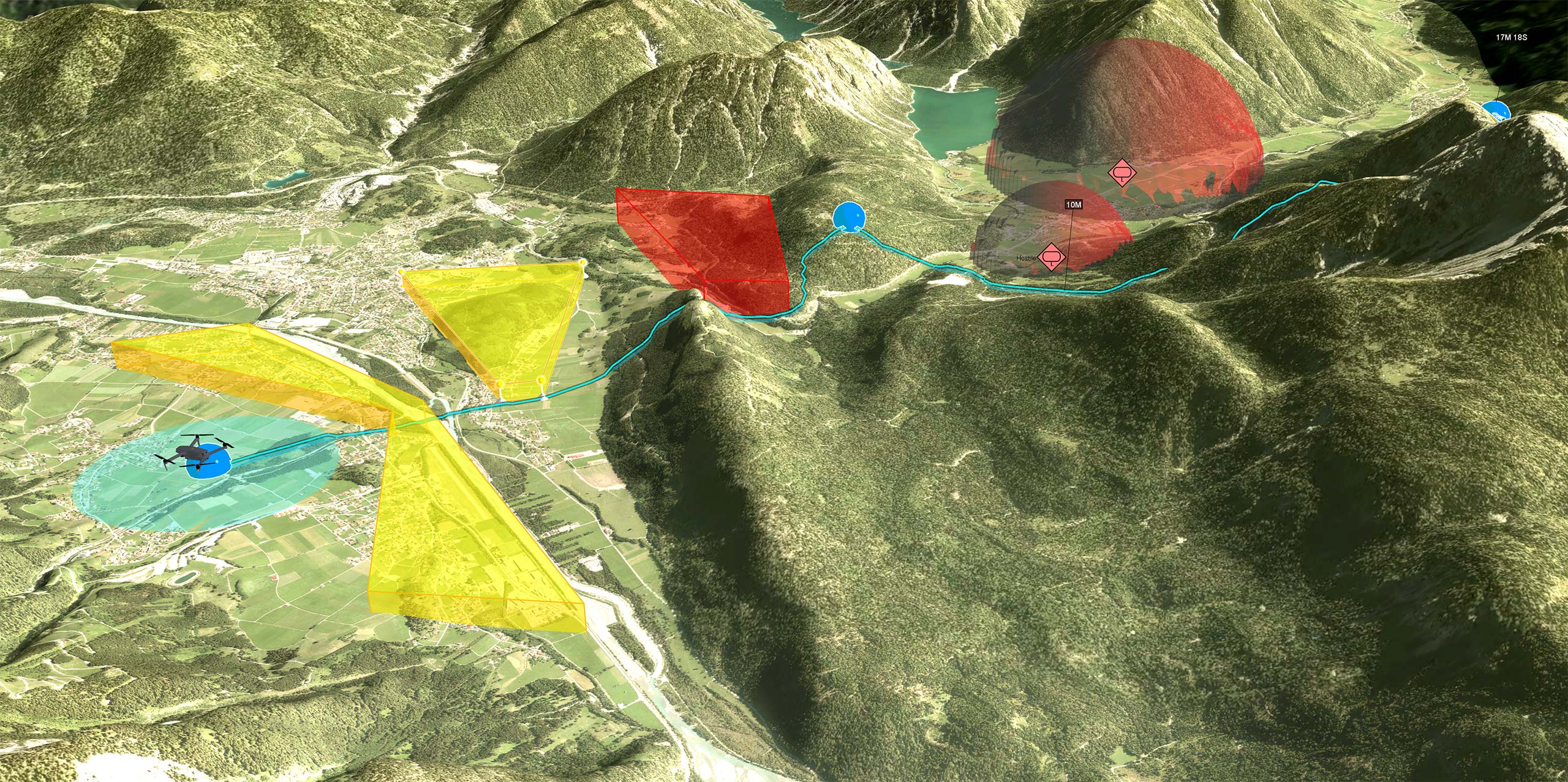
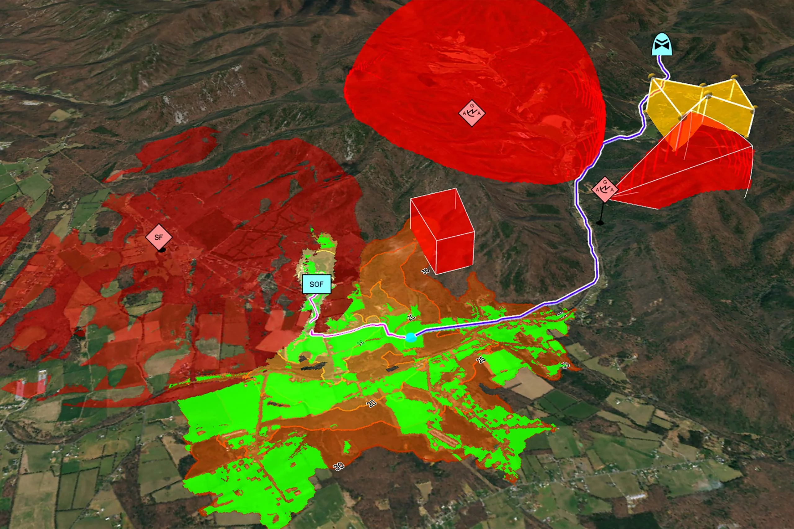
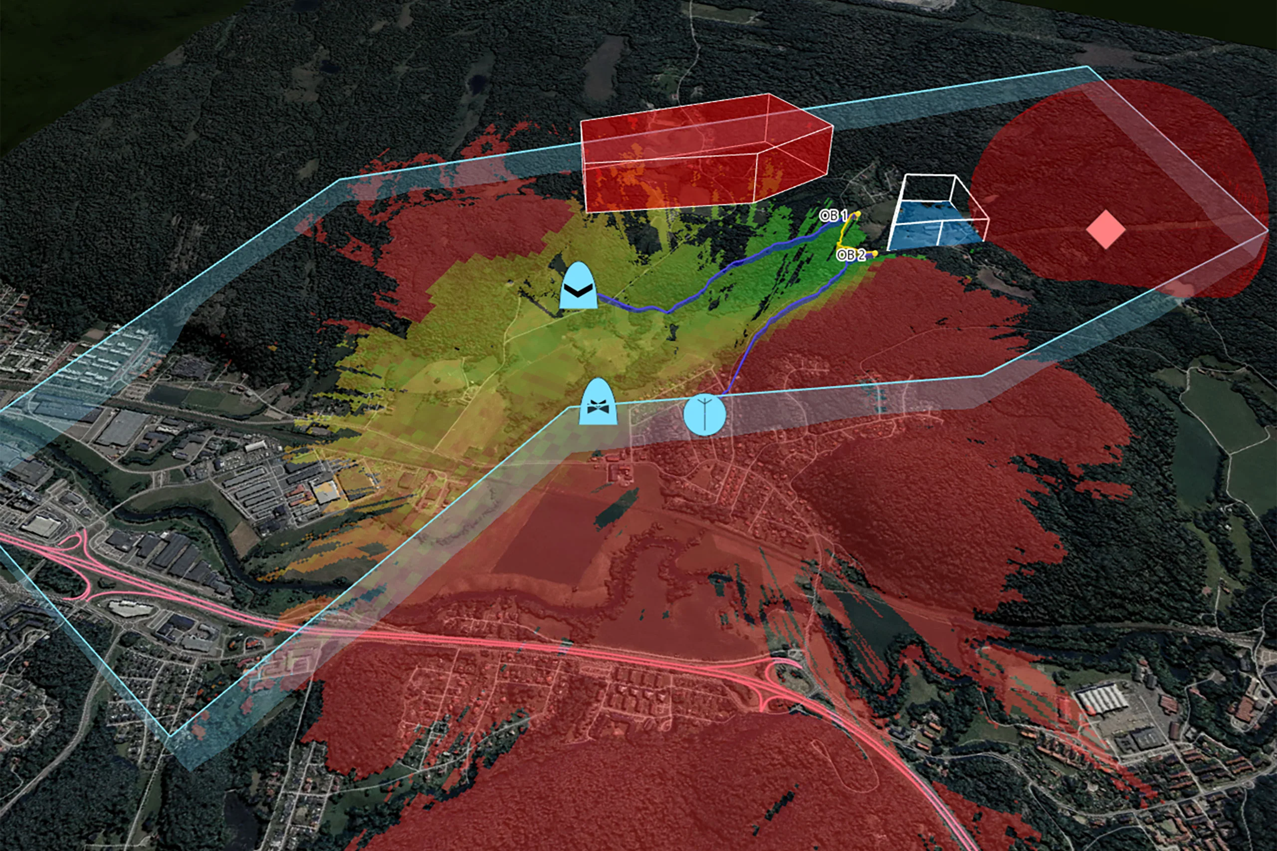
Carmenta’s geospatial technology can calculate deconflicted tactical nap-of-the-earth flight paths tailored to a wide range of mission requirements. Routes are calculated in real time and dynamically optimized based on:
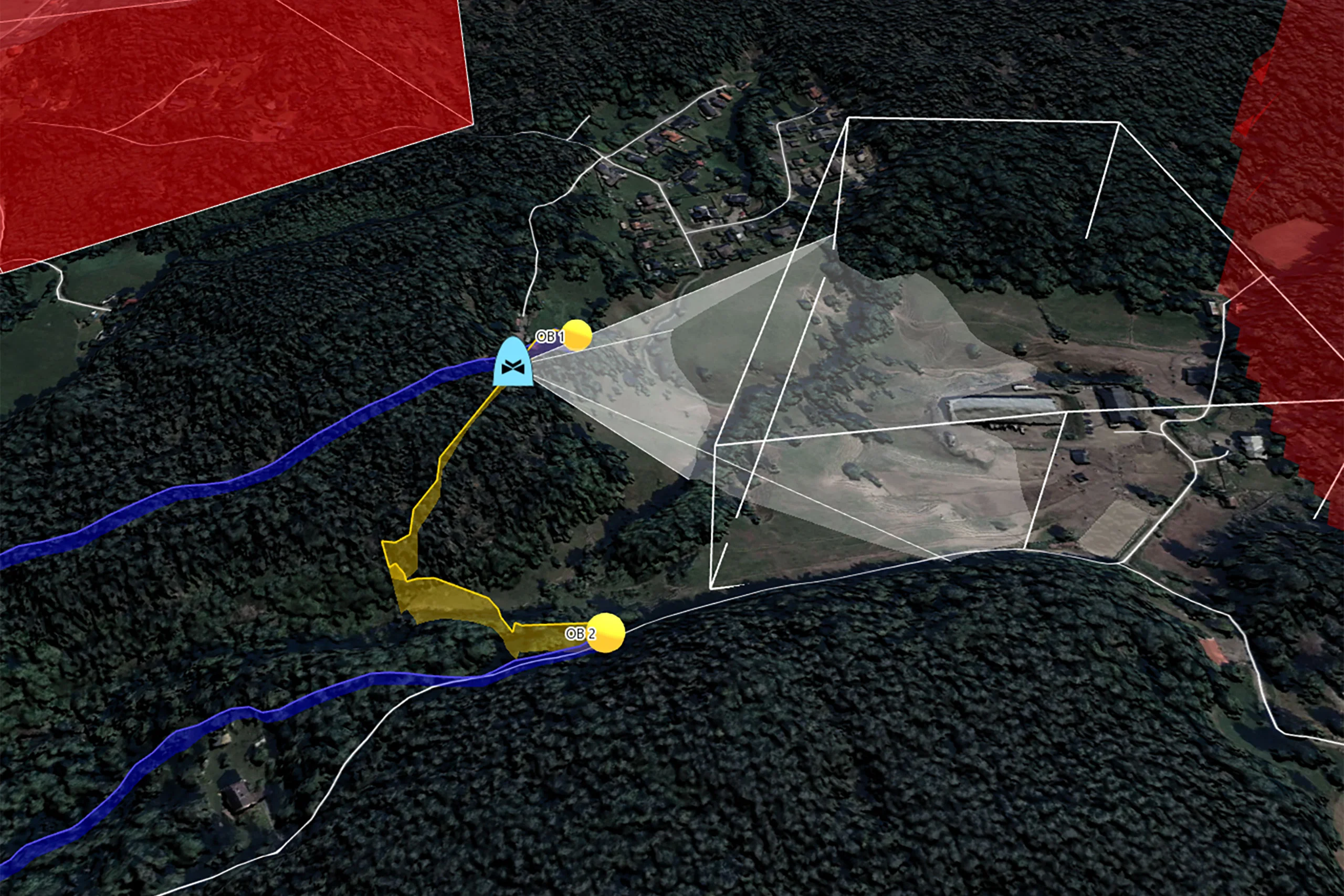
- Terrain and elevation data
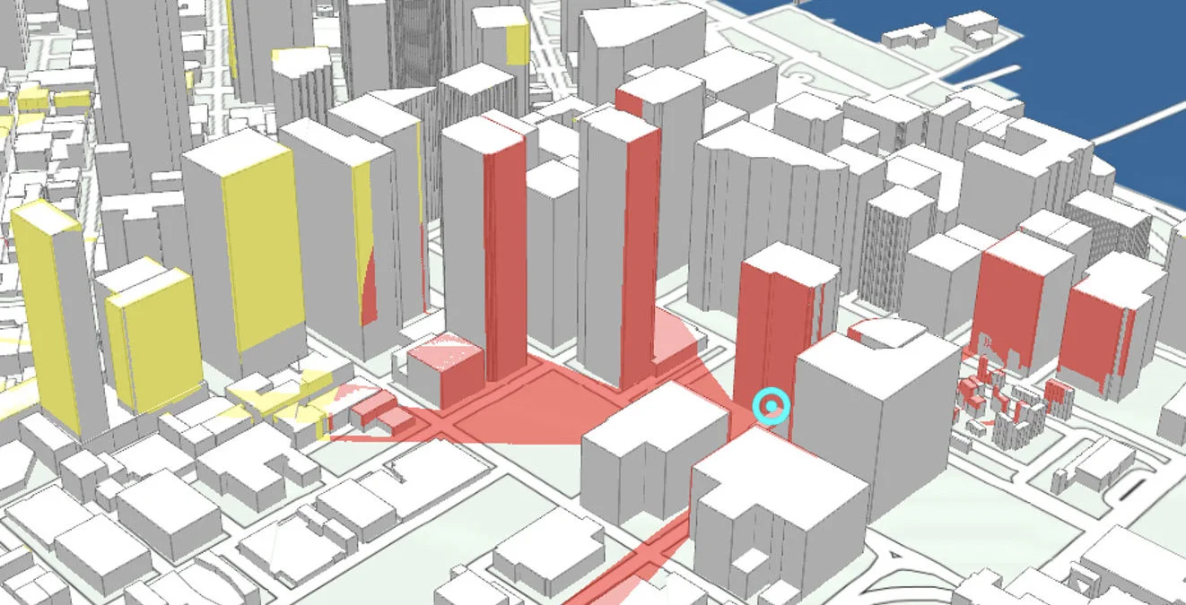
- Urban structures and buildings
- Airspace restrictions
- Static and dynamic hazards
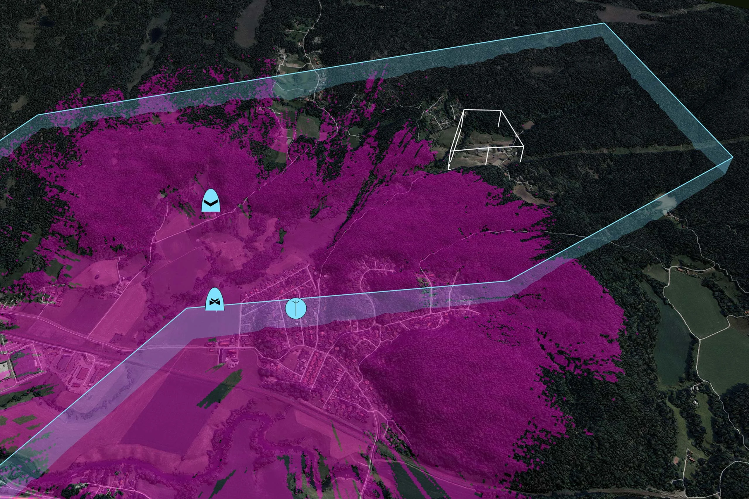
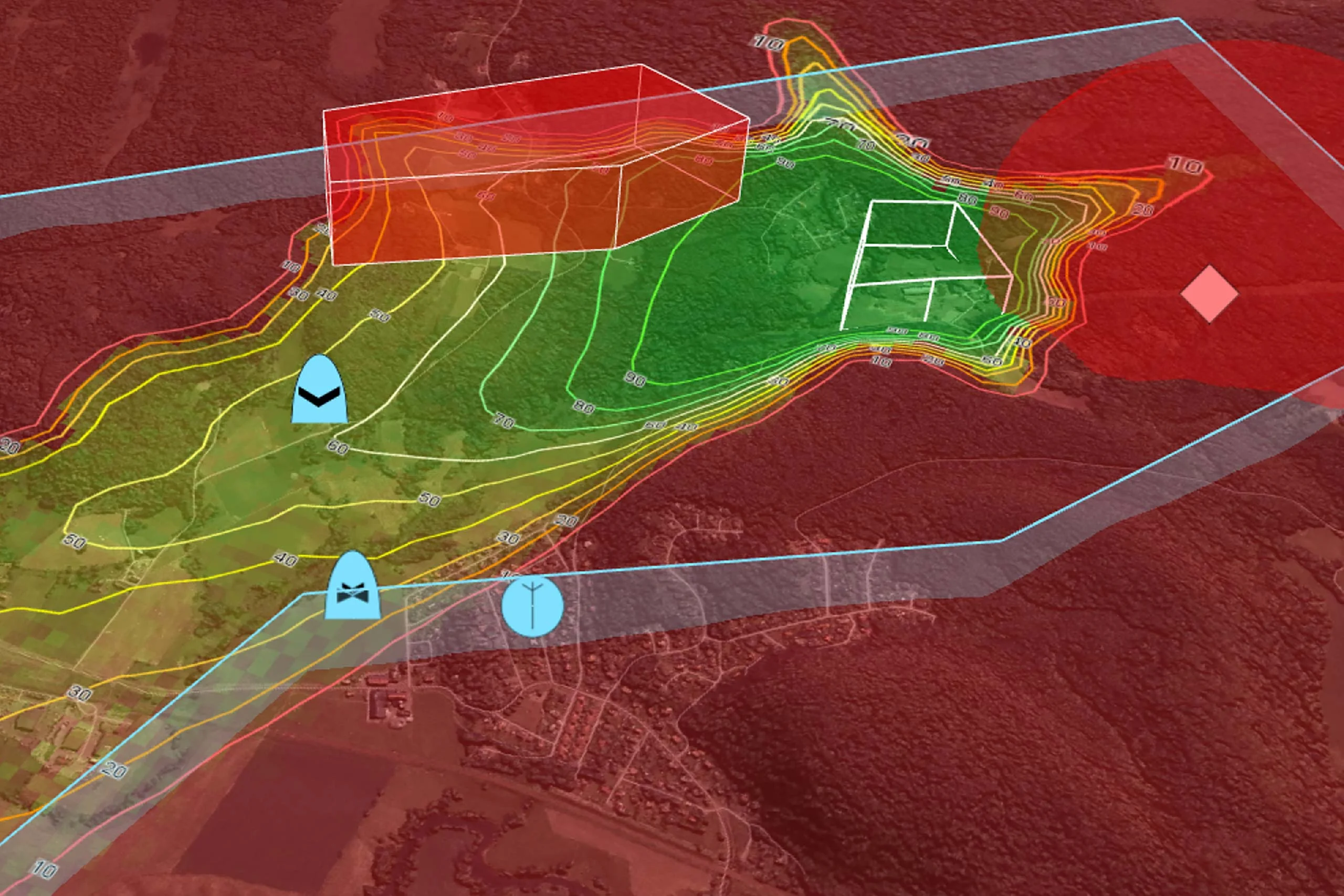
- Threat zones and visibility constraints
- Sufficient radio connection with ground control station
This ensures that UAVs can fly safely and undetected at low altitudes while minimizing their exposure to threats.
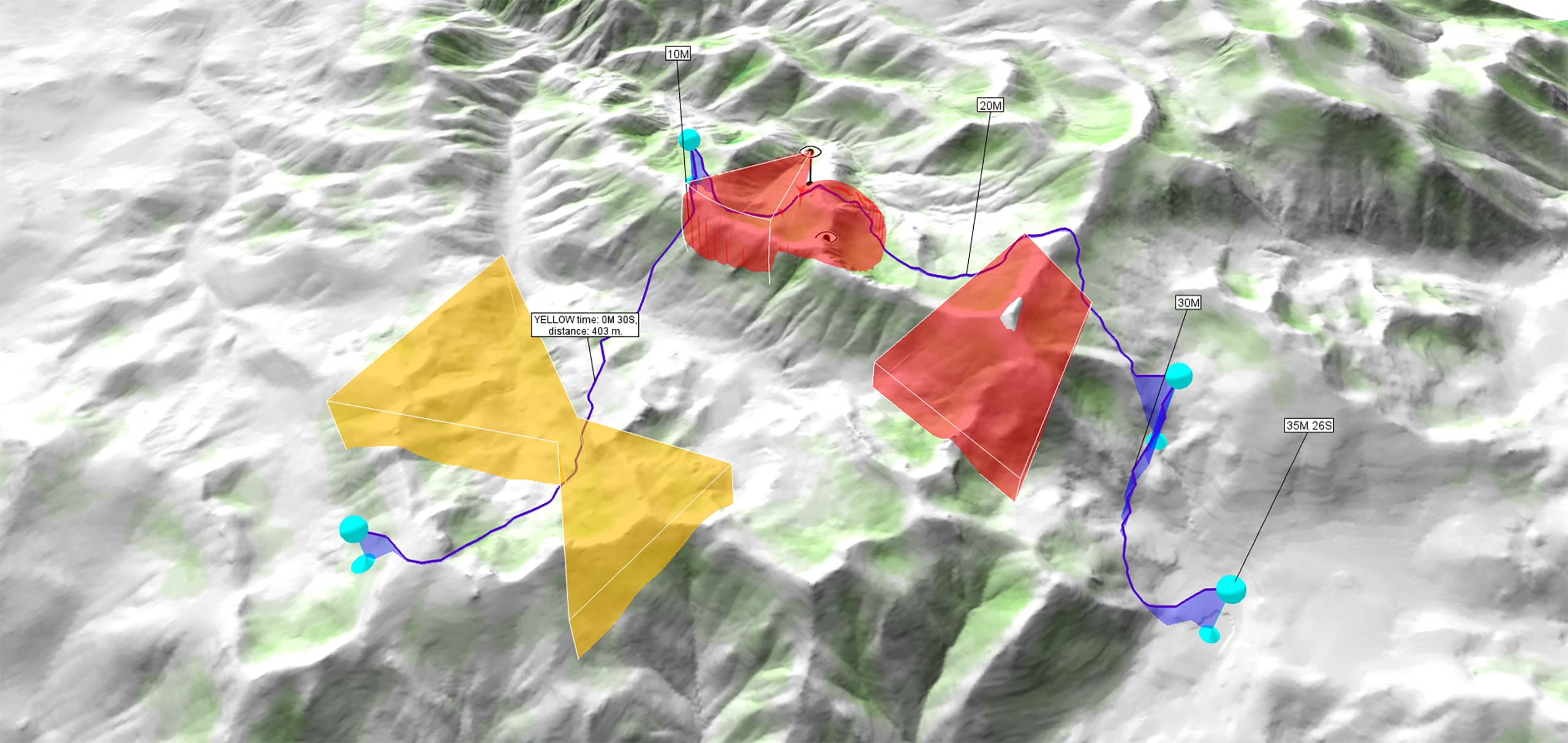
Synchronize UAV Movement
Carmenta’s routing algorithms provide precise journey time estimates, which are essential for coordinating UAV movements with ground forces or other aerial assets. This synchronization ensures:
- Timely arrivals and departures
- Coordinated multi-platform operations
- Maximum mission efficiency
- Reduced operational risk
Whether you’re planning a single UAV mission or coordinating a fleet, Carmenta’s routing capabilities help ensure that every asset is in the right place at the right time.
Stealth and Concealment
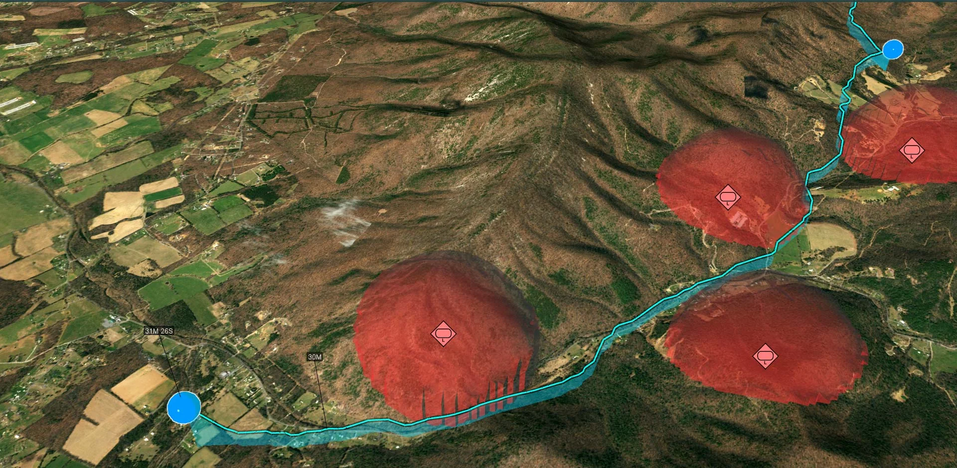
In tactical UAV operations, stealth and concealment are vital for ensuring the survival of the platform. By analysing 3D terrain coverage, mission planners can identify natural features that can protect the UAV from observation and detection.
Carmenta’s UAV routing utilizes terrain features such as ridges and valleys, as well as changes in elevation, to enable UAVs to move undetected.
- Flying along the reverse slope of a ridge can shield UAVs from enemy observation.
- Valleys provide low-altitude corridors ideal for NOE flight.
- Elevated terrain can mask UAV movement from ground-based sensors.
Enhanced UAV Routing
With Carmenta’s UAV routing also integrated in Carmenta UAS Mission Kit, planners can generate real-time, terrain-aware, and threat-sensitive nap-of-the-earth flight paths that support both covert movement and synchronized operation.
Carmenta’s UAV routing capability can be further enhanced by integrating additional mission parameters such as timing, energy consumption, radio coverage, stealth, camera-focused paths, reachable emergency landing zones, and coordination with other moving vehicles.
Learn More
- Discover Carmenta Engine’s visibility analysis capabilities:
https://carmenta.com/features/visibility-analysis
Whitepaper
Resupply with UAVs
Real-time geospatial analysis for UAVs can be used to cope with dynamic challenges, enhancing situational awareness on the battlefield and supporting both human and autonomous decision-making.
Knowledge Hub article
AI-Powered Geospatial Intelligence
Using AI-assisted computer vision, robust, near-live navigability maps and terrain analyses – continuously adapted to any detected changes – are created using 3D reconstruction, object recognition and scene-based analysis.
Technology to Empower Uncrewed Systems
Carmenta Server
Carmenta UAS Mission Kit
Carmenta UAS Services

Develop More in Less Time
Leveraging an SDK does not only accelerate the development process and cut costs, it also increases application robustness and reliability.
Related Features
Radio Coverage
Placement of Observers
Landing Zones
Camera Focused Planning
Geospatial Data from Any Source
Interoperability

Cross-Platform Development

High-Performance Rendering

Military Tactical Overlays
Georeferenced Video

Aeronautical Charts
Nautical Charts
Meteorological Data

Terrain Vehicle Mobility
Terrain Analysis
Visibility Analysis
Radar Data