Carmenta Engine 5.14
This release introduces the ability to display georeferenced full motion video streams in 3D GlobeView maps. Additionally, the new volumetric line-of-sight functionality makes it possible to perform airspace coverage calculations.
Other improvements include support for the MIL-STD-2525D and NATO APP-6(D) military symbol standards and the ability to read aeronautical data directly from files in the AIXM format.
Georeferenced Full Motion Video in 3D
The new Camera Projection Overlay makes it possible to display georeferenced full motion video streams in 3D GlobeView maps. This feature complements our existing, battle tested support for handling such video streams in traditional 2D maps.
The high resolution video streams can be draped in real time onto any 3D structures, including detailed 3D city models. Our efficient GPU implementation ensures that the frame rate stays smooth and that the CPU has time for other tasks.
Volumetric Line-of-Sight
The Line-of-Sight Operator has been extended with the ability to produce viewshed volumes that indicate which parts of its surrounding airspace an observer can see.
The volumes can be visualized in 3D GlobeView maps. They can also be cut through by the Vertical Profile analysis.

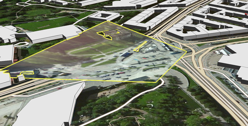
Additionally, the new Airspace Coverage Operator can be used to merge a number of such viewshed volumes into a combined volume that represents airspace covered by a sufficient number of observers. The operator can also be used to show the parts of an airspace that lacks sufficient coverage, as in the picture below.

Support for Reading Aeronautical Information Exchange Model (AIXM) Files
The new AIXM Dataset makes it possible to directly connect to aeronautical information in the XML based AIXM 5.1 and 5.1.1 formats that have been jointly developed by EUROCONTROL and FAA.
The picture below shows how information from an AIXM file can directly be visualized in the style of an Enroute Chart.

New API for Creating OGC GeoPackage Files
A new API makes it easier than ever to create and populate files in the standardized OGC® GeoPackage format – an optimized, single-file container that is perfect for distribution to mobile devices.
The API supports writing both image pyramids, coverage pyramids and vector data to the GeoPackage, and any Carmenta Engine View, Layer, Operator or DataSet can be used as the data source.
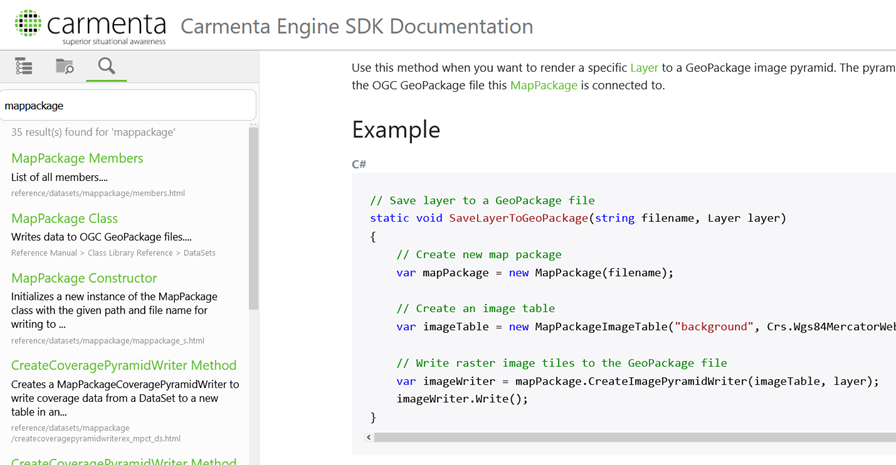
A page from the Carmenta Engine SDK documentation showing one of the GeoPackage code samples.
Support for MIL-STD-2525D and NATO APP-6(D)
The Tactical Extension has been updated to support point symbols from the US MIL-STD-2525D and NATO APP-6(D) symbol standards.
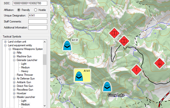
A screenshot from a Carmenta Engine SDK sample application showing MIL-STD-2525D symbology.
Other Notable Improvements
New Feature Animation API on MemoryDataSet
New feature animation methods on MemoryDataSet makes it easy to smoothly move features along a 2D or 3D trajectory.
The API can also be used to animate feature transitions to a new position. This is useful to ensure a smooth behavior even when receiving infrequent position updates.
Automatic Deactivation of Layers with Errors
The new “Disable on Error” functionality makes it possible to automatically deactivate layers that are not operational, e.g. due to unavailable map servers. This allows the rest of the map to continue to operate when such errors occur.
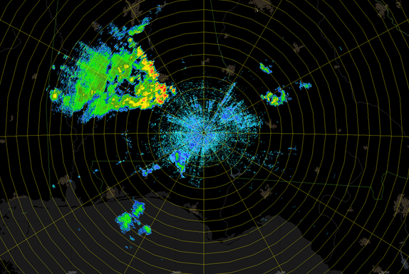
User Defined Color Tables for Radar Video
The Radar Video layer can now visualize the sweep intensity using a user-defined color table. This type of visualization is commonly used for weather radar presentation, as in the picture below.