Carmenta Engine 5.6
The new version of Carmenta Engine provides a new, highly optimized way to render radar plots and other dynamic information. Other major improvements include support for the new Open Geospatial Consortium GeoPackage standard and a powerful new off‑road routing algorithm for terrain vehicles.
Optimized Radar Plot Rendering
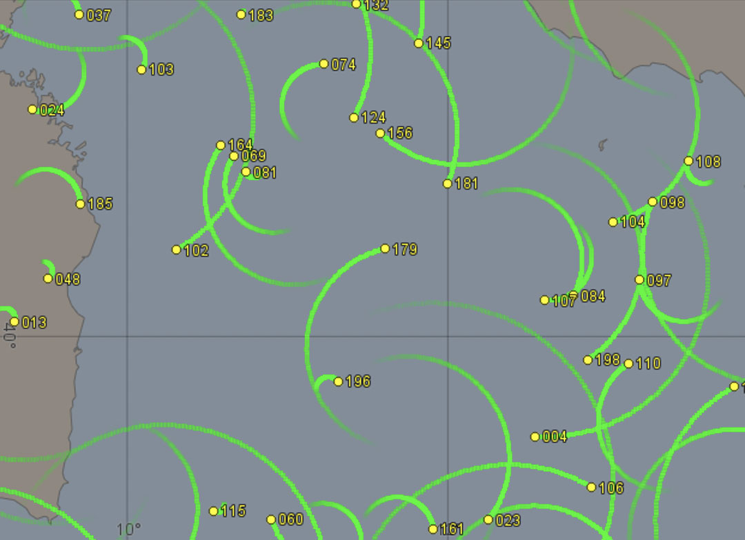
The new PlotLayer component is a new type of map layer designed specifically to render large amounts of simple point objects like radar plots.
Thanks to the highly optimized GPU accelerated rendering, PlotLayer is capable of handling millions of plots which update their positions several times per second.
The screenshot below is from the new “Dynamic Objects” sample application which uses PlotLayer to render the trails of rapidly moving objects.
Terrain Vehicle Routing Functionality
The new TerrainRouteOperator can calculate the optimal route for a terrain vehicle, based on the characteristics of the vehicle.
In addition to the road network, the sophisticated calculation takes the soil strength, roughness and slope of the terrain into account.
The real time route calculation can also avoid forbidden areas like minefields and enemy viewsheds, making it suitable for use as decision support in a Battle Management System.
OGC GeoPackage Support
GeoPackage is an SQLite-based format that efficiently stores and transfers geographic vector features and image tiles. It is standardized by OGC®, the Open Geospatial Consortium.
In Carmenta Engine 5.6, the MapPackageDataSet has been updated to support version 1.0 of the GeoPackage specification (12-128r10).
As a Technical Committee member of the OGC, Carmenta is dedicated to using and promoting open standards wherever possible.
Many New Programming Samples
The Carmenta Engine SDK has been extended with a number of new programming samples which are of course provided with full source code.
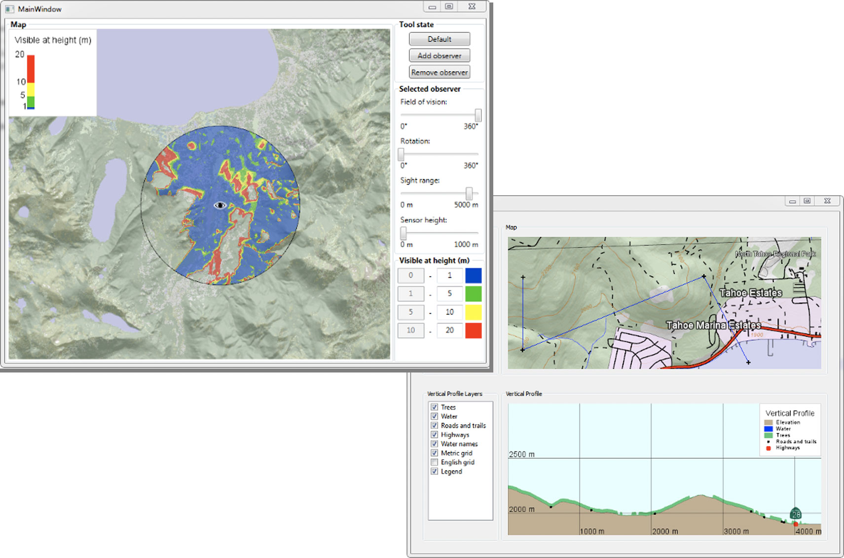
There are new sample applications that demonstrate how to access the Line of Sight and Vertical Profile functionality, as well as an application which shows you how to handle large numbers of dynamic objects efficiently.
The Java based samples have also been significantly extended: A new, more comprehensive Java based “Basic Map Application” has been added, as well as Java implementations of all the custom object samples.
The screenshots below show two of the new sample applications in action.
Other Notable Improvements
MIL-STD-2525C Support in the Tactical Extension
The Tactical Extension now supports symbols from MIL-STD-2525C (appendix A, D and E).
The new functionality complements the existing support for MIL-STD-2525B and NATO App-6B.
PostgreSQL/PostGIS Database Support
The new PostgreSqlDataSet allows you to natively read spatial data from PostgreSQL/PostGIS databases.
NATO AML Support
AML, Additional Military Layers, is a NATO-endorsed standard designed to enhance situational awareness in the marine and littoral environment.
The S57DataSet now supports reading S-57 AML data versions 2.1 and 3.0.
Improved Interoperability in the OGC CSW Client
The Carmenta Engine Catalog Extension makes it possible to connect to servers that implement the OGC Catalog Service for the Web (CSW) interface.
The interoperability of the CSW client has been improved – it is now possible to connect to many more CSW implementations.
Simplified Color Table Handling
RasterVisualizer can now automatically interpolate between the colors in the color table, avoiding the need to manually specify color ramps. It can also dynamically adjust the color table to the range of the raster values actually occurring in the raster, ensuring that the full color range is always used.