Carmenta Map Builder
Prepare and Deploy Maps to Carmenta Based Systems
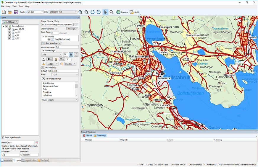
An easy-to-use application that allows end-users to create and deploy background maps for their Carmenta-based applications.
Maps can be created from a variety of sources, including vector-based maps from many different sources combined with nautical charts, high-resolution imagery, and digital elevation models.
An intuitive user interface makes it easy to set up custom symbology and legends for the map, and structured metadata such as data validity and publisher information can also be added.
Why Choose Carmenta Map Builder
Saving valuable time
Streamlining the map creation process saves valuable time for these end users.
Easy preparation and deployment
Easy creation of background maps, even for people who are new to GIS.
Optimizing map efficiency
Built-in data analysis and validation functions ensure that maps are as efficient as possible when used in the target system.
Pre-rendered Map Packages
For better performance, Carmenta Map Builder can generate optimized, pre-rendered OGC Geopackages from the source data.
Key Benefits
- Requires minimal training.
- Quickly creates efficient maps that are easy to distribute.
- Maps are ready for publishing as web services in Carmenta Server.
Carmenta Map Builder can package the maps for easy deployment to the target system. Built-in support for creating Windows Installer (MSI) files means that the maps can be distributed using standard Microsoft technology on supported platforms, or you can output all used files to a folder or archive file that can be used on any operating system on which Carmenta Engine runs.
The maps are also fully compatible with Carmenta Server. Once deployed on a map server, they can be published as Open Geospatial Consortium (OGC®) compliant web services.
Finally, data can also be packaged in the zip file based Carmenta Catalog format. This format can be used on all operating systems supported by Carmenta Engine and does not require any installation. The original data files don’t need to be converted, which makes packaging extremely fast.
Whether you are developing solutions for Air, Land, or Sea – Carmenta technology is deployed and trusted in systems across the world.
Try for free – no commitment
Are you ready to see how our products can transform your work? Request a free trial today and explore the full potential of our geospatial technology.
Our free product evaluation includes:
- 30 days unlimited access to our SDK.
- Full access to our e-mail support during the evaluation period.
- Full access to our online self-study course during the evaluation period.
Please specify which product/products you are interested in.
This form can be used to request a trial for:
- Carmenta Engine
- Carmenta Server
- Carmenta Map Builder