Carmenta Engine
Latest Updates
Carmenta Engine 5.17
Carmenta Engine 5.17 is the latest version of our core technology. You can find new features in earlier releases further down this page.
Key new features and Capabilities in Carmenta Engine 5.17:
- Enhancement of our market-leading support for live drone video processing.
- Bringing support for the next generation OGC® API standards to Carmenta Technology.
- Carmenta Engine SDK now includes Carmenta Tile Engine: A lightweight, robust, easily deployable map server that supports the OGC API Tiles specification.
On-the-fly “painted” map from drone video
A new component makes it possible to generate a continuously updated image mosaic as the video is downlinked. The result is that the map is “painted” on-the-fly with images from the video, significantly improving situational awareness for end users.
The new functionality has been designed with interoperability in mind. The image mosaic is written to an OGC GeoPackage file that can be easily distributed to other systems.
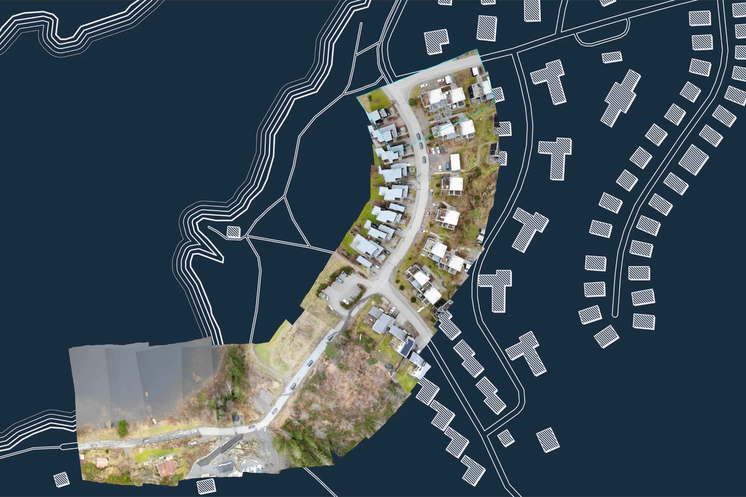
Example of “painted map” in use
The on-the-fly “painted” map from drone video functionality has been used in a project with BAE Hägglunds.
The objective of the project was integrating autonomous drone surveillance capabilities into combat vehicle – CV90 and Camenta developed a demonstrator for advanced 3D mission planning of autonomous BVLOS (Beyond Visual Line-of-Sight) drones.

Support for next generation OGC API standards
Carmenta Engine 5.17 brings support for the next generation OGC API standards to Carmenta Technology. OGC API is a lightweight, REST-based way to access geospatial data in a service-based context.
New components make it easy to connect to individual tile collections as well as to browse the content of OGC API endpoints.
Tile Engine now part of Carmenta Engine SDK
The Carmenta Engine SDK now includes Carmenta Tile Engine: A production-ready map tile server that implements the OGC API – Tiles interface.
Carmenta Tile Engine is extremely lightweight and very easy to deploy. It has never been easier to decouple the handling of background maps in your Carmenta based solutions.

Carmenta Engine and Next Generation OGC API Standards
Watch the webinar below! Discover how the new Carmenta Tile Engine component allows you to easily set up OGC API Tiles services, delivering background maps to your Carmenta Engine-based clients or any other compatible applications.
Other Notable Improvements
-
Enhanced SDK documentation
Many reference documentation pages now include links to relevant sample map configurations, and the sample map configurations have been extended with information overlays explaining the functionality they demonstrate. -
Full support for Linux Wayland
Carmenta Engine now fully supports Linux Wayland and all Qt samples have been updated accordingly. -
Extended expression syntax
The expression syntax has been extended with new functions.
Try for free – no commitment
Are you ready to see how our products can transform your work? Request a free trial today and explore the full potential of our geospatial technology.
Our free product evaluation includes:
- 30 days unlimited access to our SDK.
- Full access to our e-mail support during the evaluation period.
- Full access to our online self-study course during the evaluation period.
Please specify which product/products you are interested in.
This form can be used to request a trial for:
- Carmenta Engine
- Carmenta Server
- Carmenta Map Builder