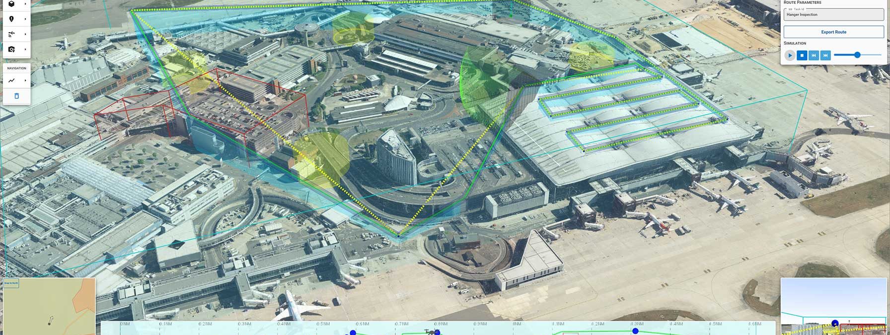
Flying BVLOS drones within London Heathrow Airport
Operating drones in highly congested urban environments is a challenge. To do it beyond visual line of sight (BVLOS) and autonomously, is an even greater challenge.
This is what Carmenta technology is currently being developed to address within the HADO® Project, initiated by Innovate UK. The goal is to implement the first real-world application of such as system at London Heathrow Airport.
The use cases in the project include perimeter surveillance, infrastructure inspection, incident inspection, and package delivery. Carmenta technology uses a high-resolution 3D model to generates an optimal route, considering obstacles such as buildings, restriction areas, overlapping UAS flight corridors, and sensor coverage. If the conditions for the route change, the route is regenerated and adapted in real-time.
In a series of videos, we will showcase various capabilities developed and used in the HADO® project, ranging from mission planning (tactical planning) to placing a camera path with area restrictions, conducting building inspection, and managing dynamic hazards and swarm routing.
Read more here