The Critical Role of Geospatial Data in Military Operations
Geospatial data is the foundation for situational awareness, mobility and decision-making in military operations. When the accuracy of this data is compromised, the consequences can be far-reaching and result in poor planning, inefficient routing, environmental miscalculation and even loss of equipment and systems.
In complex and rapidly evolving environments and situations, relying on outdated maps can mean the difference between success and failure.
The Risks of Outdated or Low-Resolution Data
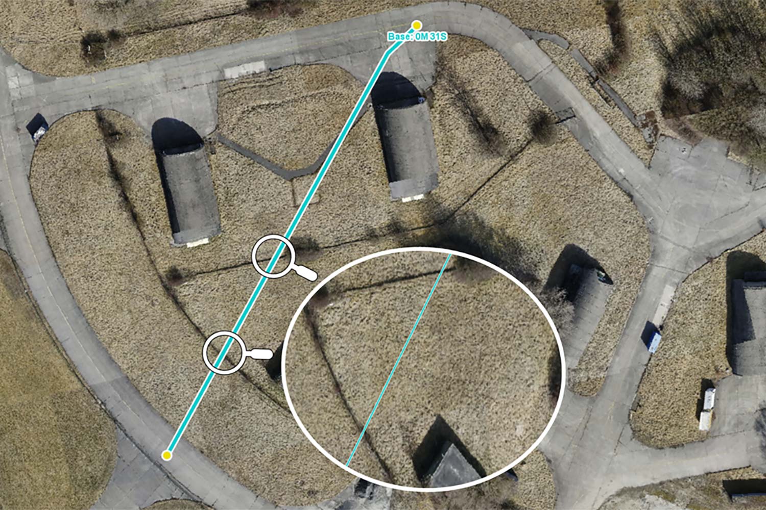
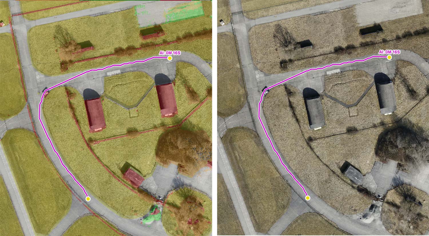
Imagine planning a route for a UGV using outdated and low-resolution data. Without knowledge of obstacles such as fences or small streams the UGV could end up falling over or getting stuck.
Additionally, recent changes to the environment such as fallen trees or destroyed buildings will not be included in the data, making the planned UGV route impossible to traverse.
The image below shows a route for a UGV planned, using only low-resolution terrain data. When overlayed on a frame from a recent drone video, it becomes clear that the planned route crosses several fences and ditches.
Leveraging Drone Video and AI for updated Geospatial Data
Despite its critical importance to military operations, the question of where to get high-resolution, up-to-date geospatial data is often overlooked. Today, however, video feeds from drones can be combined with AI tools to help generate accurate geospatial data in near real time.
AI-Powered Terrain Analysis with SpatialGPT and Carmenta
Carmenta and SE3 Labs are working together to create and exploit terrain classifications from drone-derived data using AI.
Real-time UAV data is transformed into high-resolution, semantic 3D maps using AI-assisted computer vision. SE3 Labs integrates 3D reconstruction, object recognition, and scene-based analysis via the LLM (Large Language Model) “SpatialGPT”.
This unique technology enhances geodata analysis by creating detailed terrain classifications and continuously updating geodata.
The advantage: robust, near-live navigability maps and terrain analyses that are directly integrated into the Carmenta Engine. This enables real-time mission planning and adaptation to any detected changes based on geodata that is updated every minute.
Together with the SpatialGPT language interface, this creates an intuitive, precise, and adaptive basis for mission planning – particularly relevant for autonomous and UGV-supported operations.
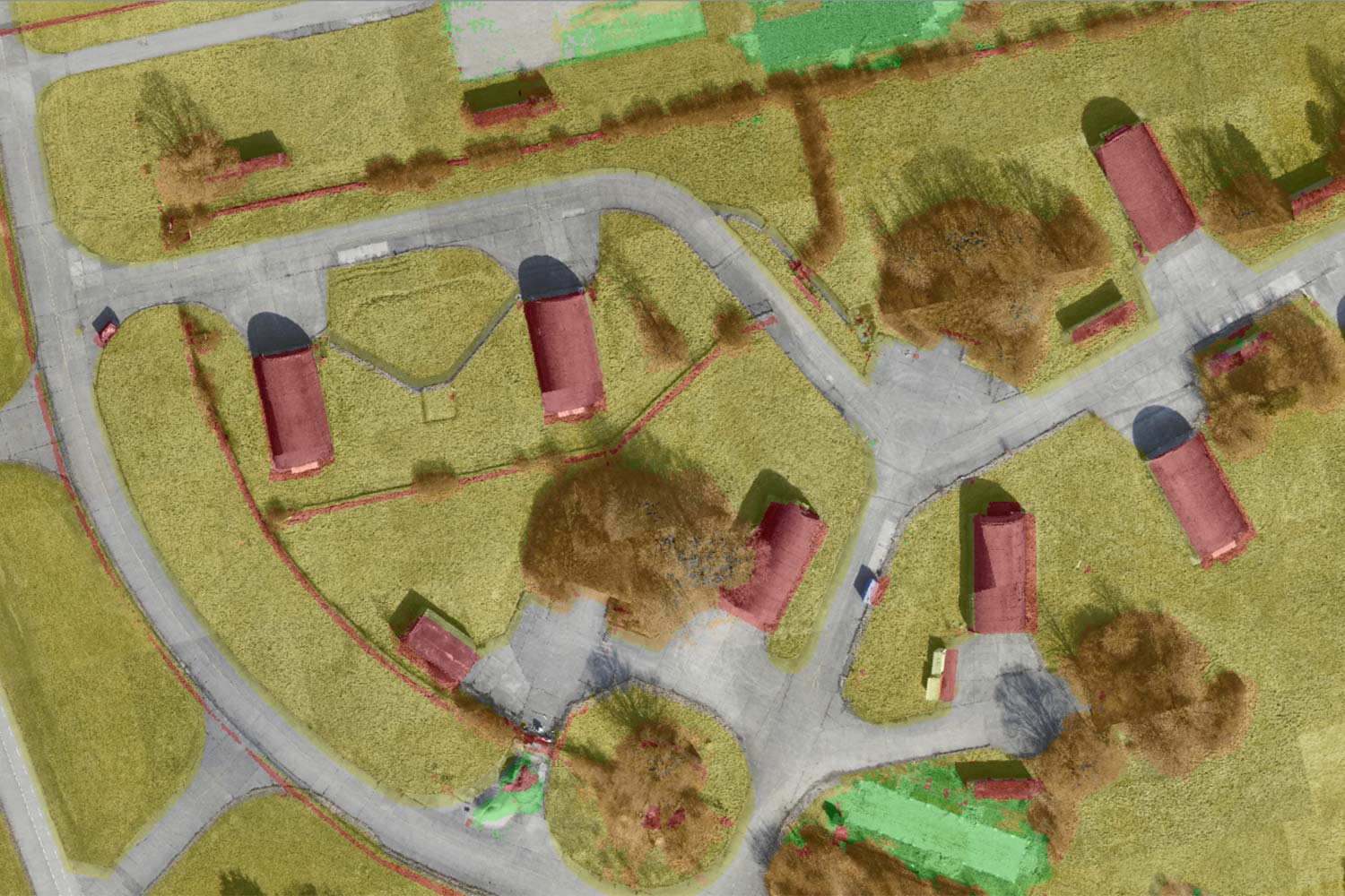
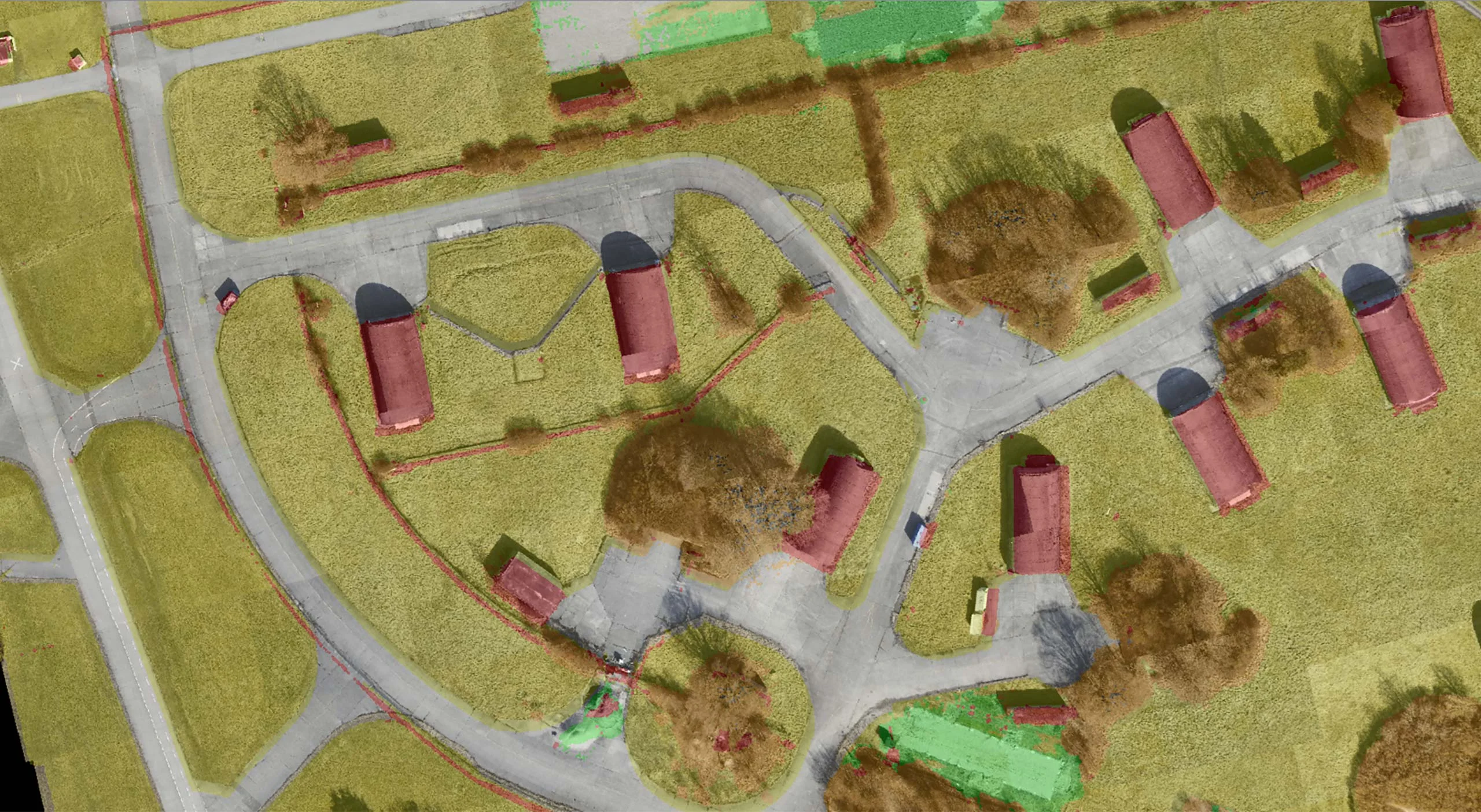
Improving UGV Routing with AI enhanced Data
The image above shows AI-generated land cover data from a UAV video. The red areas are non-traversable, the green and orange areas are grass and fields, and the grey areas are paved areas such as roads.
Such data can be generated in a very short time frame and is high resolution.
When this up-to-date, high-resolution data is incorporated into the UGV’s routing scenario, the route no longer traverses inaccessible areas, and the route is safe and fast.
Seamless Integration with Carmenta’s Geospatial Platform
The versatility and extensibility of Carmenta’s products allow for easy integration with third-party software, including AI-driven solutions.
By enabling the consumption of AI-generated geospatial data, Carmenta enables its customers to use accurate, real-time geographic intelligence, ensuring that decisions are based on the most up-to-date information available.
Revolutionizing Military Strategy with AI and Geospatial Fusion
This seamless fusion of AI and geospatial technology not only improves data accuracy, but also opens up new possibilities for AI-driven decision-making – optimizing navigation, improving situational awareness and revolutionizing operational strategies.
Want to Learn More?
Contact us