Adapt to evolving operational demands
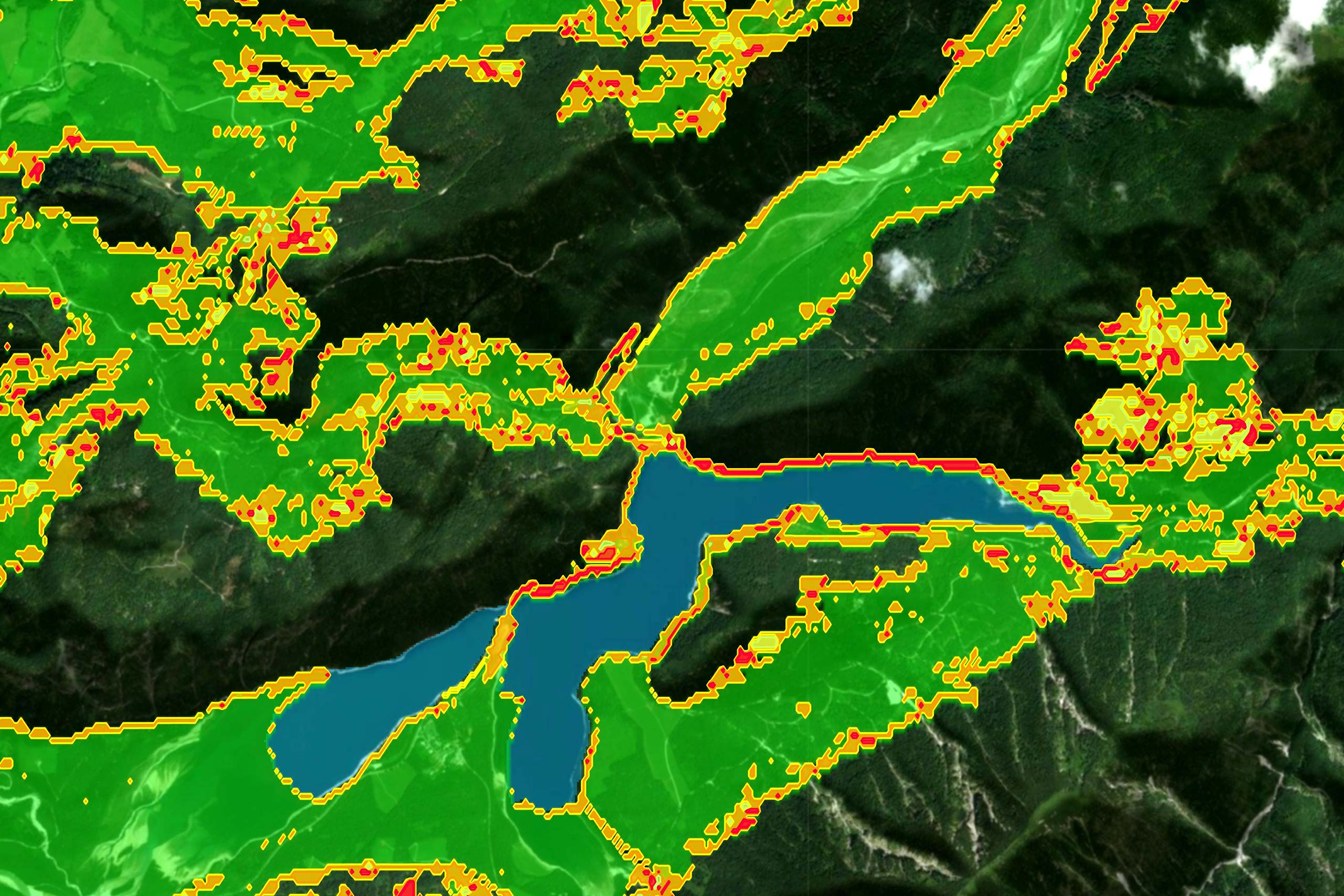
Real-time geo-analysis in conjunction with live position data can make a significant contribution to the dynamic calculation of supply points between supply vehicles and the troops to be supplied. Based on Carmenta’s Terrain router, a real-time calculation of supply points that can be reached safely and on time has been developed.
The system performs these calculations dynamically, incorporating tactical information and changes in the environment. As a result, new, time-accurate supply points are continuously and precisely generated to meet evolving operational demands. Such adaptability ensures a flexible and efficient supply chain for combat troops, even in rapidly changing battlefield conditions.
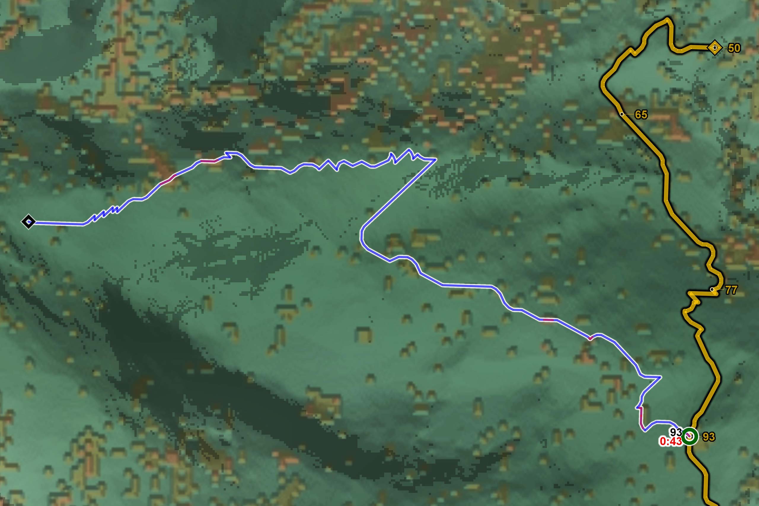
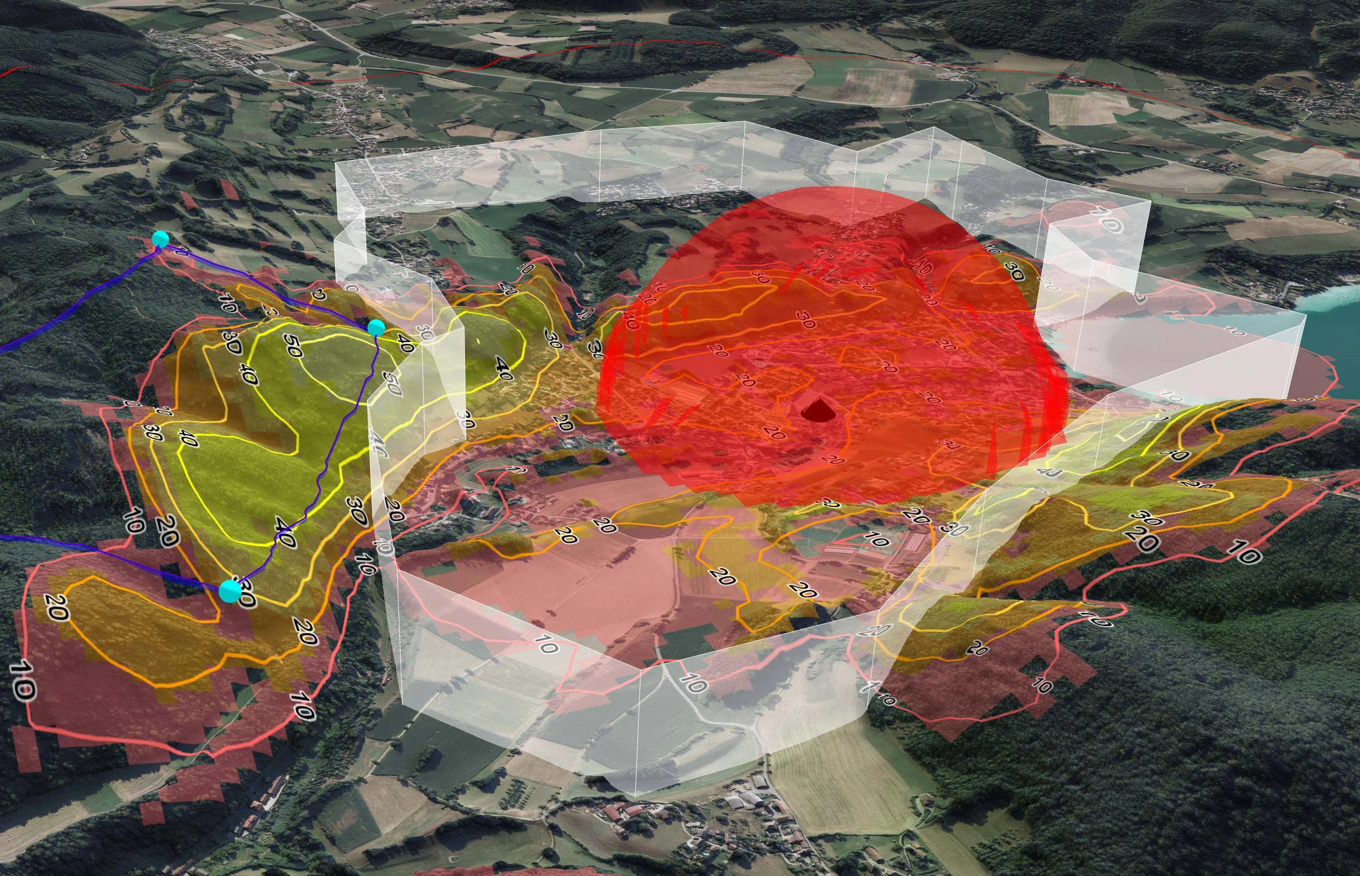
The figure shows the route of the weapon system in yellow. Possible supply points have been defined along this route. The time required for the weapon system to reach the defined supply points is also shown in yellow and in minutes.
Carmenta Engine calculates the optimal supply point and the most timely and safest route for the supply vehicle. The time required for the supply vehicle to reach the supply point is shown in black. The time spent by the supply vehicle in open terrain is shown in red. In the example shown, the supply vehicle reaches the supply point at the same time as the weapon system and spends only 43 seconds in open terrain.
This calculation enables a fast and dynamic response to changes on the battlefield. By calculating supply routes and points in real time, the efficiency and safety of supply can be significantly increased. This is particularly important in unpredictable and rapidly changing situations where flexibility and quick decision-making are essential.