
Webinar: Military last-mile resupply using UAS technology with geospatial analysis
Watch our on-demand webinar about the evolving role of Uncrewed Aerial Vehicles (UAVs) in military logistics. Sign up to get instant access.
Read moreIn this presentation and webinar Jonas Envall talks about some of the functionalities for UAS that we launched in Carmenta Engine 5.16. The video illustrates and exemplifies the display and analysis of geospatial information for UAS.
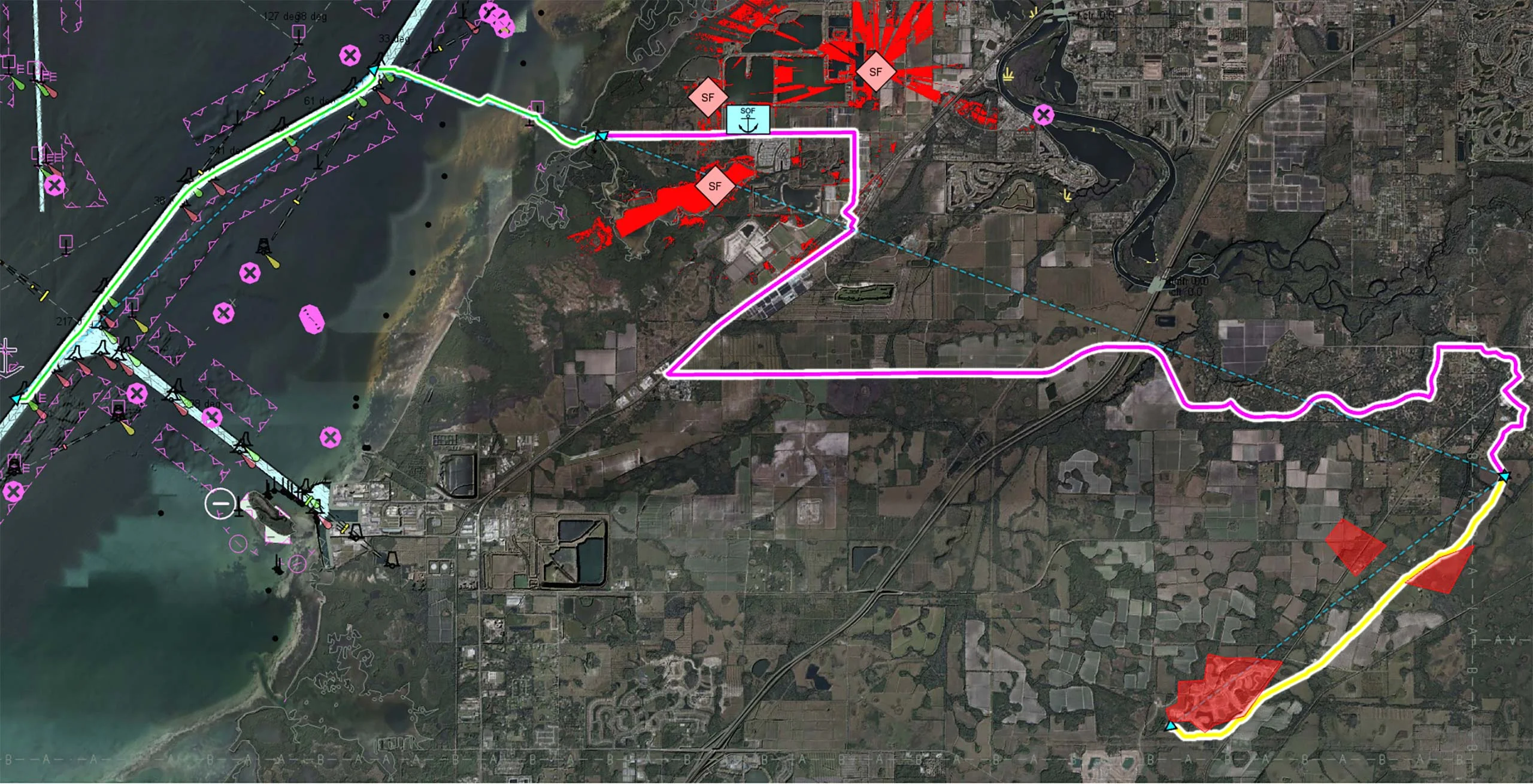
Determining safe landing zones is an essential part of many types of UAS missions. Candidates for safe landing zones can be calculated using terrain data and land classification along the planned route. In the flight planning safe landing zones can then be displayed, so that the drone can start its mission with good candidate areas where it can land safely. If needed the route can be dynamically adjusted to ensure that safe landing is possible during all of the mission.
Another vital part of UAV mission planning is the ability to calculate the best UAS route for a mission taking a number of parameters, including terrain and no-go zones into account. One type of such route is nap-of-earth flight that follows the terrain as much as possible making the drone difficult to detect.
Jonas Envall
Business Development Director UAS
Watch our on-demand webinar about the evolving role of Uncrewed Aerial Vehicles (UAVs) in military logistics. Sign up to get instant access.
Read moreDiscover how drones use carefully designed flight patterns for mapping and inspection missions, balancing efficiency, coverage, and data quality. Explore the challenges and technology behind optimized aerial routes.
Read moreCarmenta is proud to announce the conclusion of the HADO® project, paving the way for safe and autonomous drone flights in urban environments and high-intensity airspace.
Read more