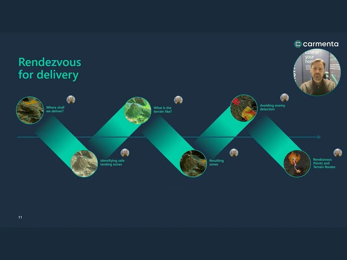
Geospatial Analysis in Resupply Missions
Geospatial 3D analysis plays a crucial role in military last-mile resupply operations by providing valuable insights into the three-dimensional aspects of the environment. In the following section, we explore how 3D coverage analysis can assist in optimising and securing last-mile resupply efforts in scenarios similar to the one described above.
Terrain Analysis
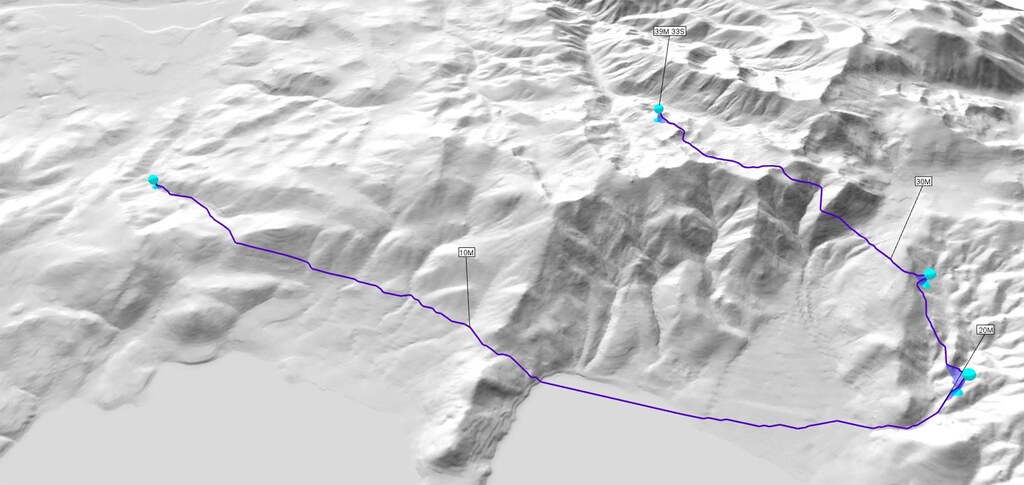
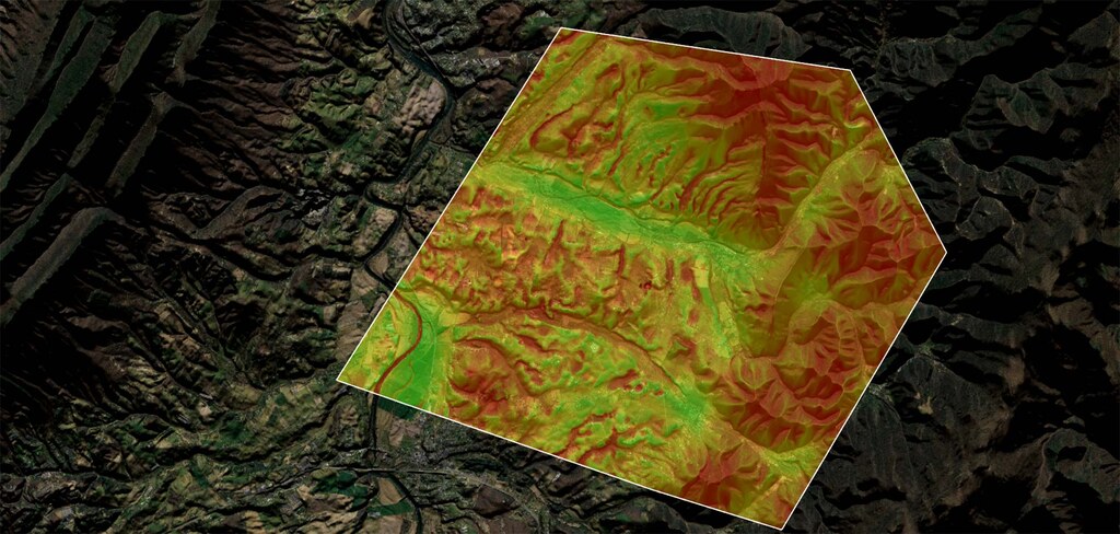
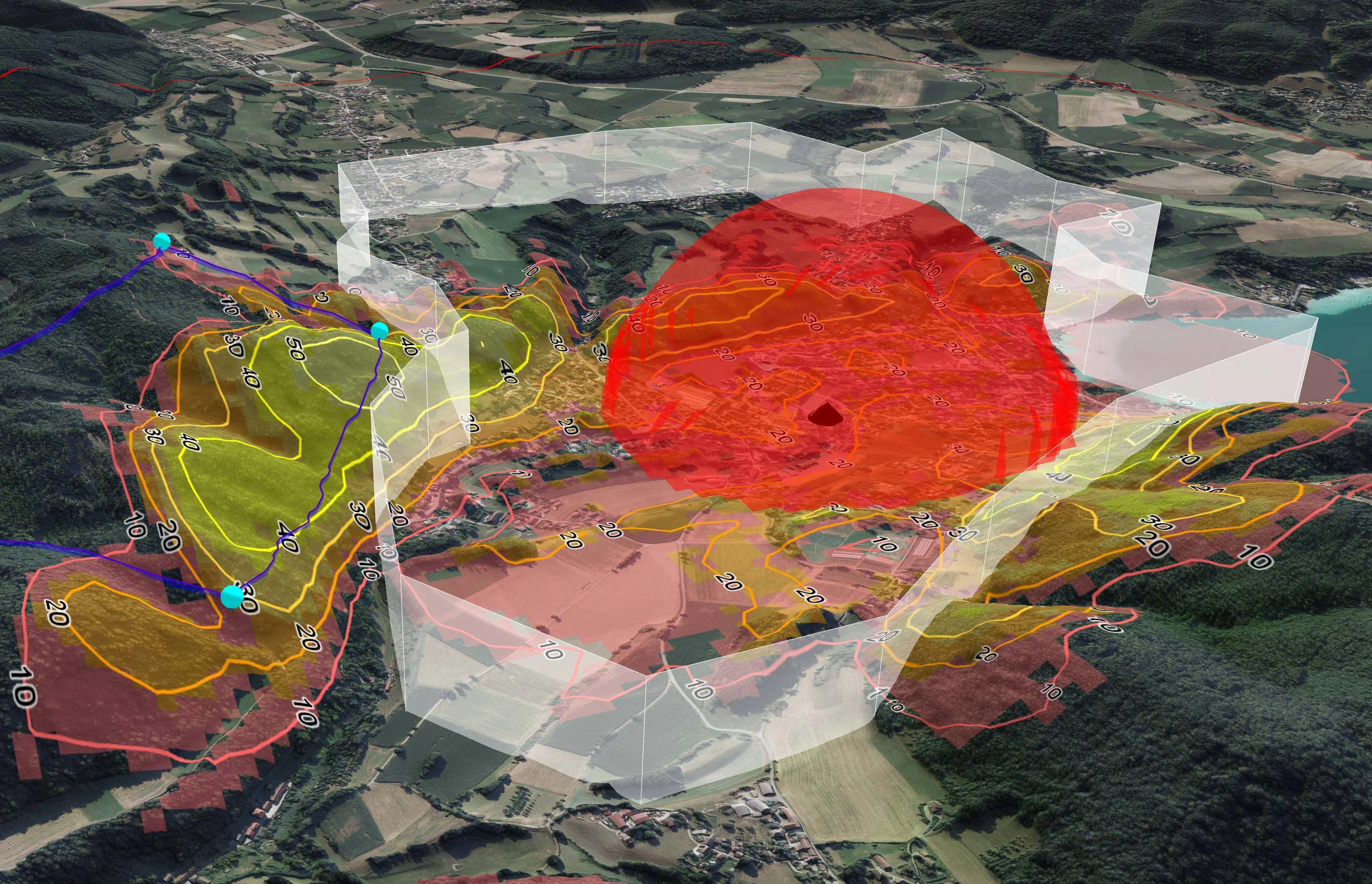
3D coverage analysis helps assess terrain elevation, slopes and obstacles, providing a comprehensive understanding of the physical environment. This information is crucial for determining the most suitable flight routes for last-mile resupply, avoiding difficult terrain and ensuring efficient movement.
Terrain analysis aids in understanding where the UAV can land, whether the site is accessible to front-line personnel, and whether it provides sufficient cover.
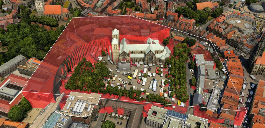
Obstacle Detection and Avoidance
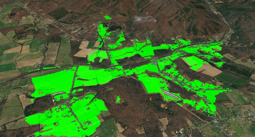
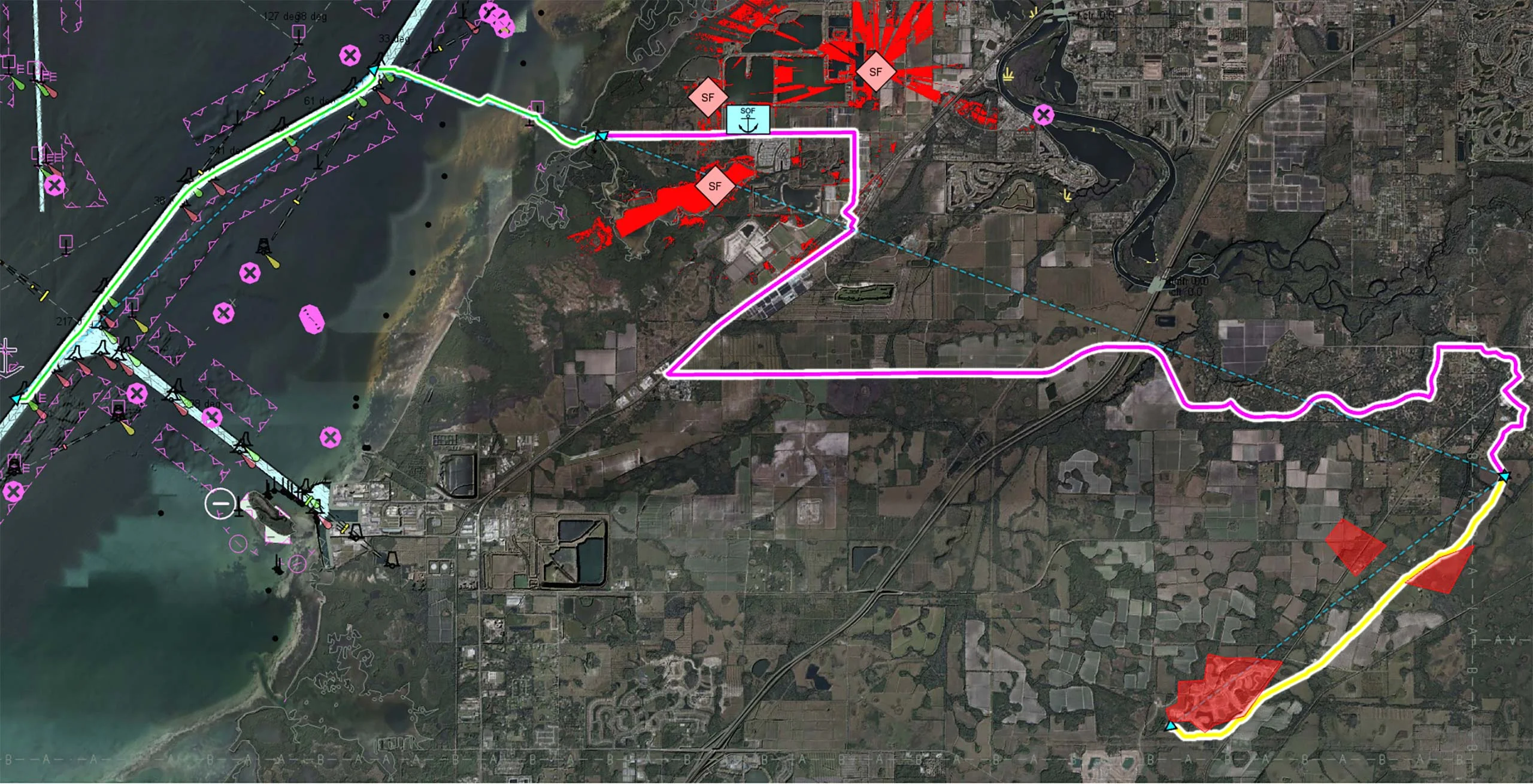
3D mapping helps identify natural and man-made obstacles in the operational area, including buildings, vegetation and bodies of water. By avoiding or mitigating these obstacles, military planners can optimise UAV resupply routes, reduce the risk of damage to supplies, and enhance overall mission success.
The identification of obstacles within the operational area is crucial for determining the most suitable UAV flight path to safely get to the target and back. In addition, it helps to identify possible escape routes. As with terrain analysis, identifying obstacles assists in understanding where the UAV can land and whether these areas can be reached by ground forces.
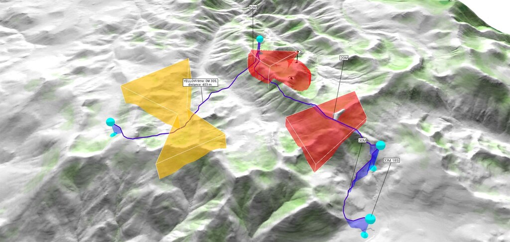
Line-of-Sight Analysis
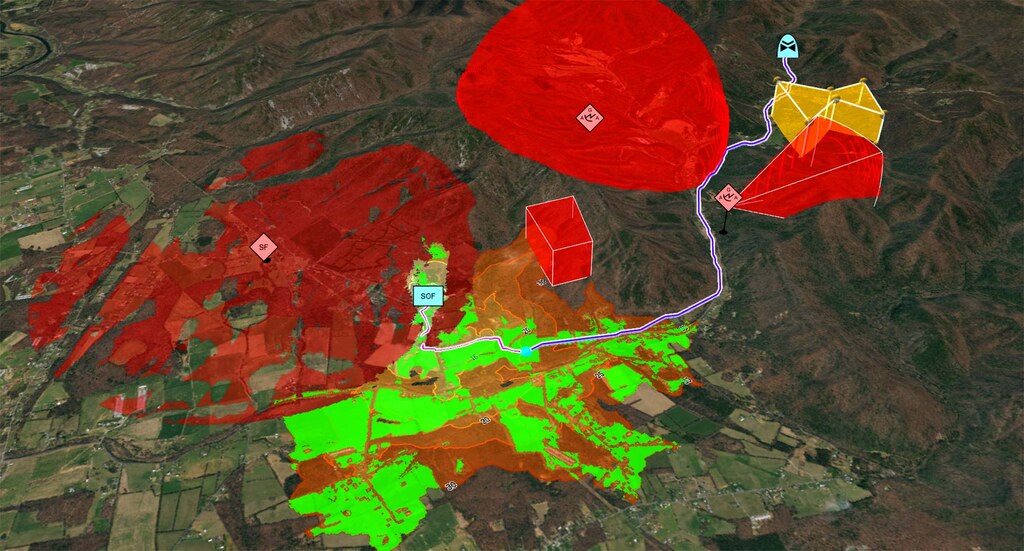
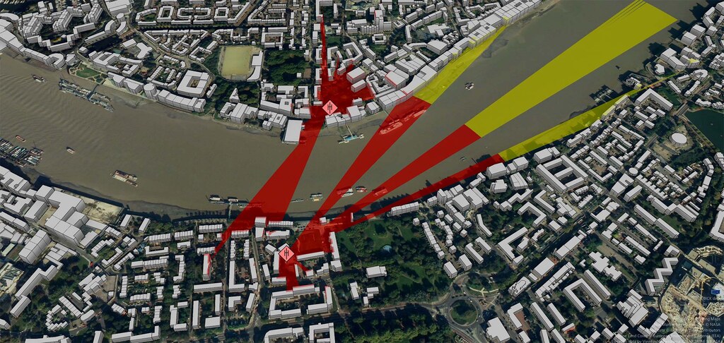
3D coverage analysis enables the evaluation of line-of-sight (LOS) conditions between various points in the operational area. LOS analysis helps identify potential communication challenges and areas where resupply drops or pick-ups may be more vulnerable to enemy observation or interference.
LOS analysis provides information on areas where the drone can safely operate without detection or interception, while staying within communication range and maintaining GNSS signal for navigation. It also makes it possible to identify potential threats in the drop zone for ground forces.
Drop Zone Selection
Analysis of 3D coverage assists in the selection of optimal drop zones for airborne resupply operations. Factors such as elevation, wind patterns and surrounding terrain are considered to ensure safe and accurate delivery of supplies to the intended locations.
These 3D analyses provide information to identify suitable drop zones that ground troops can safely reach, and to identify alternative drop zones if the original plan has to change.
Airspace Deconfliction
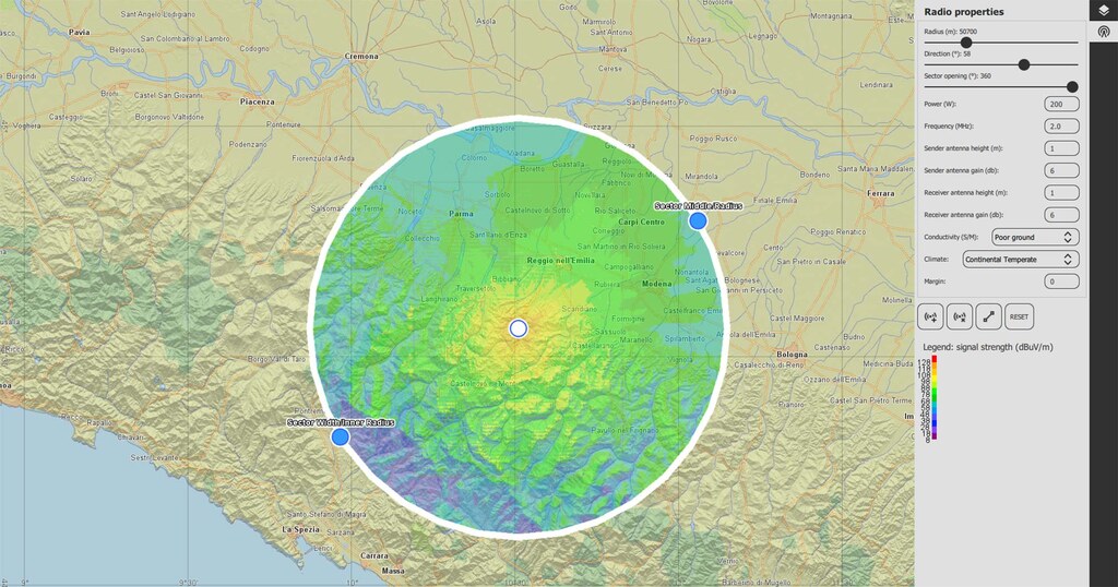
Airspace deconfliction is another area where 3D coverage analysis proves invaluable. Understanding the vertical distribution of air traffic and potential obstacles assists in coordinating safe and efficient air operations.
Ensuring airspace deconfliction is crucial for safe UAV operations and provides guidance on where the UAV can fly without entering restricted or hostile airspace. Additionally, this has an influence on the UAV flight route and thus also on the arrival time.
Stealth and Concealment
Analysing 3D coverage assists in identifying areas that offer natural stealth and concealment for resupply operations, serving as a fundamental asset in ensuring safe UAV operations. This analysis also offers insight into the level of concealment potential drop zones provide. Selecting flight routes and drop zones with natural cover reduces the risk of detection by hostile forces.
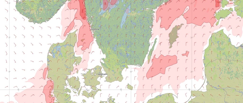
Weather Impact Assessment
Assessing weather conditions in the vertical dimension is a critical aspect of 3D coverage analysis. This analysis considers the impact of wind, turbulence and other atmospheric factors on UAV operations, providing essential information for planning safe flight routes and drop zones.
Weather analyses provides information on whether flying is possible at all and if so, under what performance conditions. In addition, they help identify dangerous weather zones that may need to be avoided. Weather conditions also play a decisive role in the selection of a drop zone, ensuring that the UAV can remain over the drop zone long enough and maintain sufficient stability to deliver its payload.
Precision Navigation
Finally, 3D coverage analysis enhances precision navigation by providing detailed information about the three-dimensional aspects of the environment. This is especially important for the low-altitude and precise navigation required in last-mile resupply missions.