Carmenta UAS Mission Kit
Plan and visualize the most effective observer positions by combining multiple advanced analysis capabilities in Carmenta Engine. Whether you’re placing static observation points or designing mobile surveillance routes, Carmenta UAS Mission Kit gives you the tools, training, and support to succeed.
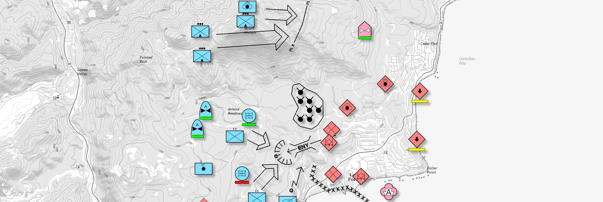
The effectiveness of surveillance in Uncrewed Aerial Vehicle (UAV) missions depends not only on the capabilities of the platform, but also on the strategic placement and mobility of observers. Whether deploying static observation points or designing mobile surveillance routes, Carmenta UAS Mission Kit uses multiple advanced geospatial analyses to help you visualise and implement the most effective observation strategies.
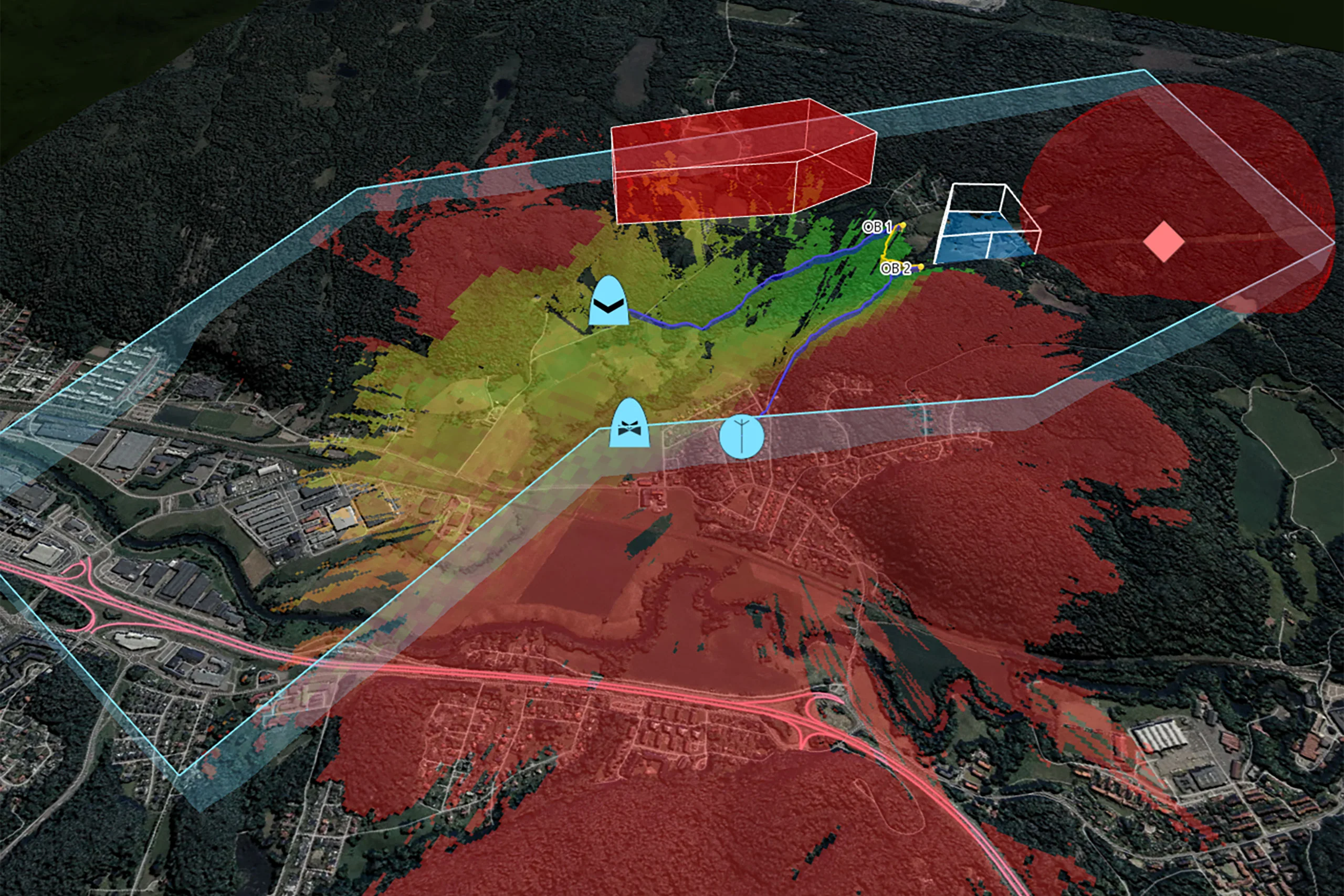
Identify the best vantage points using intervisibility and terrain analysis for drone surveillance of an area.
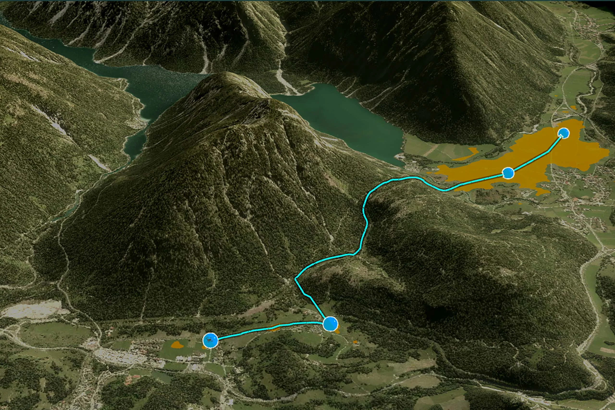
These could be either static observer points or a set of waypoints along an observation line, with the objective is to ensure good coverage of the target area. This can be combined with radio analysis to maintain good radio coverage from the ground control station.
By using intervisibility and terrain analysis, planners can identify the best vantage points for drone-based surveillance. These observer positions can be static points placed to monitor key areas.
Radio coverage analysis can be combined with this planning to ensure uninterrupted communication and maintain strong links between UAVs and the Ground Control Station.
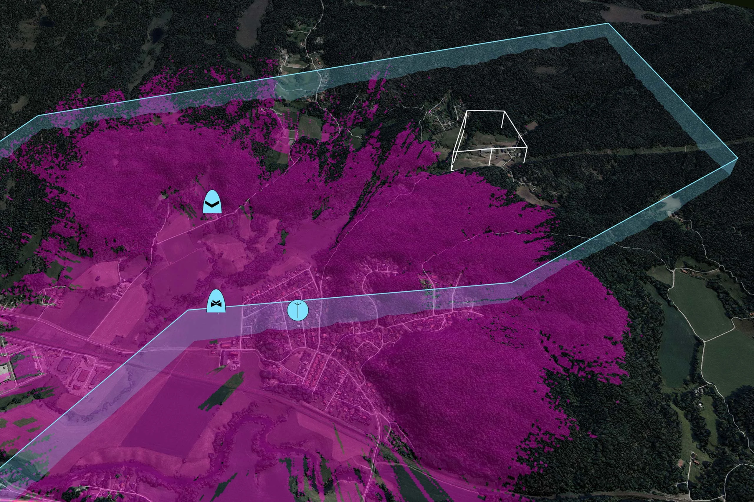
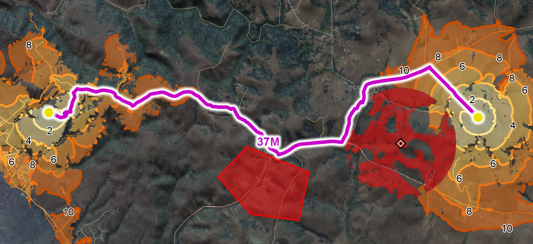
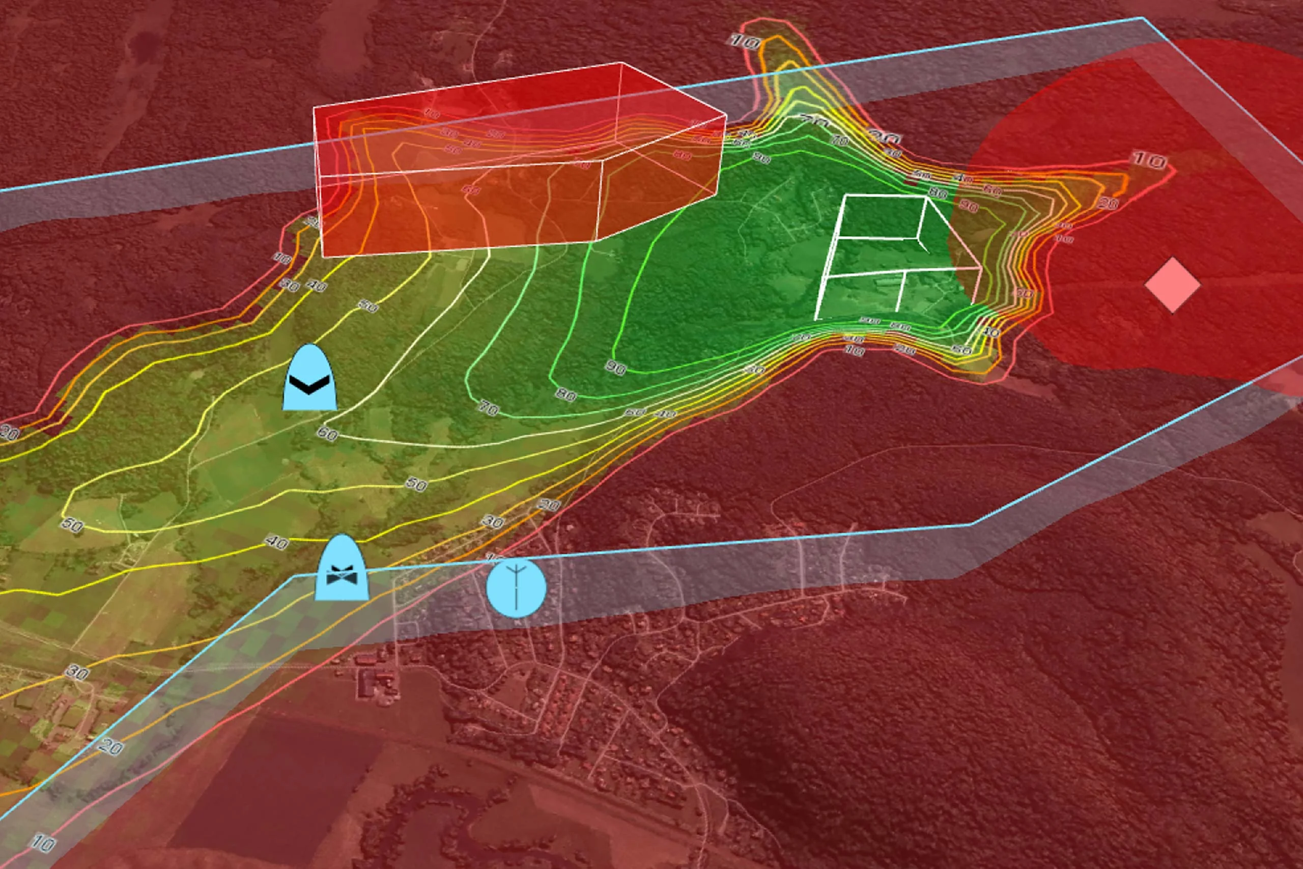
The image shows how intervisibility analysis can help to determine the best location for a waypoint, using an observer altitude of 80 metres and a target height of 2 metres.
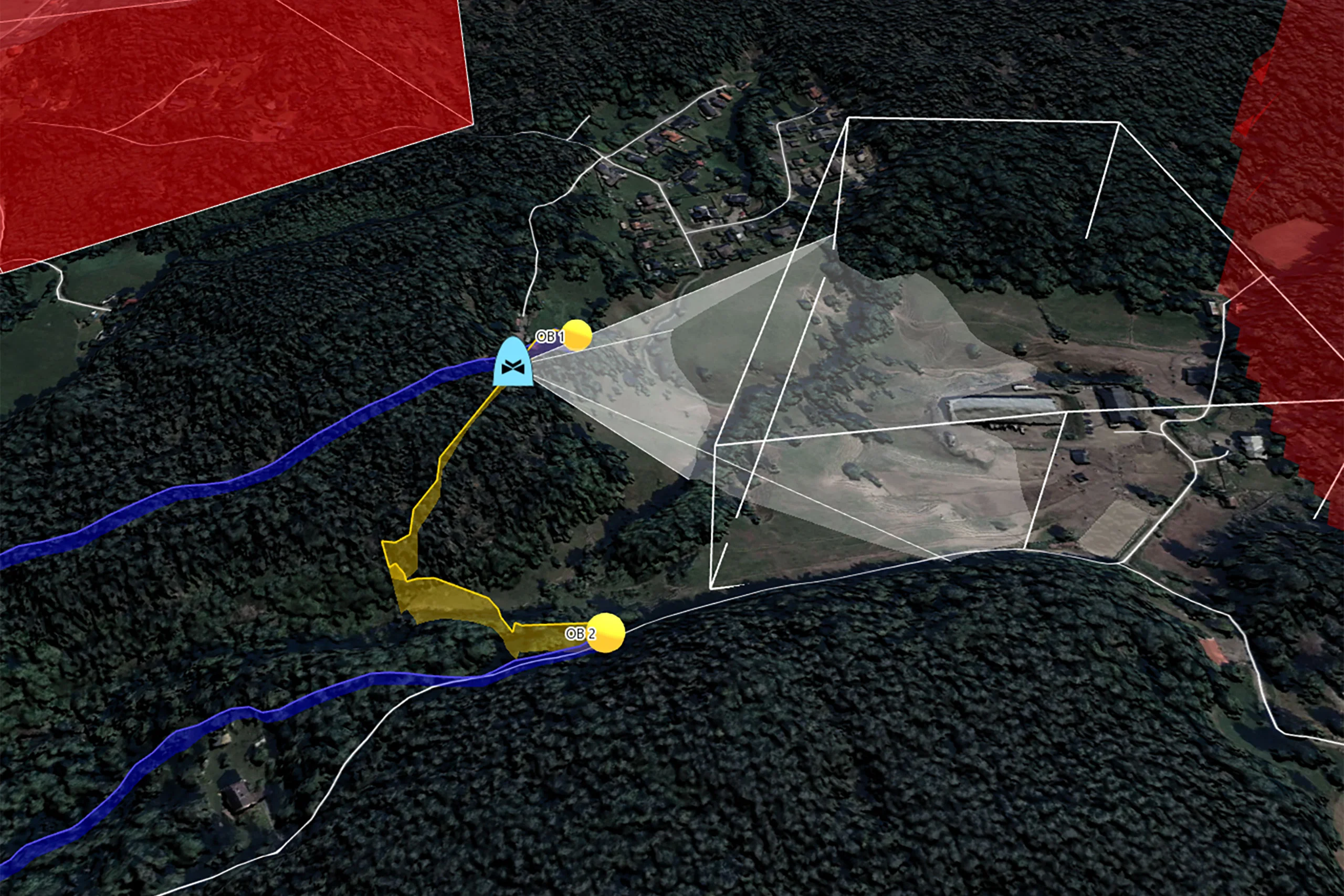
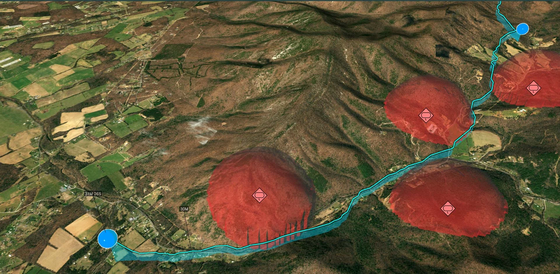
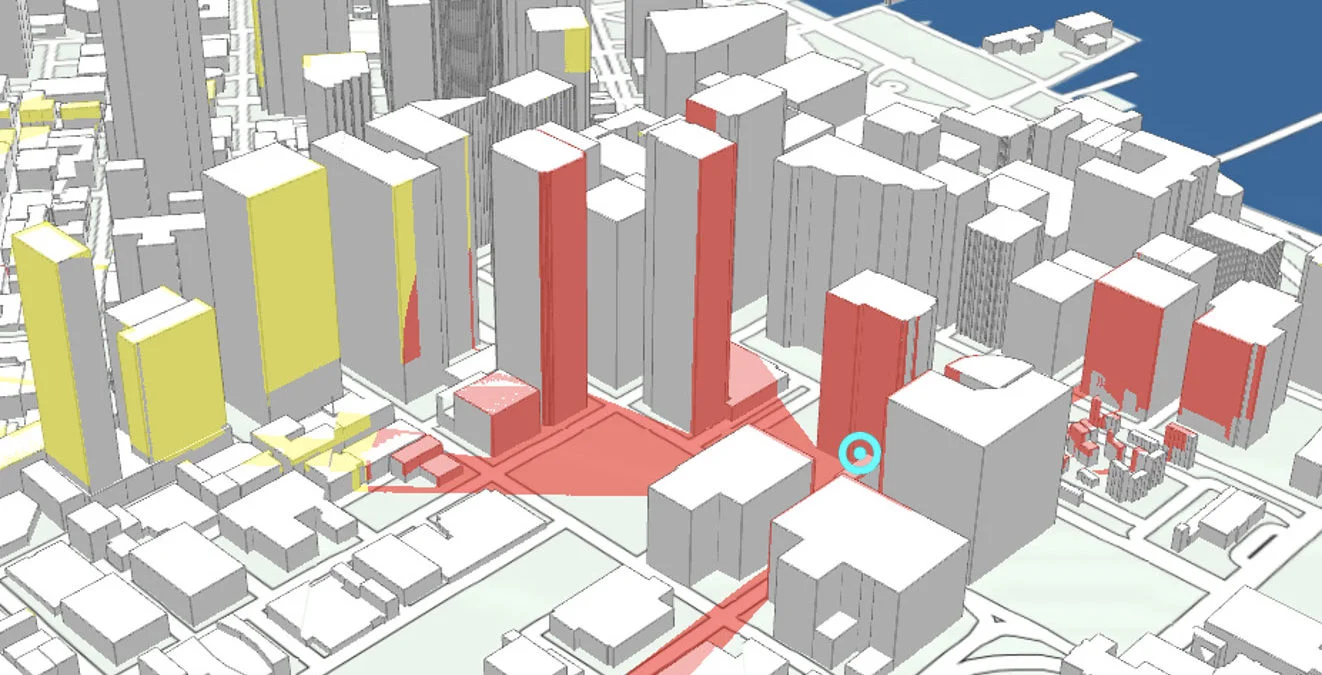
Once the observer’s positions have been defined, line-of-sight analysis can be used to determine which parts of the target area are visible from each position. This helps to ensure that surveillance objectives are met with minimal blind spots.
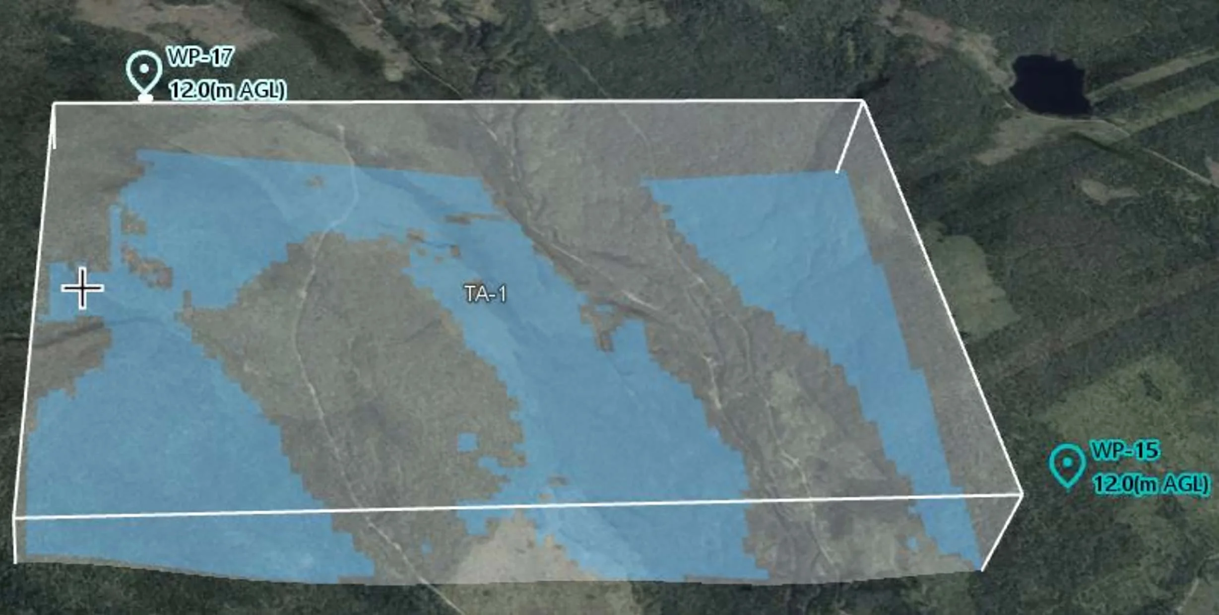
The image illustrates the line-of-sight coverage from two selected waypoints. The visible areas are highlighted in blue, and the altitude of the observation points directly affects the coverage result.