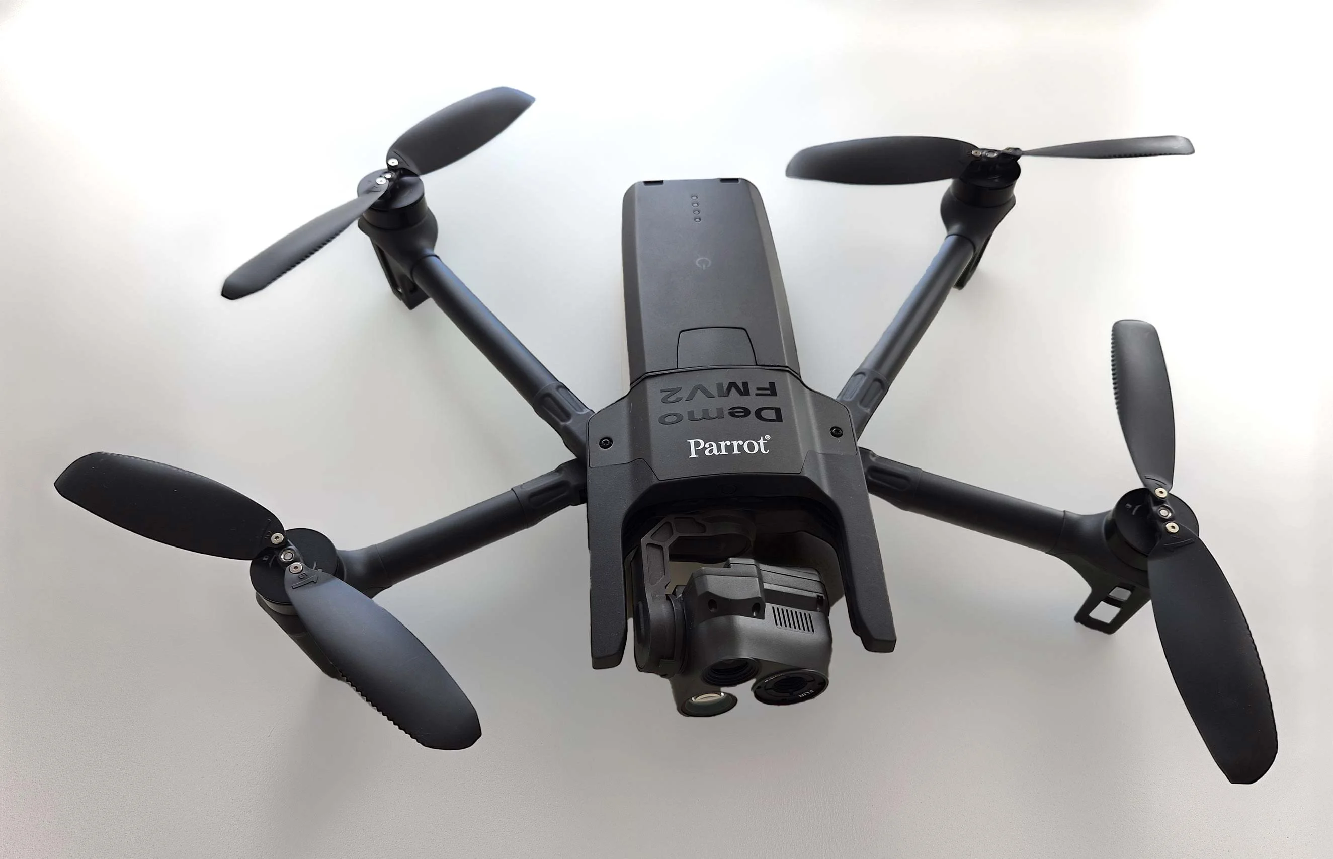
Carmenta in drone exercise during Aurora 26
As part of Project Demo UCAV, Carmenta is proud to have participated in a drone exercise during Aurora 26, where its technology was used for UAS routing and mission planning.
Read moreLast week, we were honored to speak at XPONENTIAL Europe 2025 in Düsseldorf! We had the opportunity to share insights on geospatial analysis for military last-mile resupply using UAS technology. We also had an interesting follow-up discussion on the importance of flexibility in handling diverse data types with different resolutions, as well as the ability to efficiently combine multiple sources.
A big thank you to everyone who attended our session and to those who joined us for engaging discussions throughout the trade show. We look forward to continuing the dialogue about the future of autonomous logistics and geospatial analysis!
If you want to learn more about this topic, read our recently published whitepaper Resupply with UAVs – Military last-mile resupply using UAS technology with geospatial analysis.

Subscribe to our newsletter to receive:
Sign up today to get the latest geospatial technology updates and insights!
As part of Project Demo UCAV, Carmenta is proud to have participated in a drone exercise during Aurora 26, where its technology was used for UAS routing and mission planning.
Read more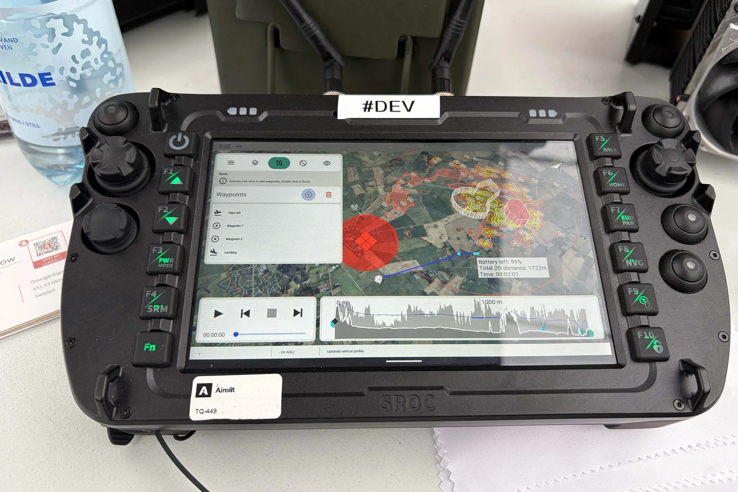
At the International Drone Show, Carmenta and Airolit demonstrated how easily Carmenta UAS Mission Kit integrates into existing UAV ecosystems.
Read more
Carmenta is proud to participate in NATO's Coalition Warrior Interoperability Exercise (CWIX 2026) in collaboration with Allied Armed Forces, and to contribute to this collaborative effort.
Read more