Carmenta in drone exercise during Aurora 26
As part of Project Demo UCAV, Carmenta is proud to have participated in a drone exercise during Aurora 26, where its technology was used for UAS routing and mission planning.
Read moreAs part of Project Demo UCAV, Carmenta is proud to have participated in a drone exercise during Aurora 26, where its technology was used for UAS routing and mission planning.
Read more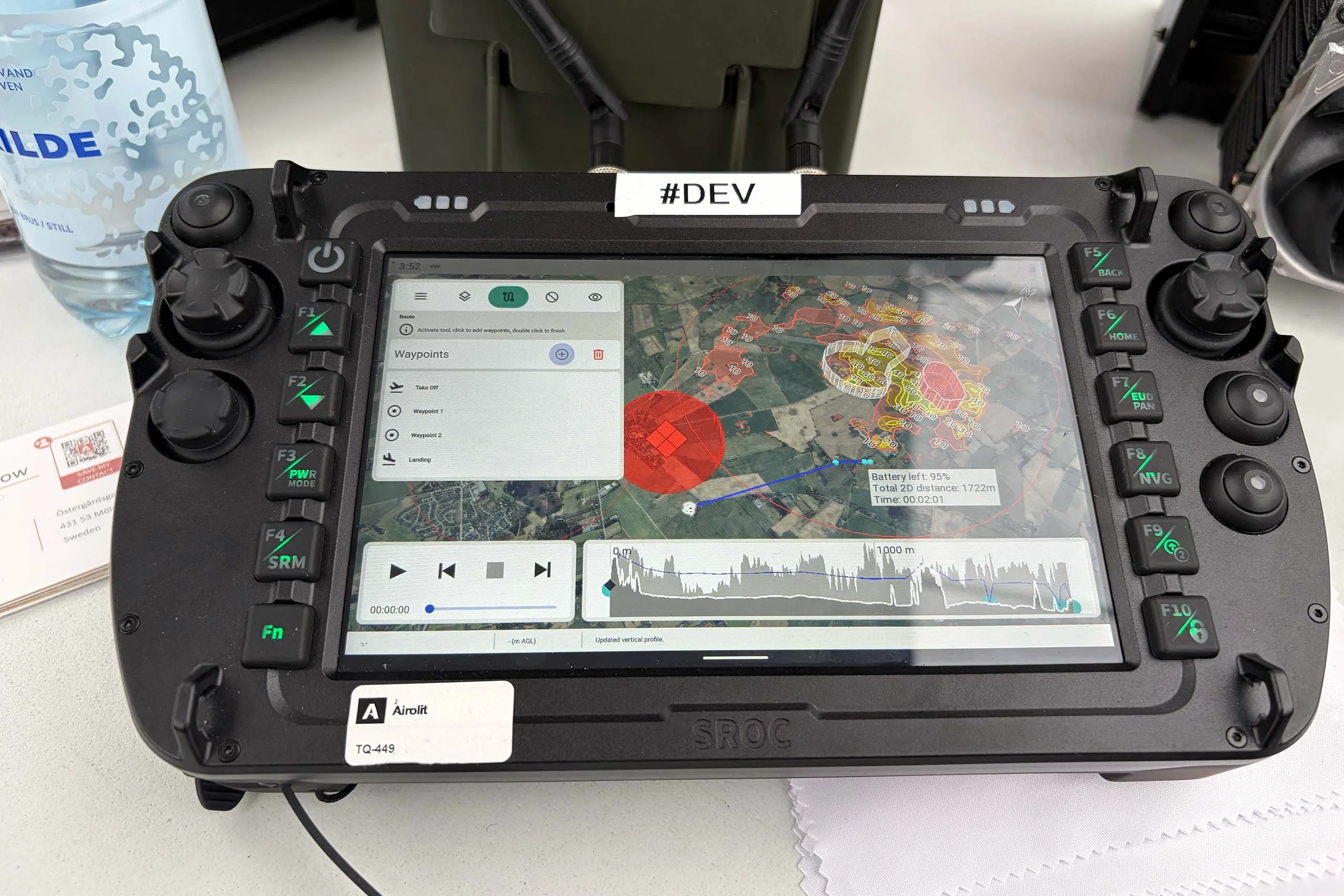
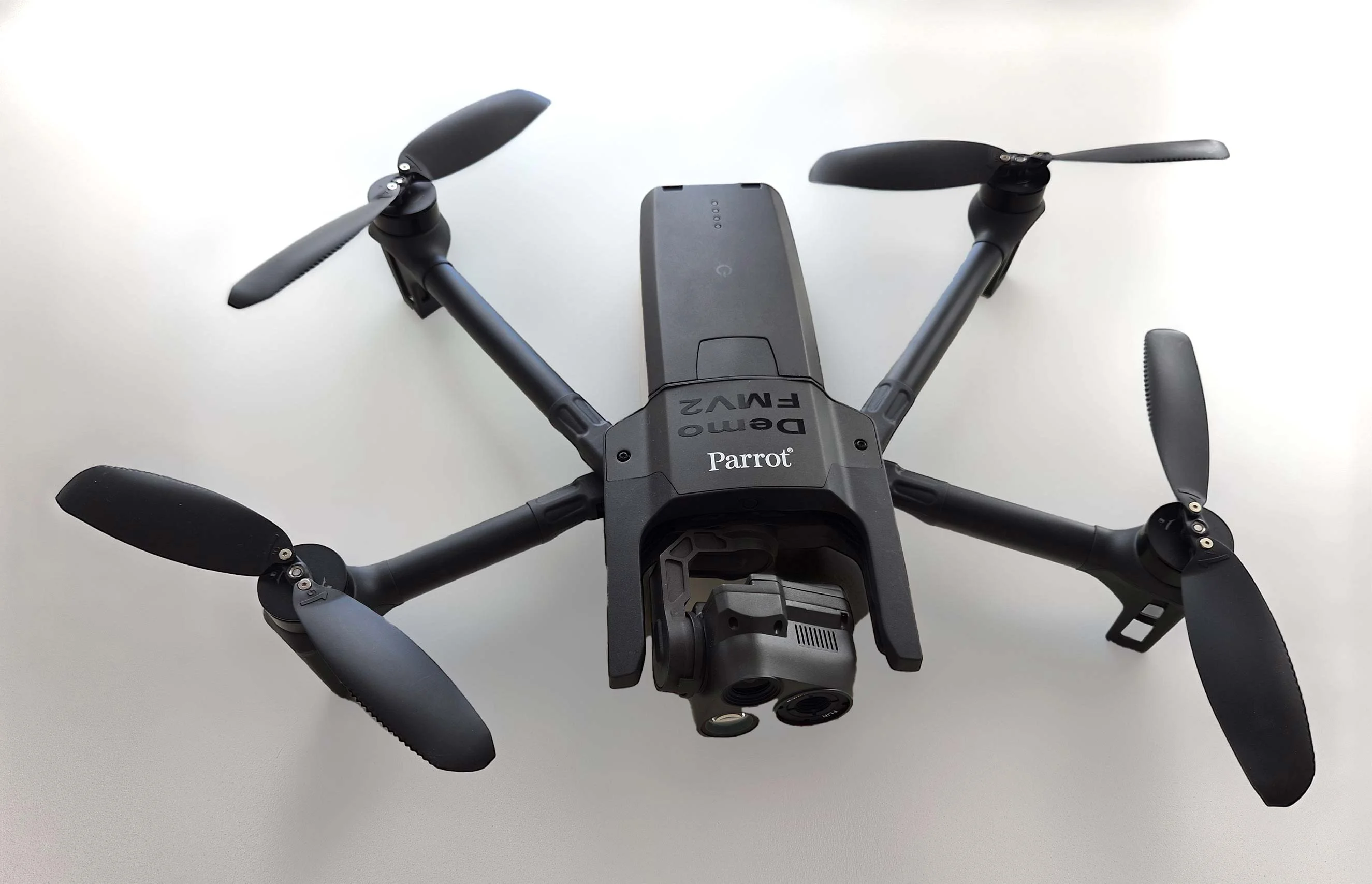
At the International Drone Show, Carmenta and Airolit demonstrated how easily Carmenta UAS Mission Kit integrates into existing UAV ecosystems.
Read more
Yesterday, we hosted a conference session at International Drone Show in Odense, Denmark, on a topic that is becoming increasingly relevant in defence: Uncrewed Military Mobility Across All Domains – From Sea to Land to Air.
Read more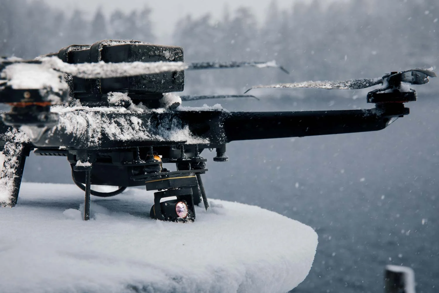
Tomorrow, at International Drone Show in Odense you can both catch our conference session "Uncrewed Military Mobility Across All Domains – From Sea to Land to Air”, and see Carmenta technology in action during a live drone demo by Airolit.
Read more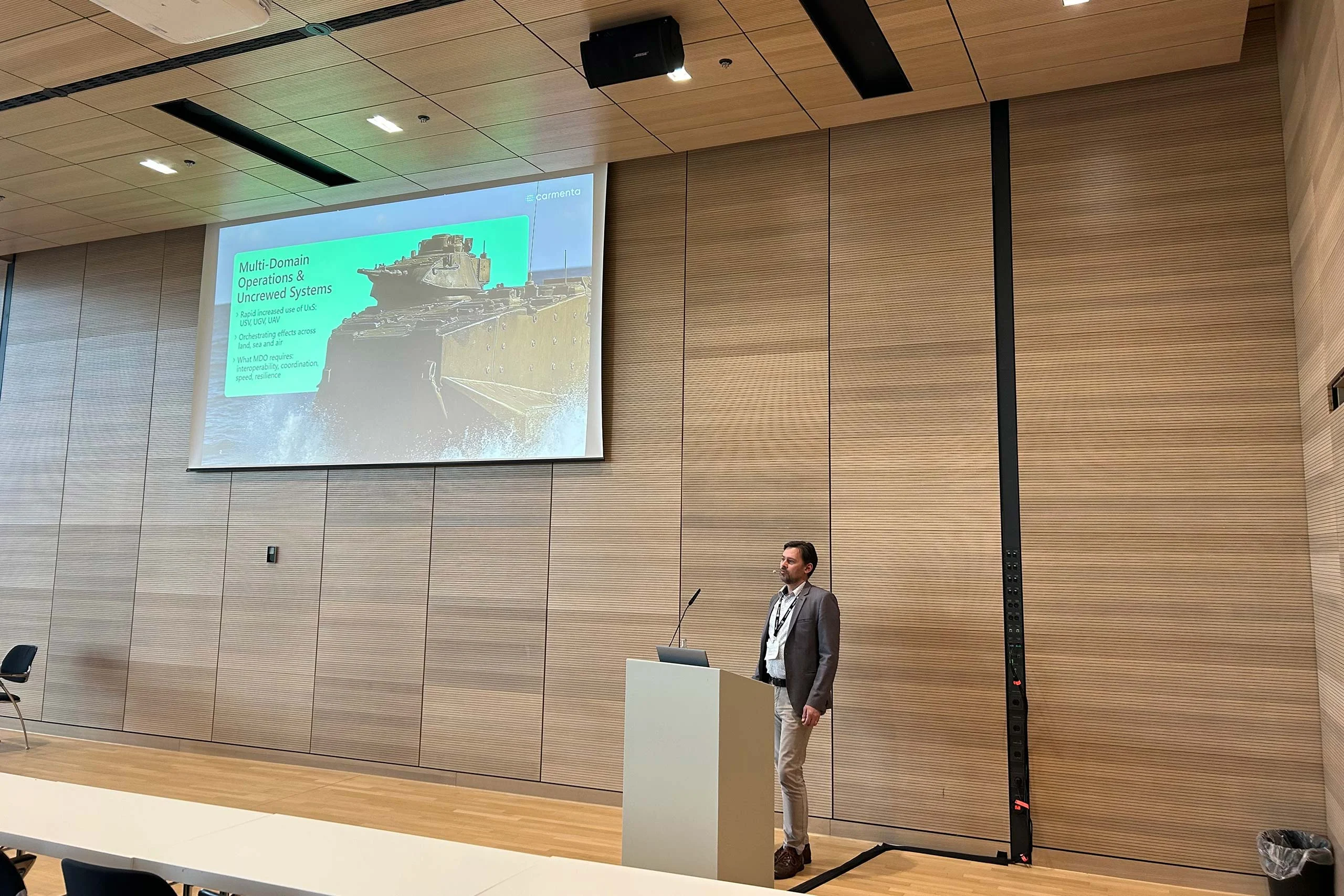
Yesterday, we had the honor of presenting at XPONENTIAL Europe 2026 on the topic "Uncrewed Military Mobility Across All Domains - From Sea to Land to Air".
Read more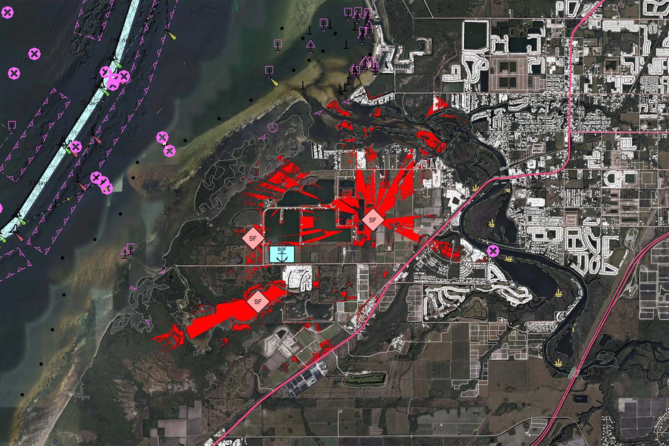
There is no reason why the map display in a mission-critical system should be any less responsive or visually appealing than the map on a smartphone. In our latest article, we outline 7 core geospatial requirements for mission-critical applications, and how Carmenta technology can meet these needs.
Read more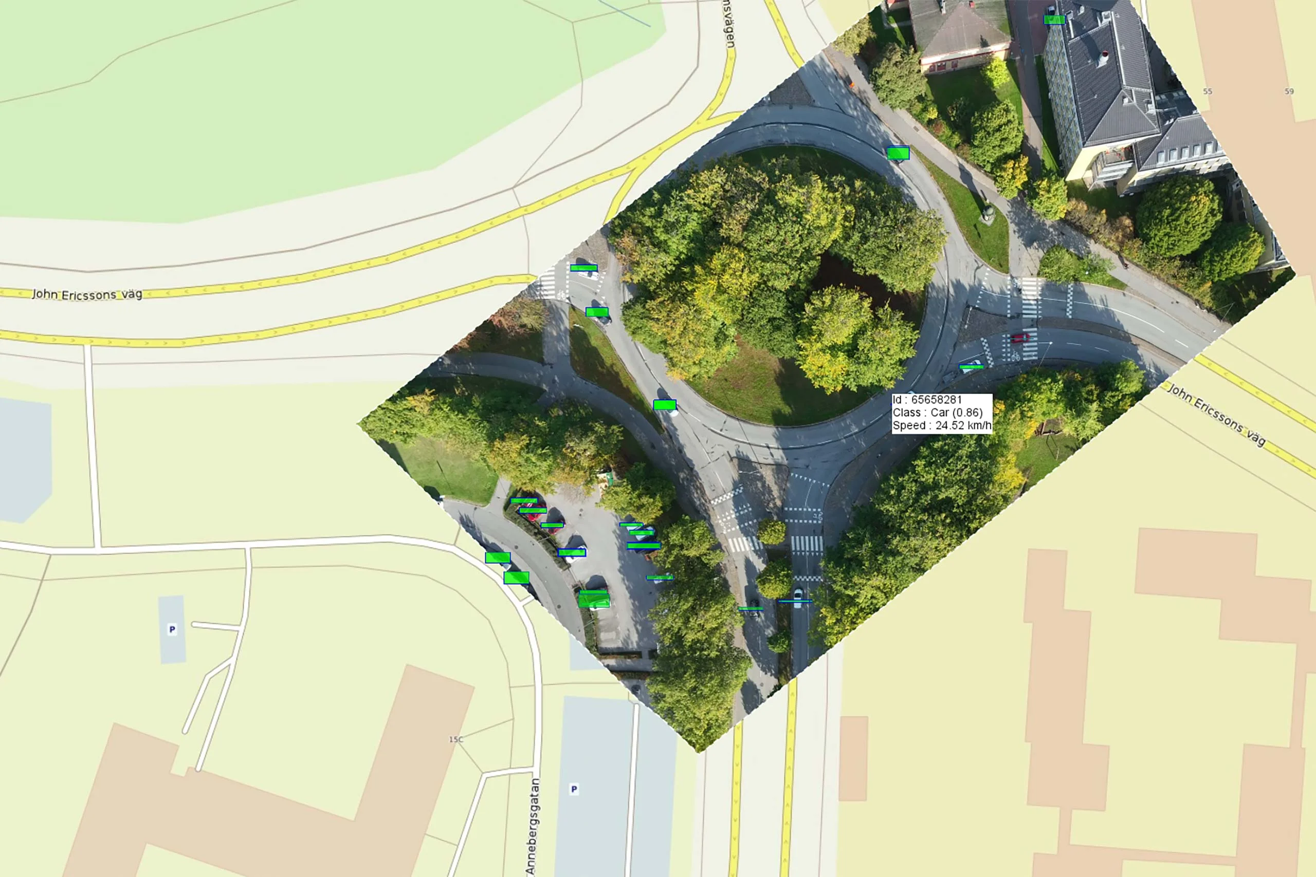
Earlier this year, Carmenta participated in a Vinnova Innovair funded project together with Spacemetric and PandionAI. The initiative aimed to create a solution capable of processing and visualizing real-time AI-enhanced drone data.
Read more
The evolving threat landscape in military operations underscores the importance of precise, adaptive, and intelligence-driven mission planning. Explore how geospatial analysis empowers UAVs to adapt to these challenges by enhancing situational awareness and supporting human and autonomous decision-making processes.
Read more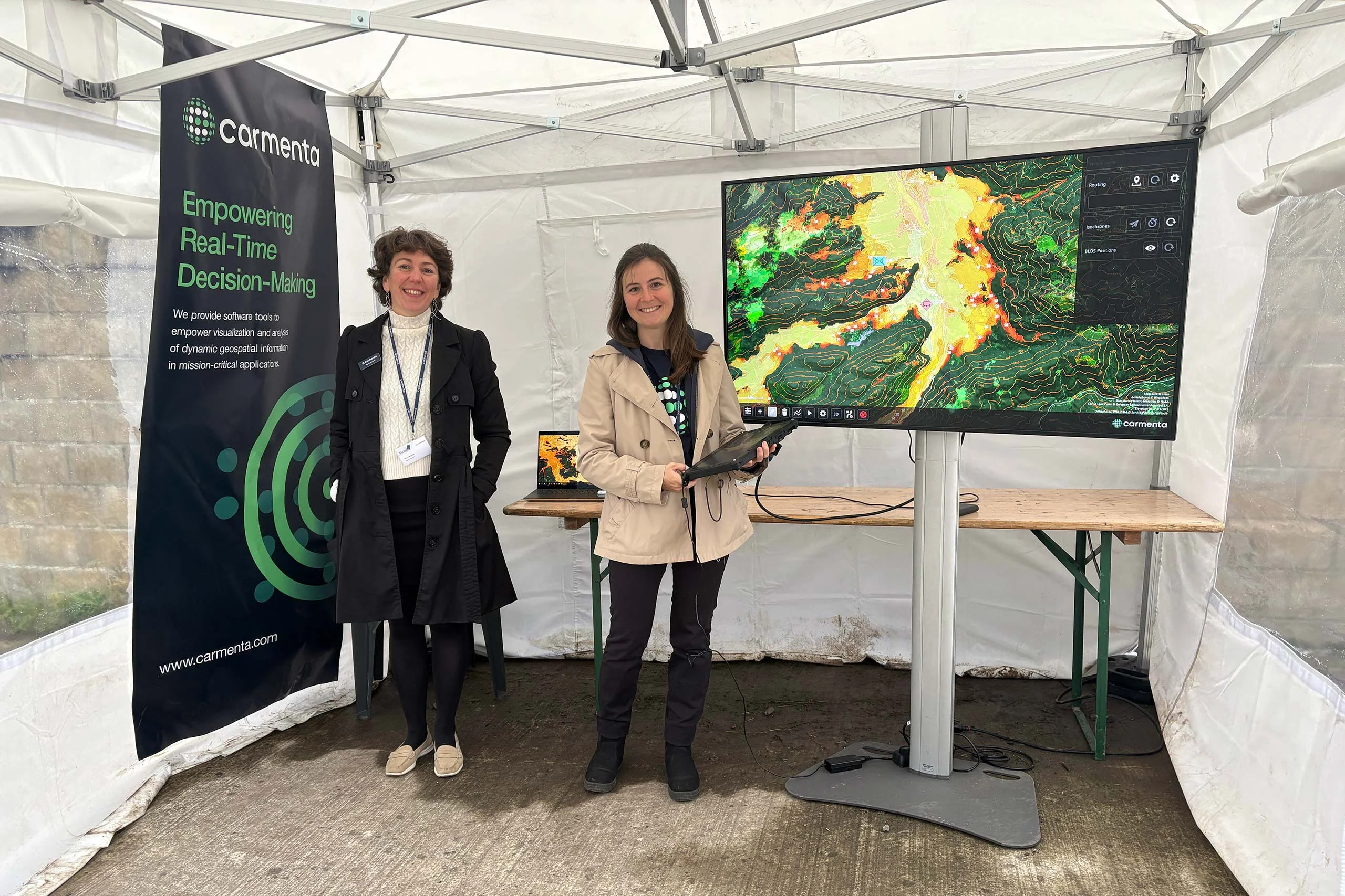
End of September, Carmenta took part in the final live and static demonstrations of the EDF Project MarsEUs. Focus was on enhancements on Beyond Line of Sight (BLOS) technology.
Read more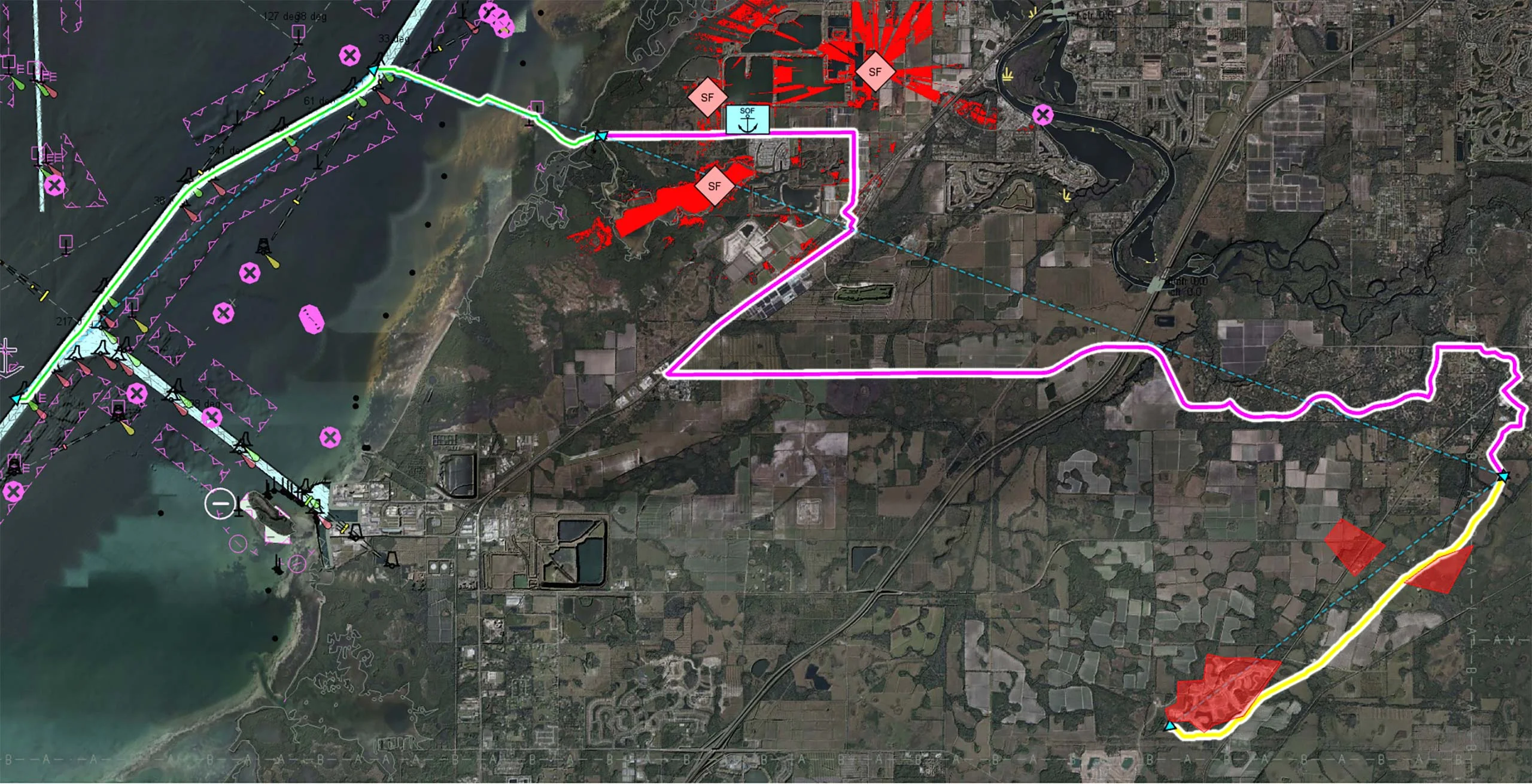
Multi-domain operations demand a high degree of interoperability, real-time responsiveness, and adaptive decision-making across diverse and often contested environments. Discover how Carmenta technology enables seamless coordination of uncrewed systems (UxS) across land, air, and sea in modern multi-domain operations.
Read more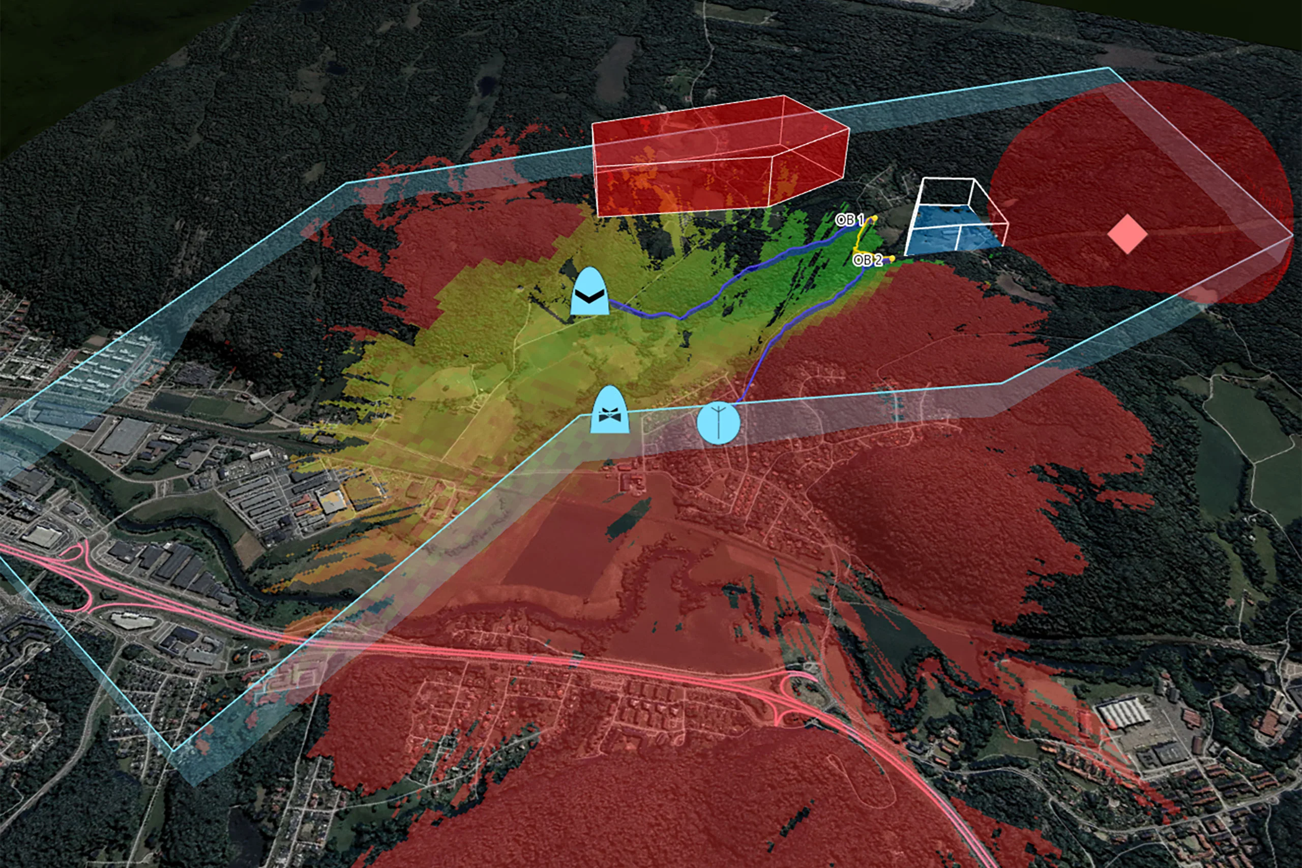
Carmenta UAS Mission Kit enables risk-mitigated and efficient development of demanding Uncrewed Aerial Systems (UAS) mission applications for defense or high-end civil use.
Read more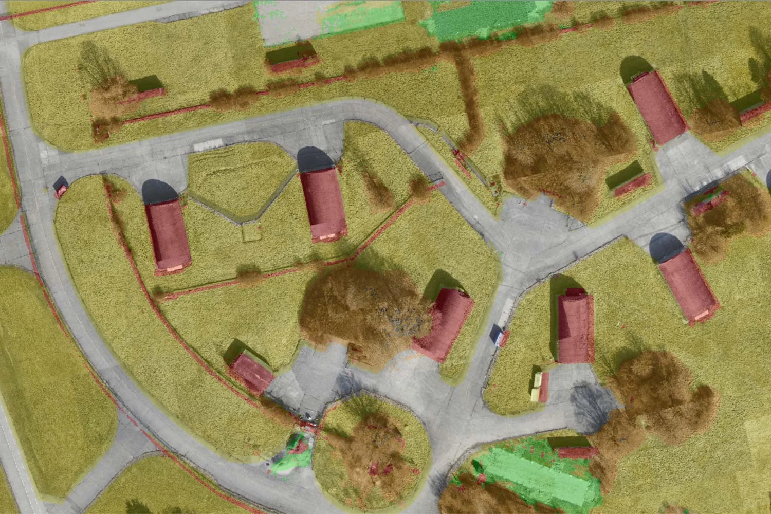
By leveraging AI-assisted computer vision, Carmenta and SE3 Labs are transforming real-time UAV data into high-resolution, semantic 3D maps, offering a new level of precision and adaptability in geospatial intelligence.
Read moreSE3 Labs and Carmenta are creating new possibilities for AI-driven decision-making by using AI-assisted computer vision to transform real-time UAV data into high-resolution, semantic 3D maps.
Read more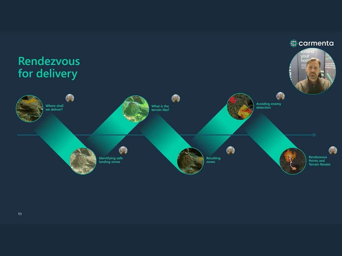
Watch our webinar, first presented at XPONENTIAL Europe 2025, about the evolving role of Uncrewed Aerial Vehicles (UAVs) in military logistics.
Read more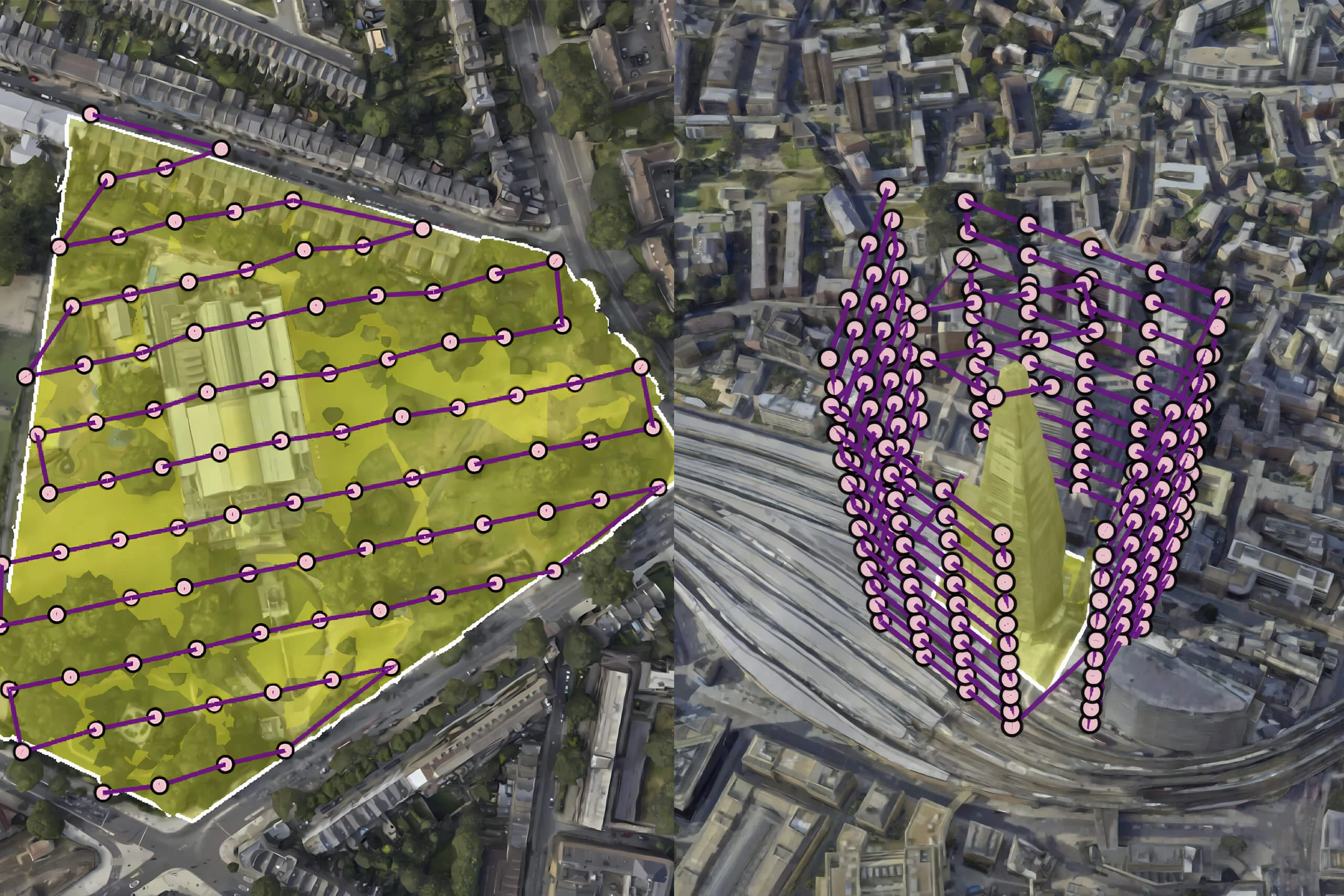
Discover how drones use carefully designed flight patterns for mapping and inspection missions, balancing efficiency, coverage, and data quality. Explore the challenges and technology behind optimized aerial routes.
Read more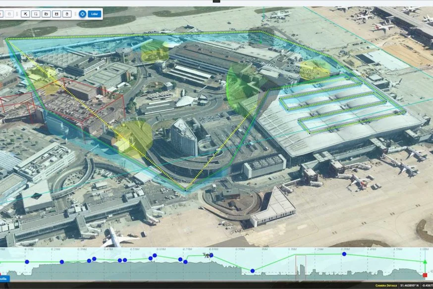
Carmenta is proud to announce the conclusion of the HADO® project, paving the way for safe and autonomous drone flights in urban environments and high-intensity airspace.
Read more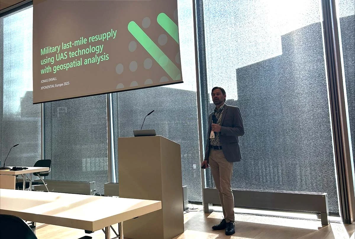
Last week, we were honored to speak at XPONENTIAL Europe 2025 in Düsseldorf! We had the opportunity to share insights on geospatial analysis for military last-mile resupply using UAS technology.
Read more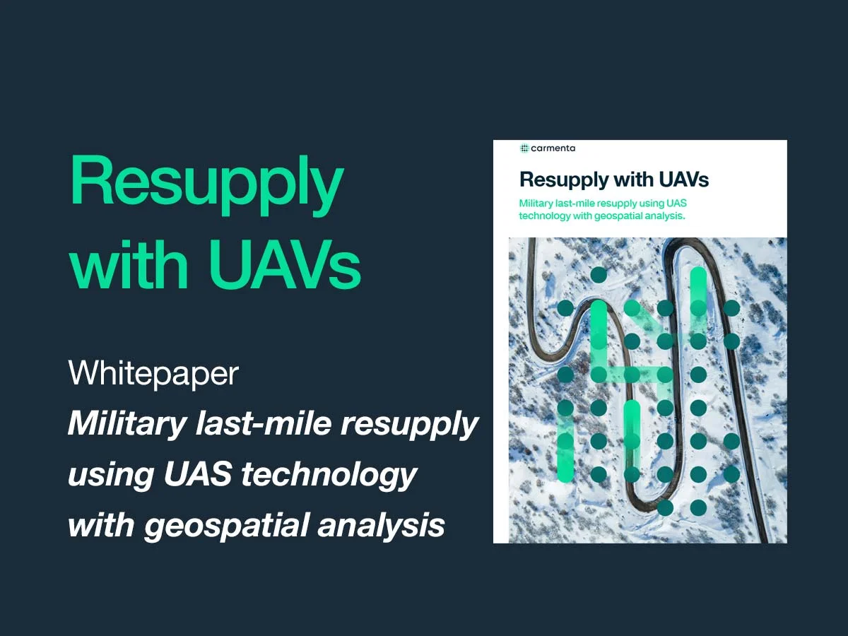
Military last-mile resupply using UAS technology with geospatial analysis. Real-time geospatial analysis for UAVs can be used to cope with dynamic challenges, enhancing situational awareness on the battlefield and supporting both human and autonomous decision-making.
Read more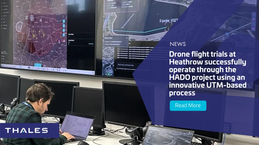
End of last year, Carmenta, Thales, Herotech8 and Cranfield University carried out a series of successful drone flight trials within Heathrow Airport’s Flight Restriction Zone.
Read more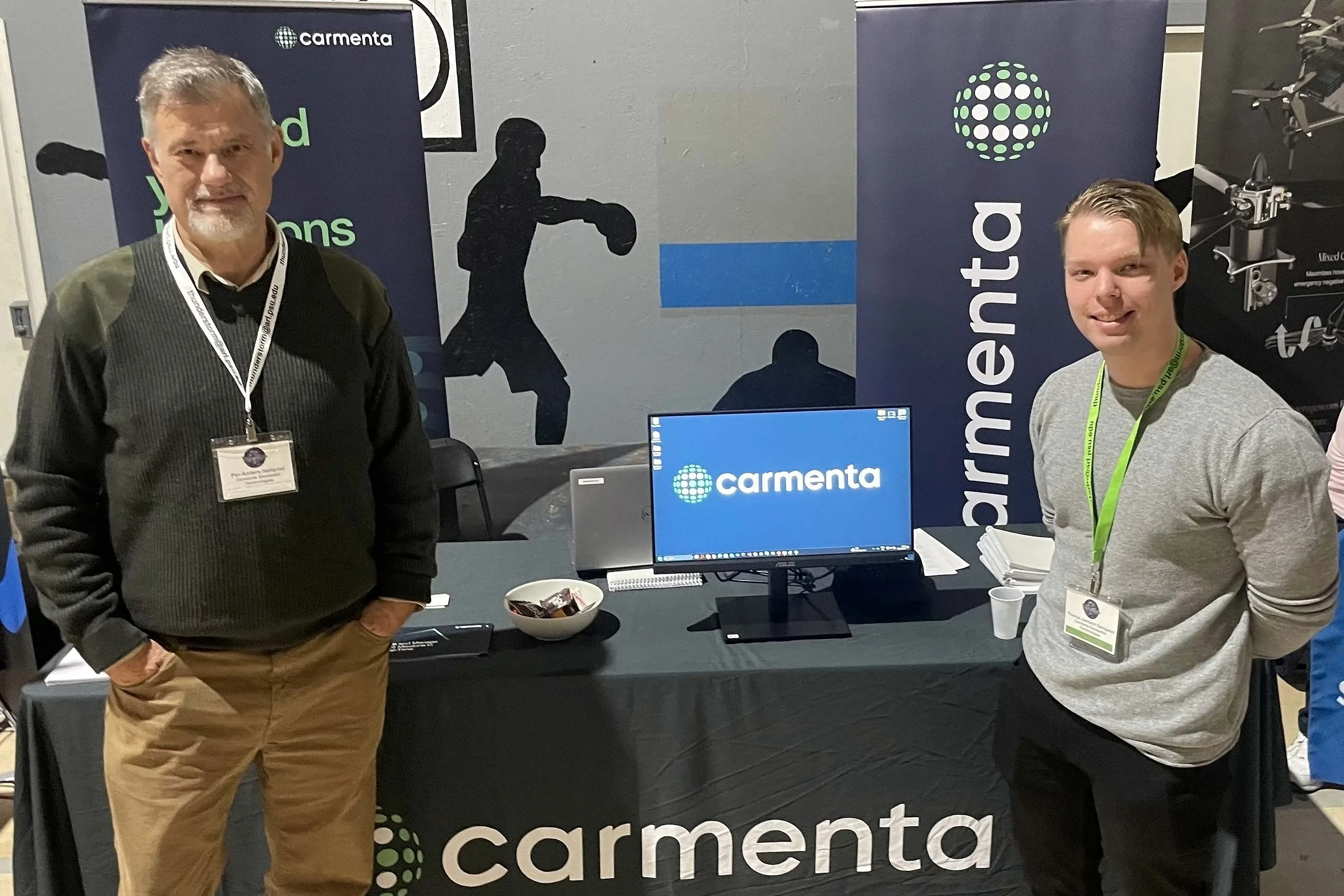
We’re proud to have recently participated in the invitation-only Thunderstorm event in the US. It was an honor to be selected for our cutting-edge technology in Rendezvous Planning for Resupply Missions and Combat Robustness.
Read more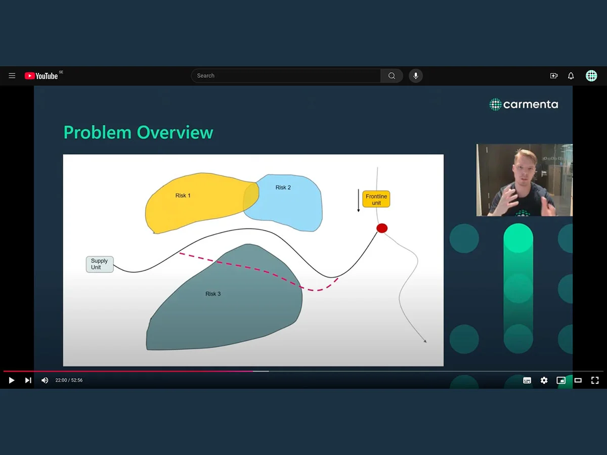
Watch our on-demand webinar about the crucial role of supply lines in the battlefield. Deep dive into the intricacies of determining the best rendezvous points in a resupply mission, taking into account the various threats that exist.
Read more
Join our upcoming webinar that will explore the critical aspects of secure and timely resupply missions, including advanced and secure terrain routing, and risk management.
Read more
Join our upcoming webinar 'Enhancing Efficiency and Safety in UAS Operations' for an overview of the critical challenges and opportunities in UAS Mission Planning and introduction to Carmenta UAS Services.
Read more
Today, at DroneX Exhibition in London, Carmenta launches a new mission planning service for uncrewed systems. Carmenta UAS Services – Beta Version allows software developers to easily integrate advanced routing and geospatial analysis capabilities for autonomous flights.
Read more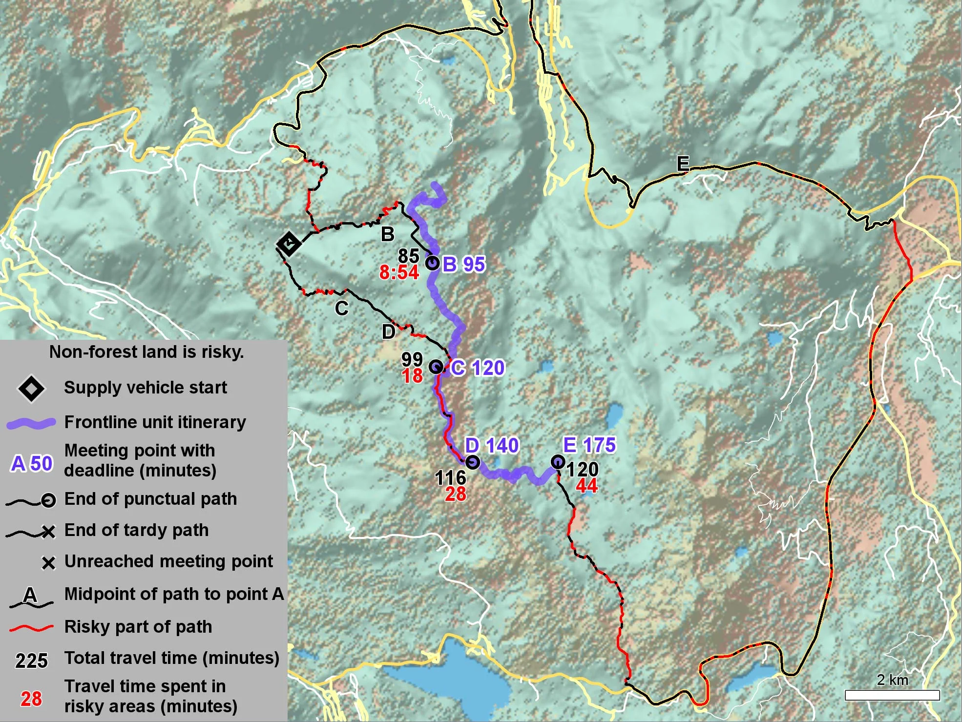
Resupply missions are critical logistical components of modern warfare. Supply vehicles carrying fuel and ammunition are high-value targets, making the choice of route sensitive to both risk and delivery time. Read our latest whitepaper here.
Read more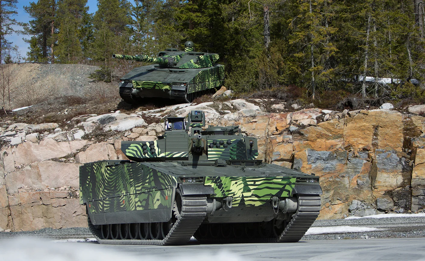
Carmenta and BAE Systems Hägglunds, together with hardware UAV manufacturer Airolit, have partnered to develop a solution with the objective of integrating autonomous drone surveillance capabilities into combat vehicle – CV90.
Read moreOperating drones in highly congested urban environments is a challenge. To do it beyond visual line of sight (BVLOS) and autonomously, is an even greater challenge. This is what Carmenta technology is currently being developed to address within the HADO® Project, with the goal to implement the first real-world application of such as system at London Heathrow Airport.
Read more
The latest issue of Defence & Security Systems International magazine, features an interesting article about Carmenta technology. It describes how real-time handling and analysis of geospatial data from diverse sources allows for dynamic decision-making, which is crucial for efficient planning and management of UAS missions.
Read more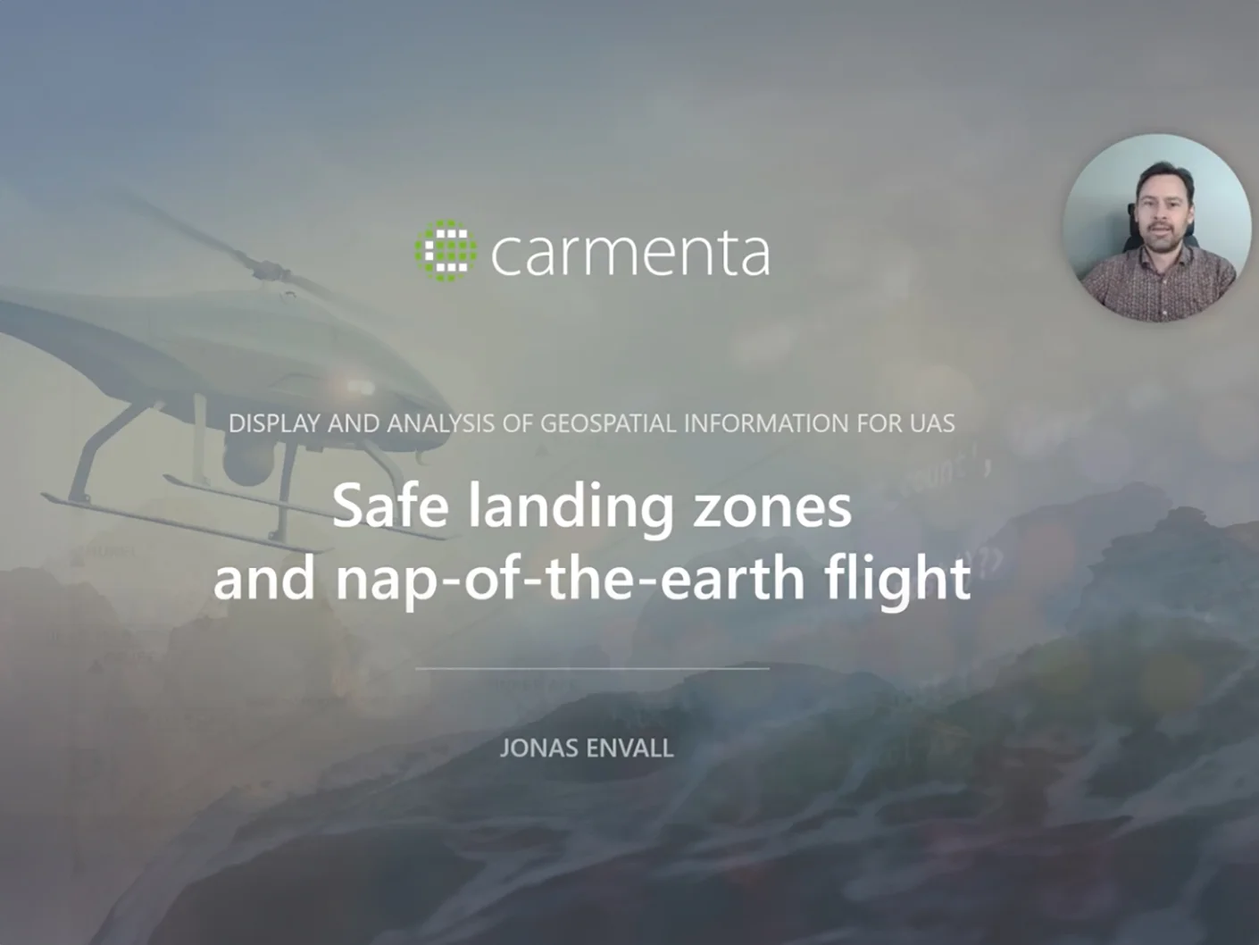
In this presentation Jonas Envall will, in more depth, talk about some of the new functionalities for UAS that we have launched in Carmenta Engine 5.16. The video illustrates and exemplifies the display and analysis of geospatial information for UAS.
Read more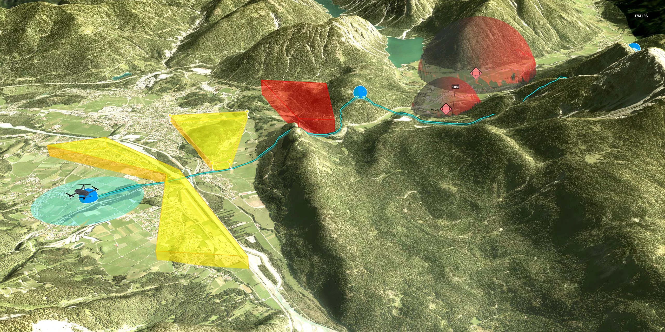
Determining safe landing zones is an essential part of many types of UAS missions. It is often important to identify safe landing zones along the route in case of an emergency during a flight.
Read more
Helping the UK to lead the way in autonomous drone operations. Carmenta Ltd, a geospatial technologies organisation, has as part of a consortium of UK partners secured funds from Future Flight Challenge and UK Research and Innovation (UKRI) to help lead the way in UK autonomous drone operations across high intensity airspace.
Read more
Determining safe landing zones is an essential part of many types of UAS missions. Two examples of such UAS missions is delivering supplies to military ops and doing emergency medical delivery.
Read more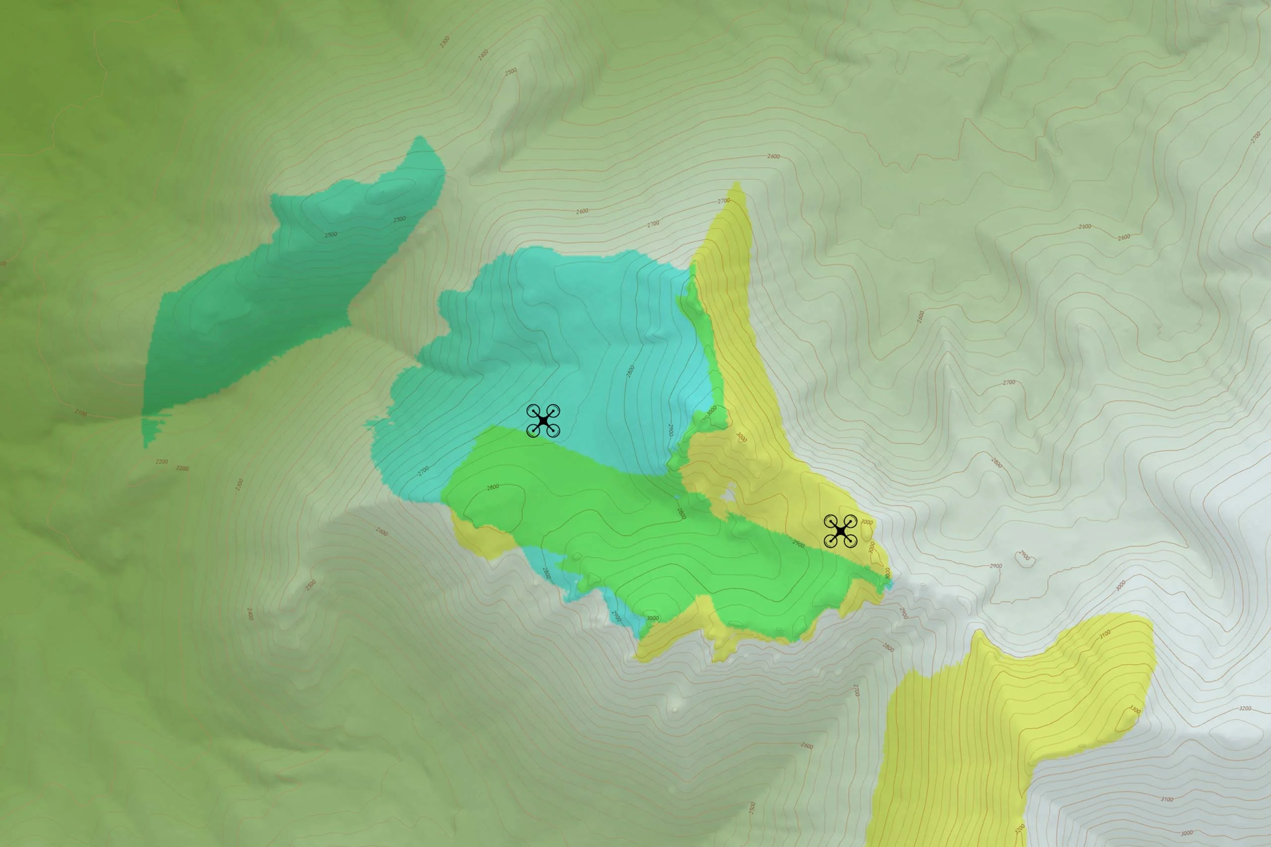
Geographical data can be used to create all sorts of map presentations as synthesized representations of reality. Adding analyses to the process can enhance our perception of this reality.
Read more
The Unmanned Aviation Association (UAV DACH) exists since year 2000 and is the most experienced association for commercial unmanned aviation in Europe.
Read more
This webinar presents the advantages of using Carmenta Engine combined with High Resolution data in a UAS mission planning, operation and debriefing.
Read moreCarmenta Engine is a powerful situational-awareness platform for designers of UAS applications. Integrated into your system, Carmenta Engine brings a higher level of intelligence to both remotely controlled and fully autonomous drone missions.
Read more