Carmenta in drone exercise during Aurora 26
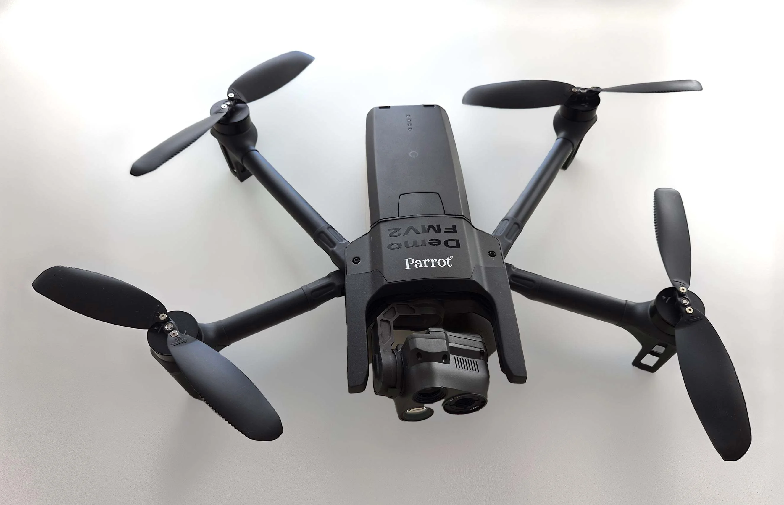
As part of Project Demo UCAV, Carmenta is proud to have participated in a drone exercise during Aurora 26, where its technology was used for UAS routing and mission planning.
Read moreAs part of Project Demo UCAV, Carmenta is proud to have participated in a drone exercise during Aurora 26, where its technology was used for UAS routing and mission planning.
Read more
Carmenta is proud to participate in NATO's Coalition Warrior Interoperability Exercise (CWIX 2026) in collaboration with Allied Armed Forces, and to contribute to this collaborative effort.
Read more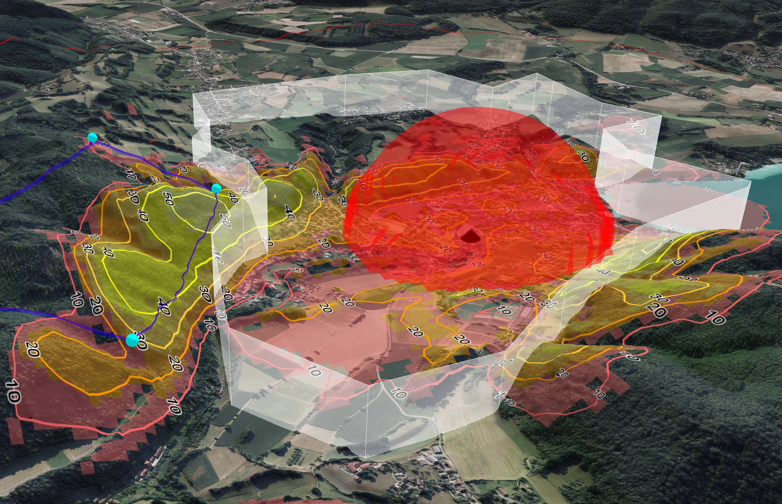
TRL Accel are currently developing a lightweight, modular UAS demonstrator that requires a high-performance C2 software solution. To solve several technical challenges and keep ambitious timelines on track, they turned to Carmenta UAS Mission Kit.
Read more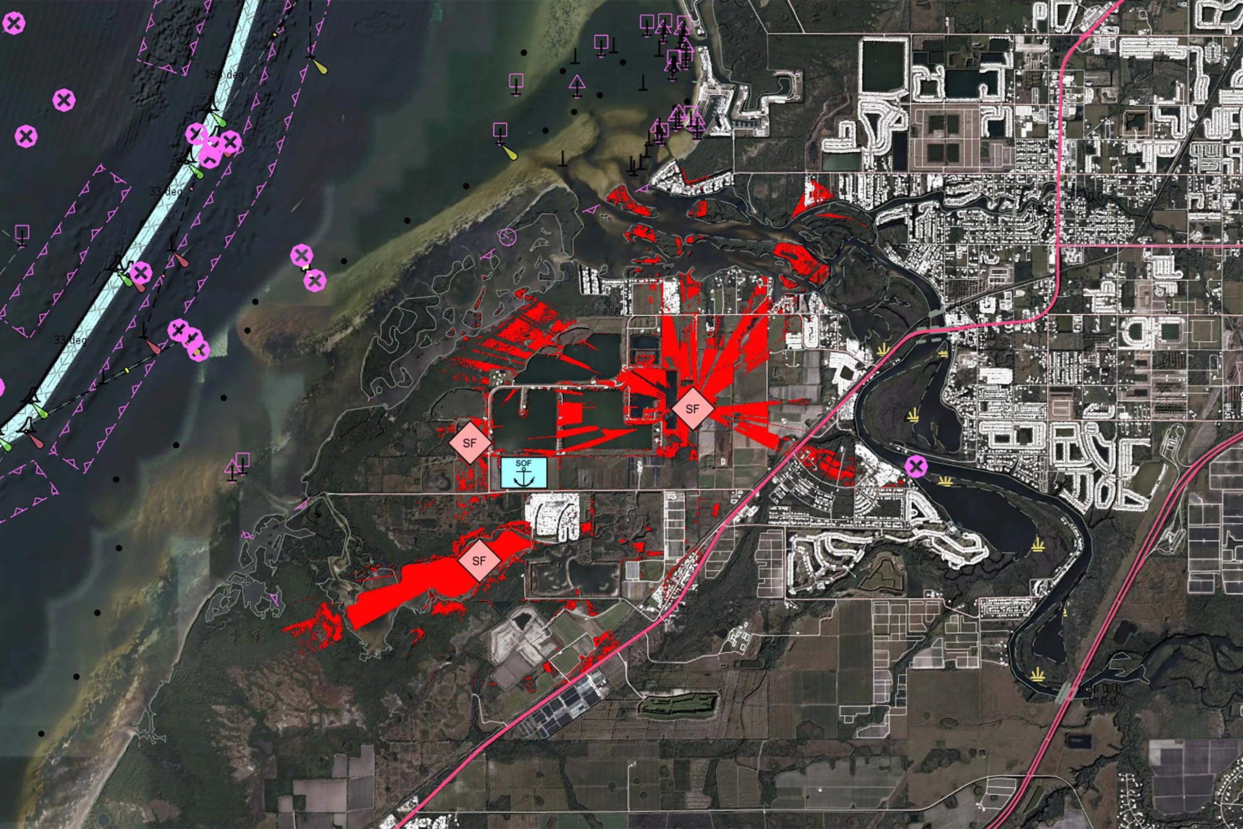
There is no reason why the map display in a mission-critical system should be any less responsive or visually appealing than the map on a smartphone. In our latest article, we outline 7 core geospatial requirements for mission-critical applications, and how Carmenta technology can meet these needs.
Read more
The evolving threat landscape in military operations underscores the importance of precise, adaptive, and intelligence-driven mission planning. Explore how geospatial analysis empowers UAVs to adapt to these challenges by enhancing situational awareness and supporting human and autonomous decision-making processes.
Read more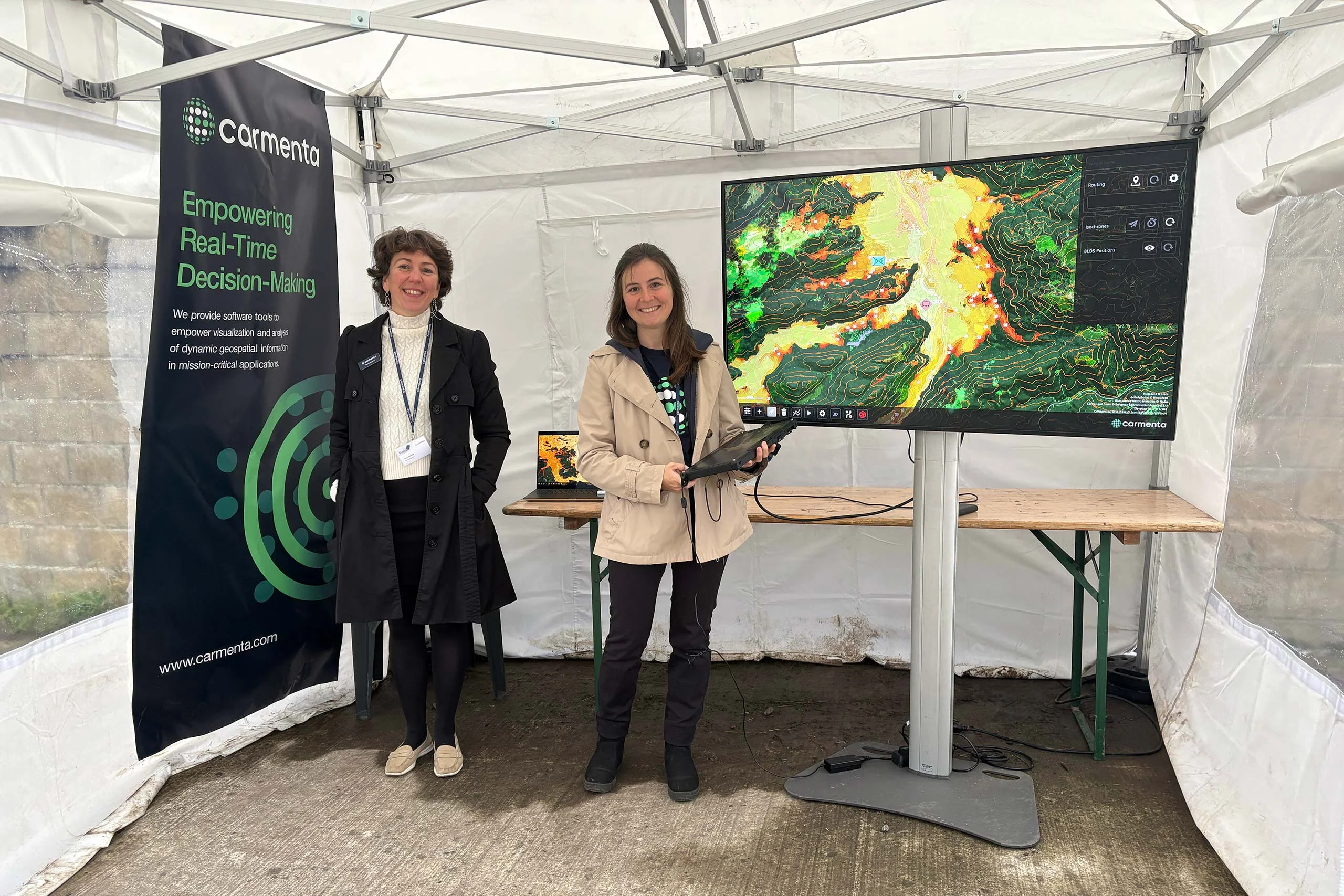
End of September, Carmenta took part in the final live and static demonstrations of the EDF Project MarsEUs. Focus was on enhancements on Beyond Line of Sight (BLOS) technology.
Read more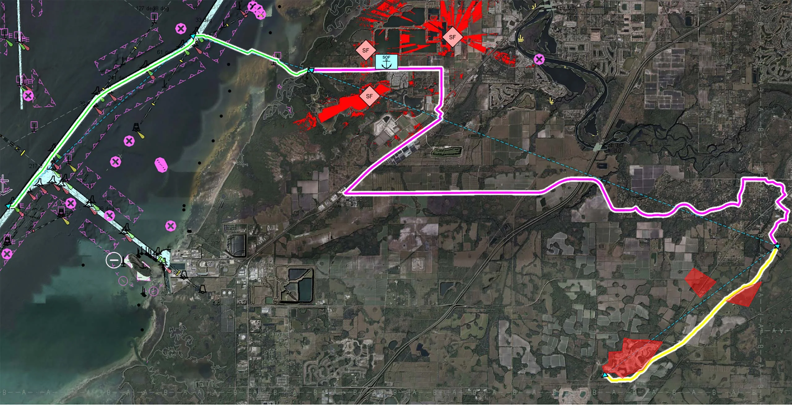
Multi-domain operations demand a high degree of interoperability, real-time responsiveness, and adaptive decision-making across diverse and often contested environments. Discover how Carmenta technology enables seamless coordination of uncrewed systems (UxS) across land, air, and sea in modern multi-domain operations.
Read more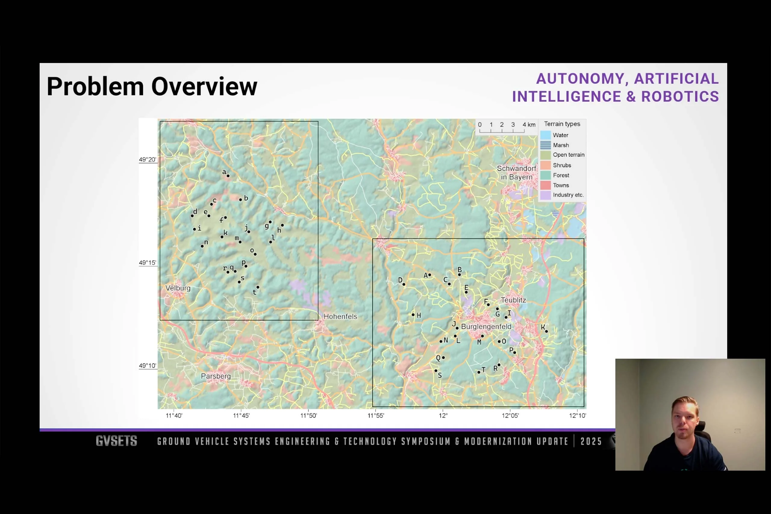
Did you miss the presentation of our technical paper at GVSETS 2025? Watch the full presentation as an on-demand webinar and learn about maximizing the number of firing positions while minimizing travel time under strict movement constraints.
Read more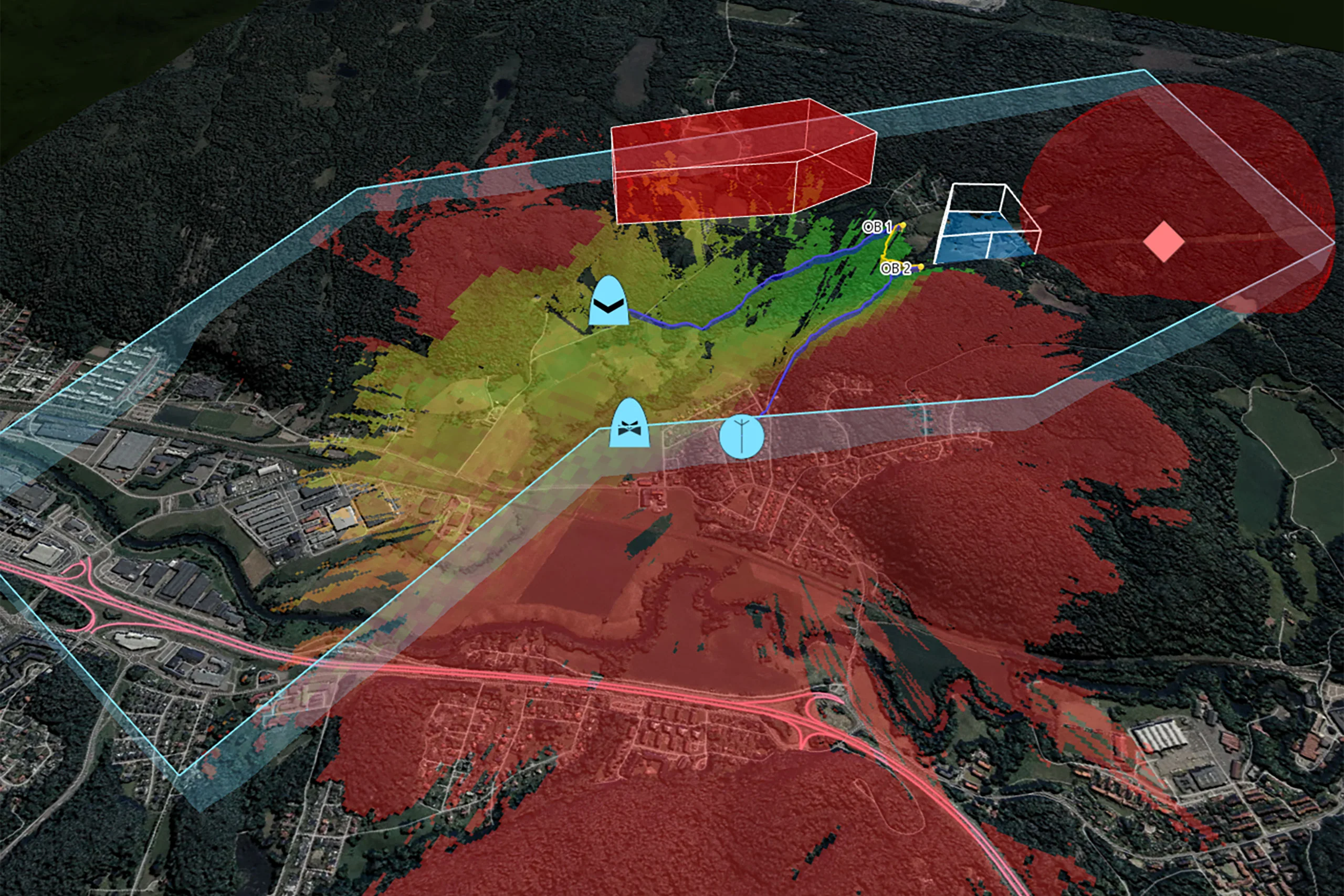
Carmenta UAS Mission Kit enables risk-mitigated and efficient development of demanding Uncrewed Aerial Systems (UAS) mission applications for defense or high-end civil use.
Read more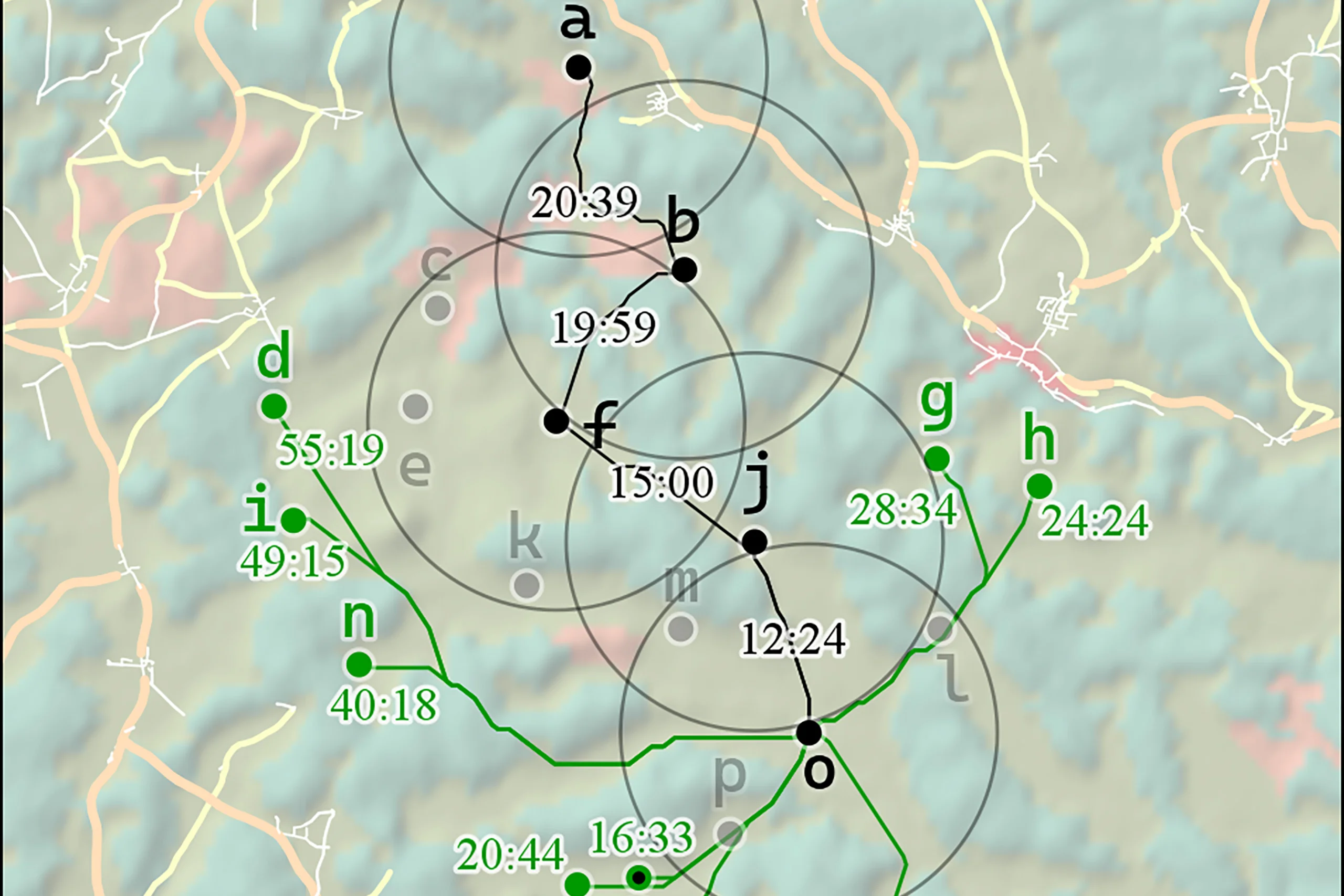
In shoot-and-scoot tactics, a common rule is that artillery units should not reuse firing positions; a more cautious rule is that they should not even pass near an old firing position when relocating.
Read more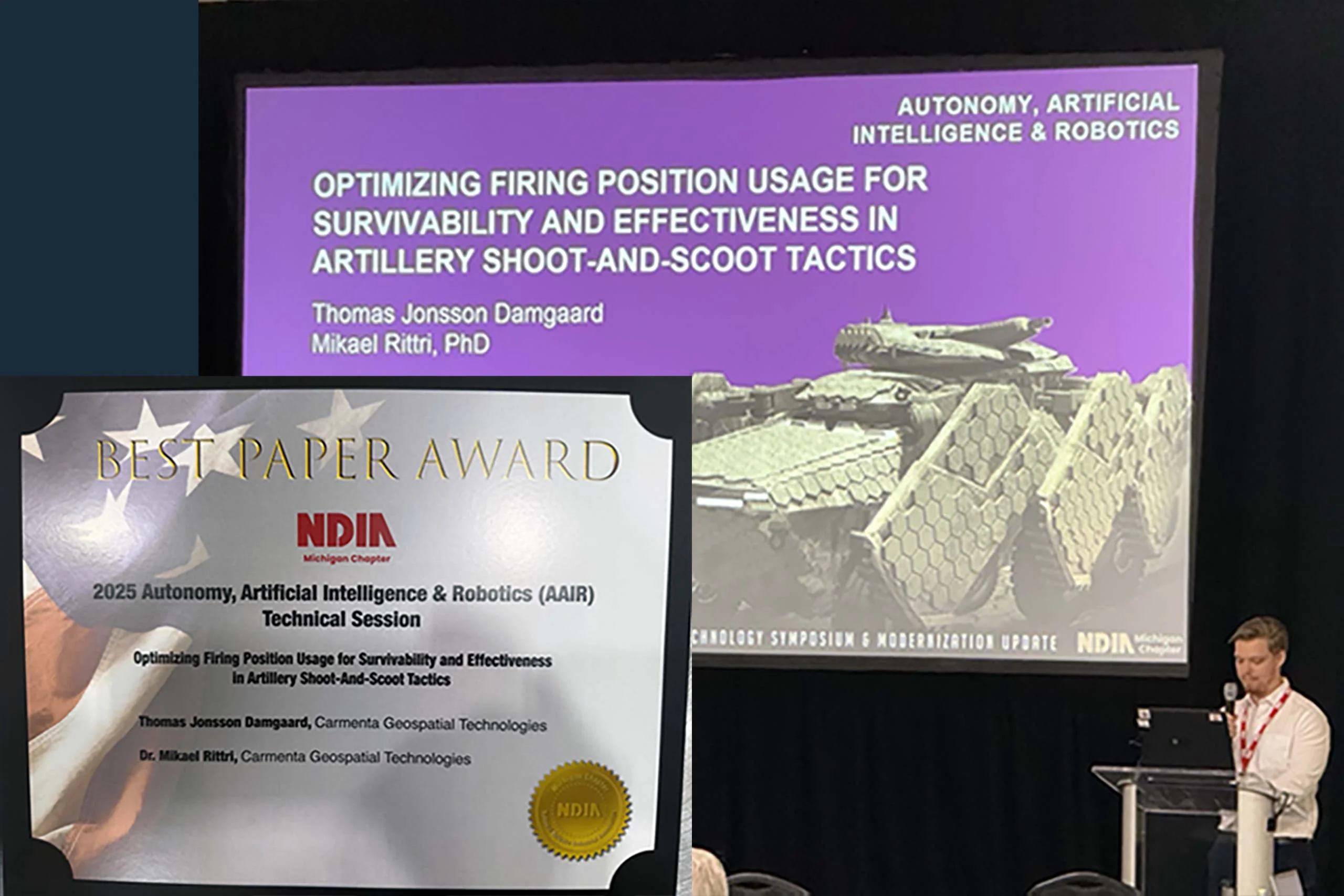
We are proud to announce that Carmenta yesterday received the Best Paper Award for our technical paper presented at the Autonomy, Artificial Intelligence & Robotics track at GVSETS 2025.
Read more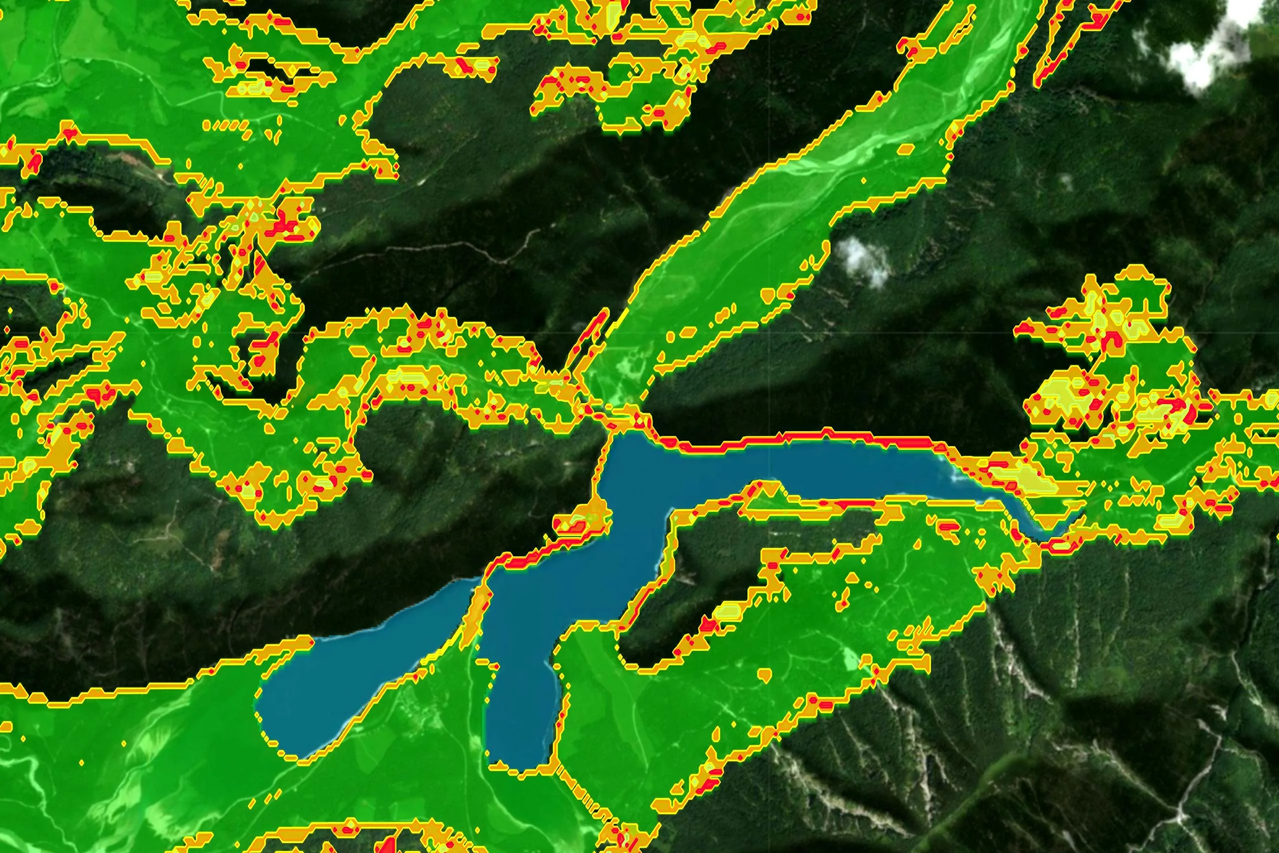
By integrating live terrain data, AI-driven route planning, and dynamic supply coordination, advanced real-time geospatial analytics are key enablers of robust, adaptive military logistics in fast-changing, high-risk environments.
Read more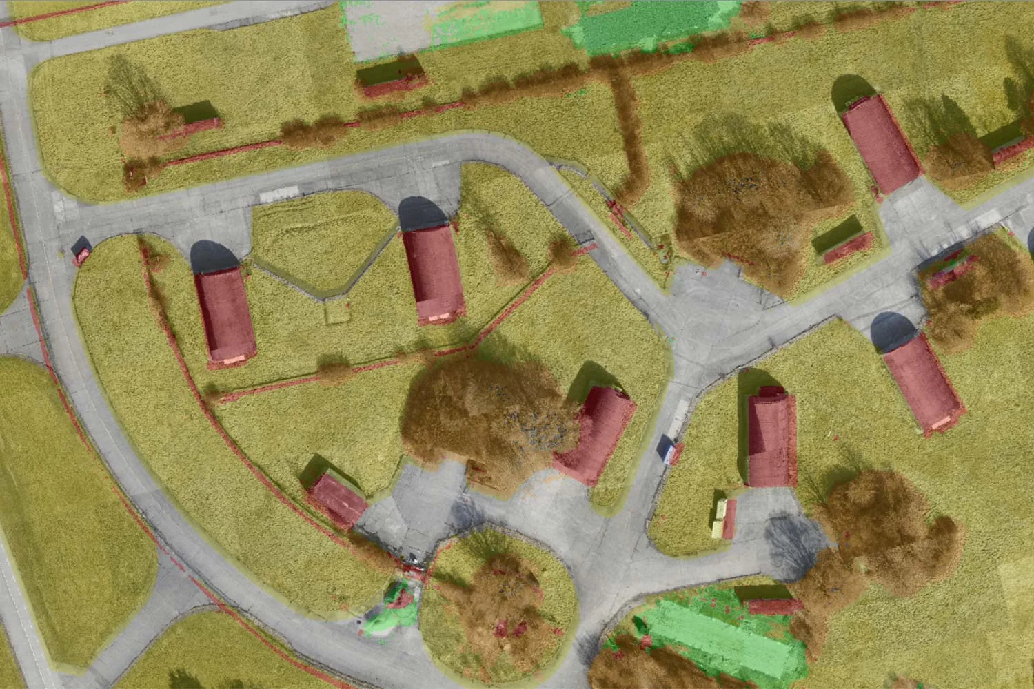
By leveraging AI-assisted computer vision, Carmenta and SE3 Labs are transforming real-time UAV data into high-resolution, semantic 3D maps, offering a new level of precision and adaptability in geospatial intelligence.
Read moreSE3 Labs and Carmenta are creating new possibilities for AI-driven decision-making by using AI-assisted computer vision to transform real-time UAV data into high-resolution, semantic 3D maps.
Read more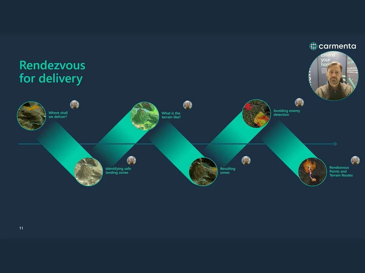
Watch our webinar, first presented at XPONENTIAL Europe 2025, about the evolving role of Uncrewed Aerial Vehicles (UAVs) in military logistics.
Read more
We’re excited and proud to share that our latest technical paper has been selected for presentation at GVSETS 2025 – marking the third consecutive year our technology and solutions have been selected by the AAIR Technical Board.
Read more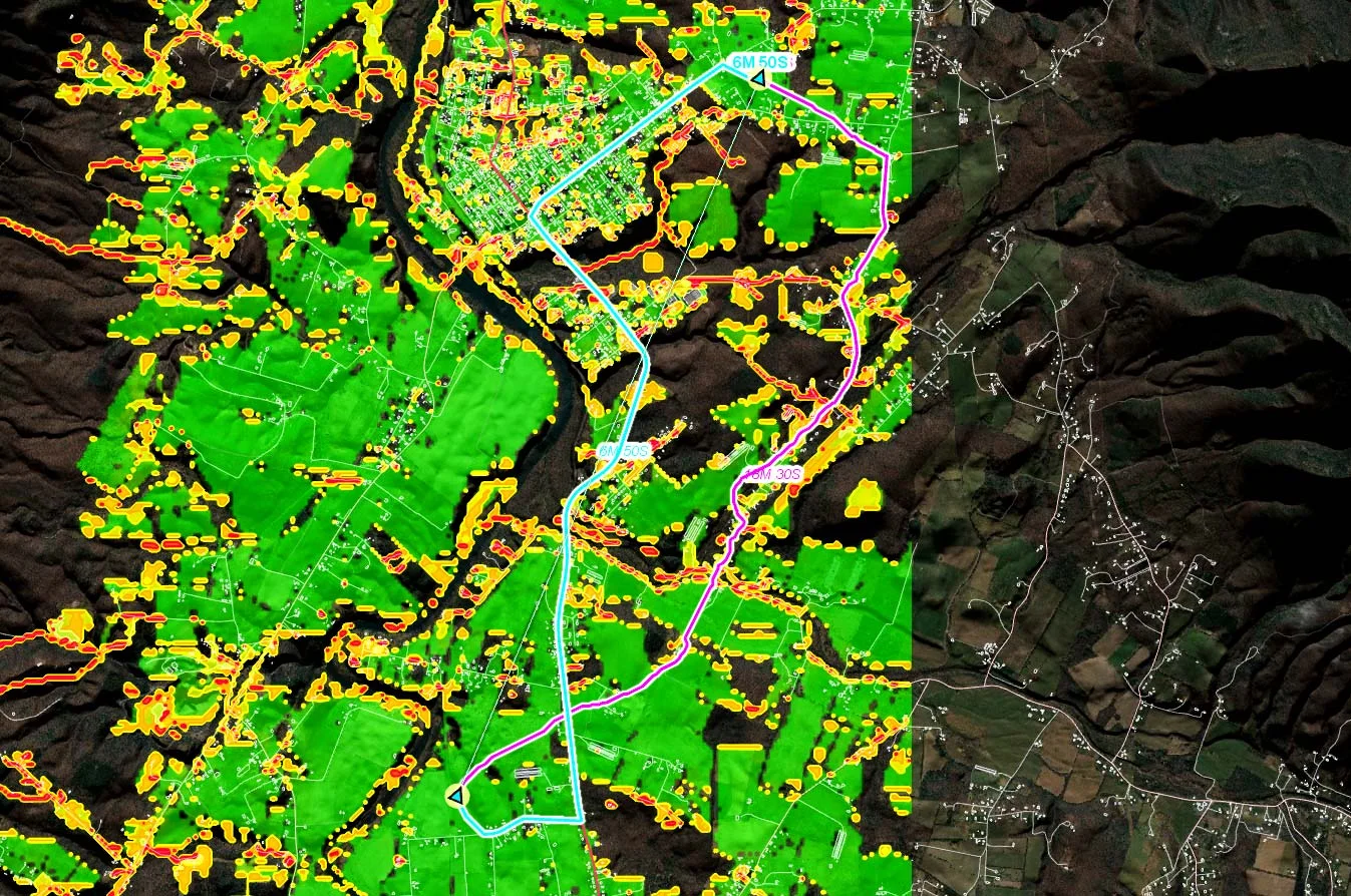
In modern combat scenarios, autonomous vehicles play a crucial role. This whitepaper explores robust path planning for autonomous vehicles, enhancing resilience and mission success in complex battlefield environments.
Read more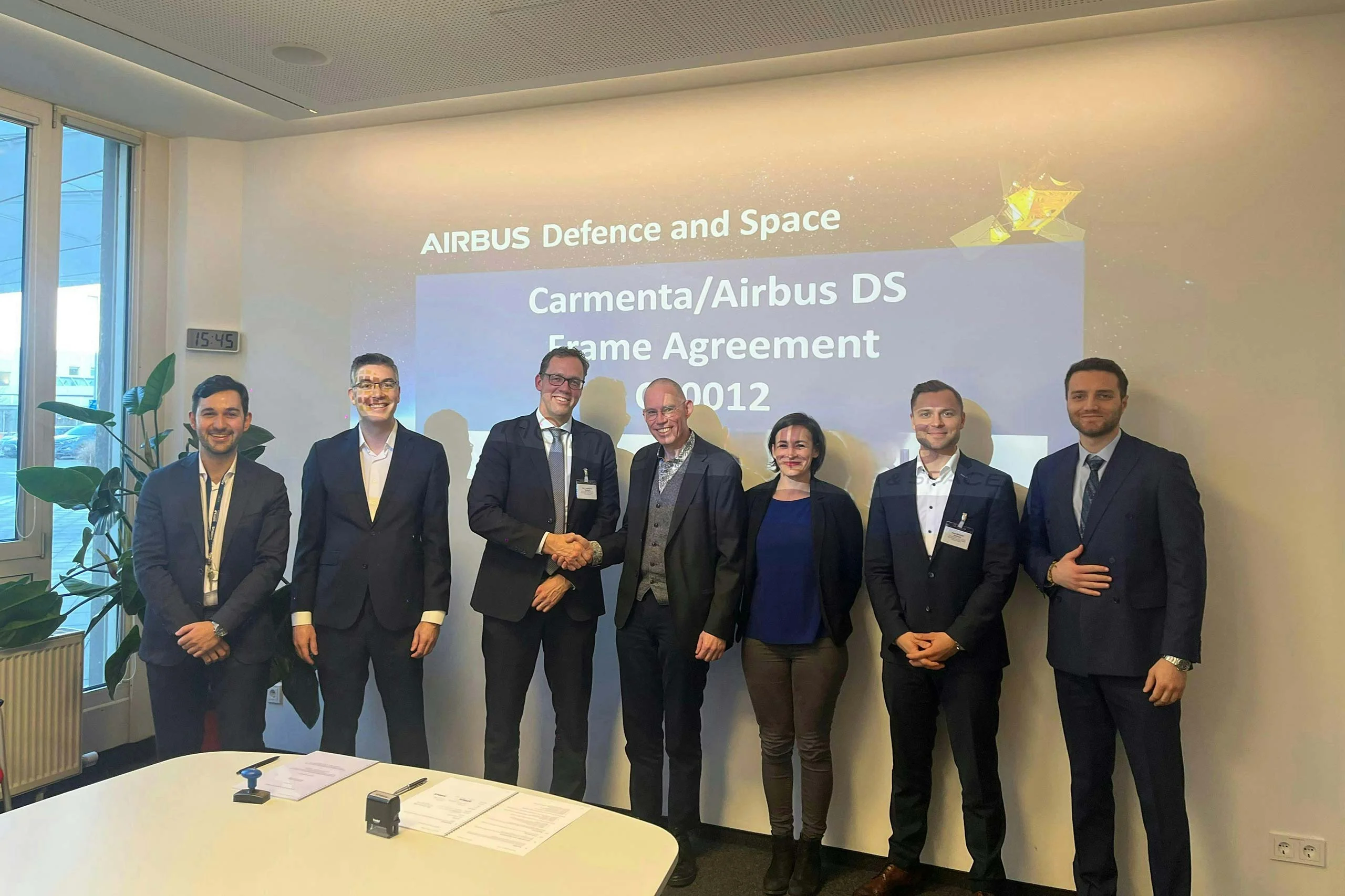
Carmenta is pleased to announce the extension of its frame agreement with Airbus Defence and Space. The partnership has resulted in advanced geospatial functionality across various mission support systems for aircraft, helicopters and drones.
Read more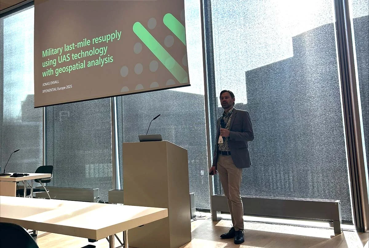
Last week, we were honored to speak at XPONENTIAL Europe 2025 in Düsseldorf! We had the opportunity to share insights on geospatial analysis for military last-mile resupply using UAS technology.
Read more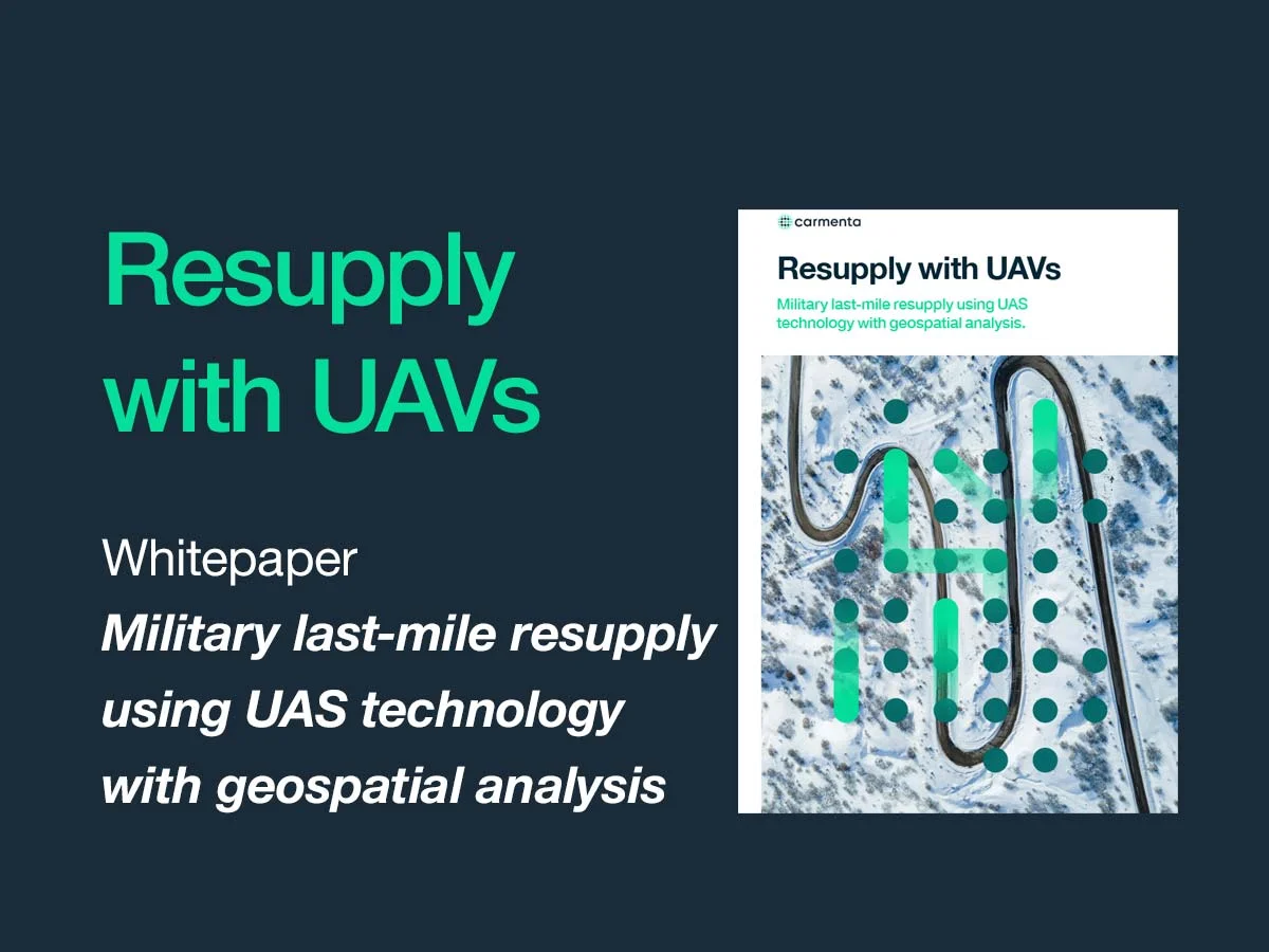
Military last-mile resupply using UAS technology with geospatial analysis. Real-time geospatial analysis for UAVs can be used to cope with dynamic challenges, enhancing situational awareness on the battlefield and supporting both human and autonomous decision-making.
Read more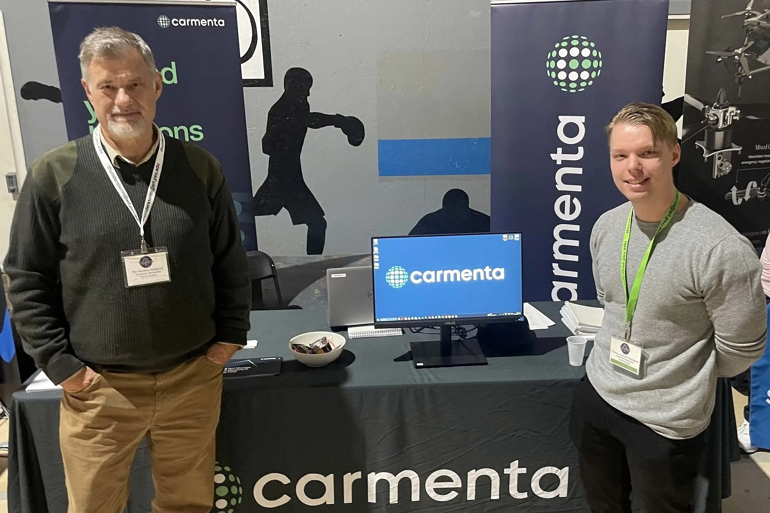
We’re proud to have recently participated in the invitation-only Thunderstorm event in the US. It was an honor to be selected for our cutting-edge technology in Rendezvous Planning for Resupply Missions and Combat Robustness.
Read more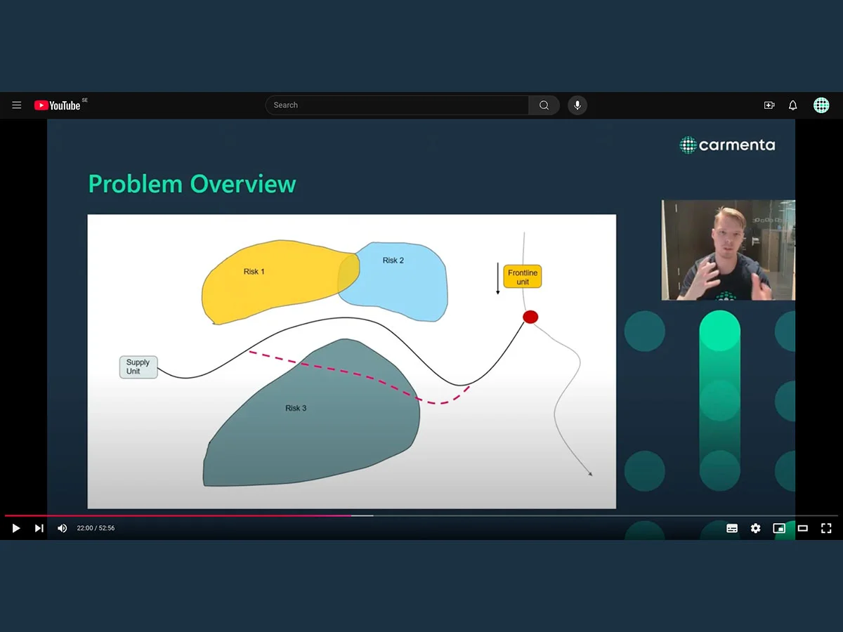
Watch our on-demand webinar about the crucial role of supply lines in the battlefield. Deep dive into the intricacies of determining the best rendezvous points in a resupply mission, taking into account the various threats that exist.
Read more
Last week, we exhibited at AUSA 2024, the largest land power exposition and professional development forum in North America. It was a busy and inspiring week, with great discussions with customers and contacts from all over the world.
Read more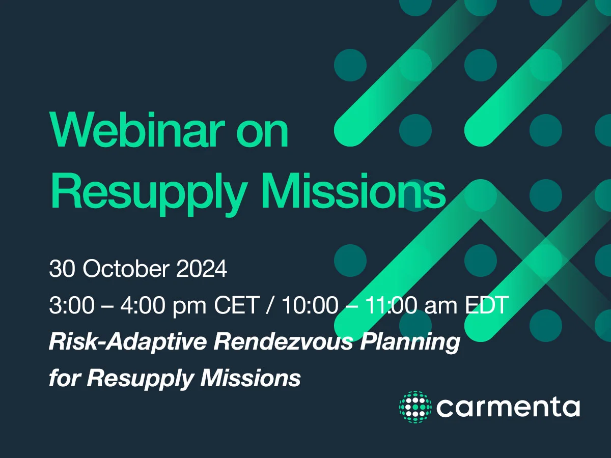
Join our upcoming webinar that will explore the critical aspects of secure and timely resupply missions, including advanced and secure terrain routing, and risk management.
Read more
Carmenta is proud to be one of 39 companies selected to participate in Thunderstorm 24-4. The invitation-only field technology showcase will take place 4–8 November outside Fredericksburg, Virginia, US.
Read more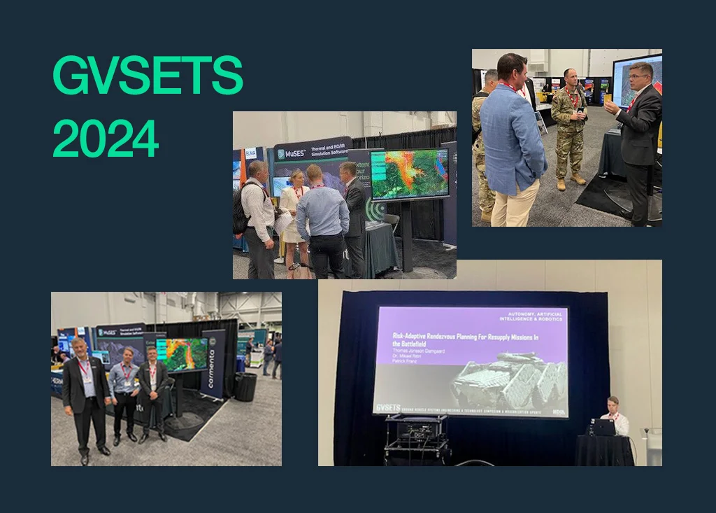
13–15 August, we exhibited at GVSETS 2024. Thank you to everyone who attended our presentation ‘Risk-adaptive rendezvous planning for resupply missions in the battlefield’, and to everyone who visited our booth for great discussions.
Read more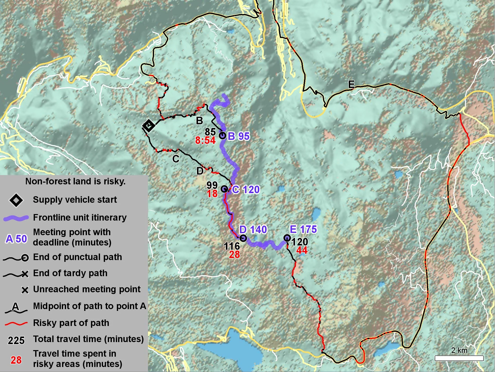
Resupply missions are critical logistical components of modern warfare. Supply vehicles carrying fuel and ammunition are high-value targets, making the choice of route sensitive to both risk and delivery time. Read our latest whitepaper here.
Read more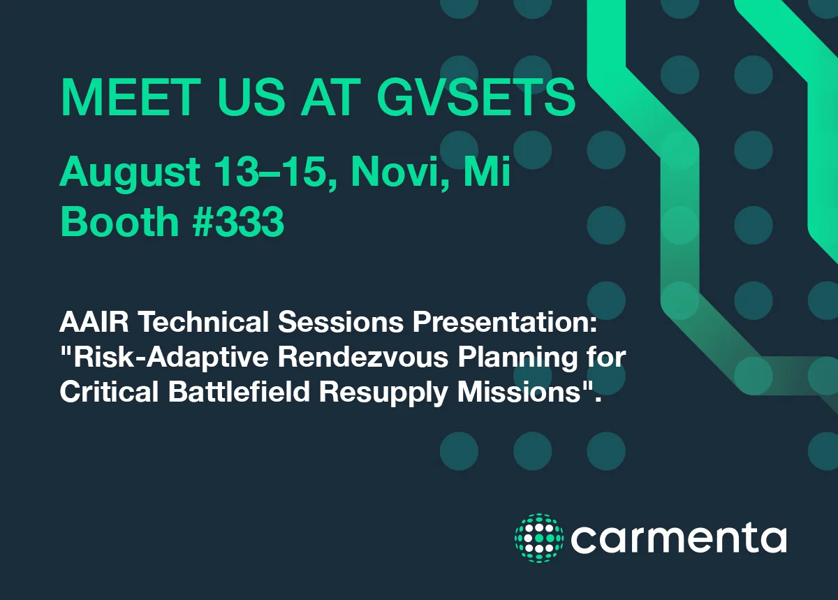
Next week, 13–15 August, you can meet us at GVSETS 2024 in Novi, Michigan, USA. Join us at booth #333 to explore our latest geospatial technology developments across unmanned and manned platforms.
Read more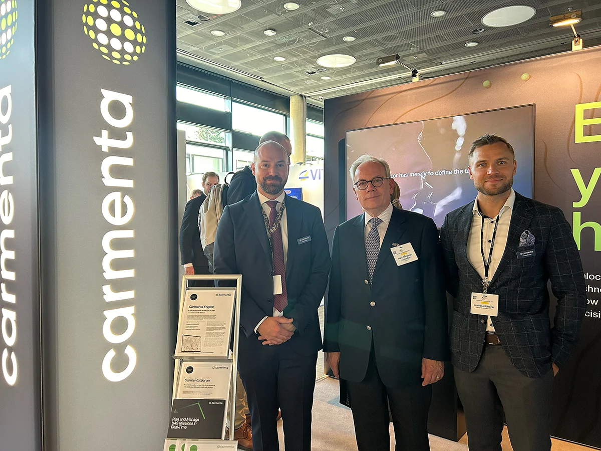
Last week, we exhibited at the AFCEA Exhibition 2024. We had hectic and inspiring days, and we want to thank everyone who visited our booth for the engaging discussions.
Read more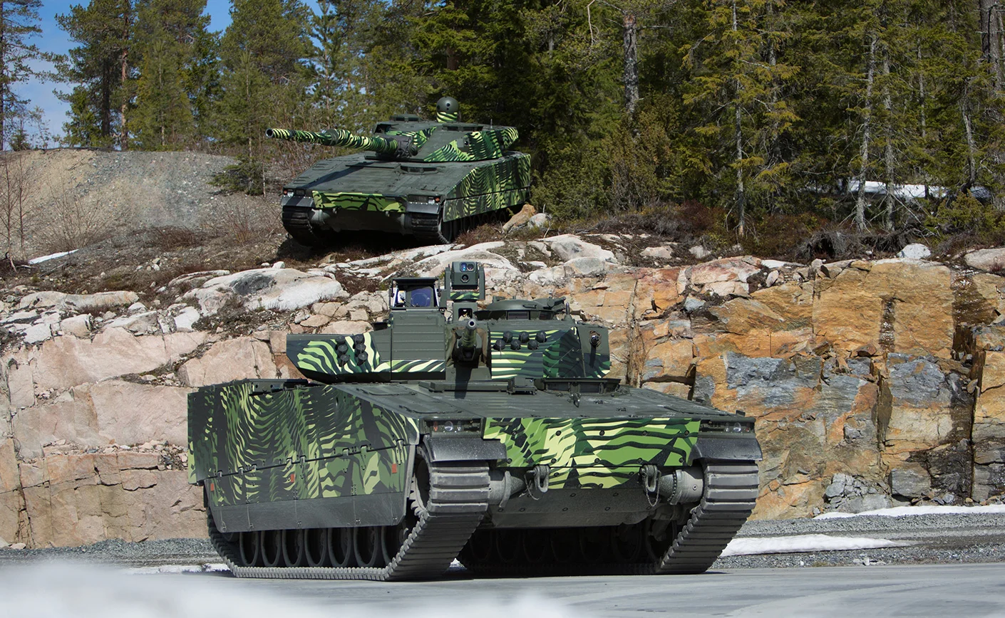
Carmenta and BAE Systems Hägglunds, together with hardware UAV manufacturer Airolit, have partnered to develop a solution with the objective of integrating autonomous drone surveillance capabilities into combat vehicle – CV90.
Read more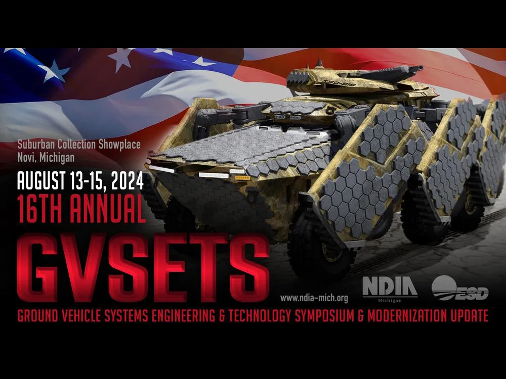
We are excited to announce that for the second consecutive year, Carmenta’s Geospatial Technical Paper has been chosen for presentation at the prestigious Autonomy, Artificial Intelligence & Robotics (AAIR) Technical Session at GVSETS.
Read more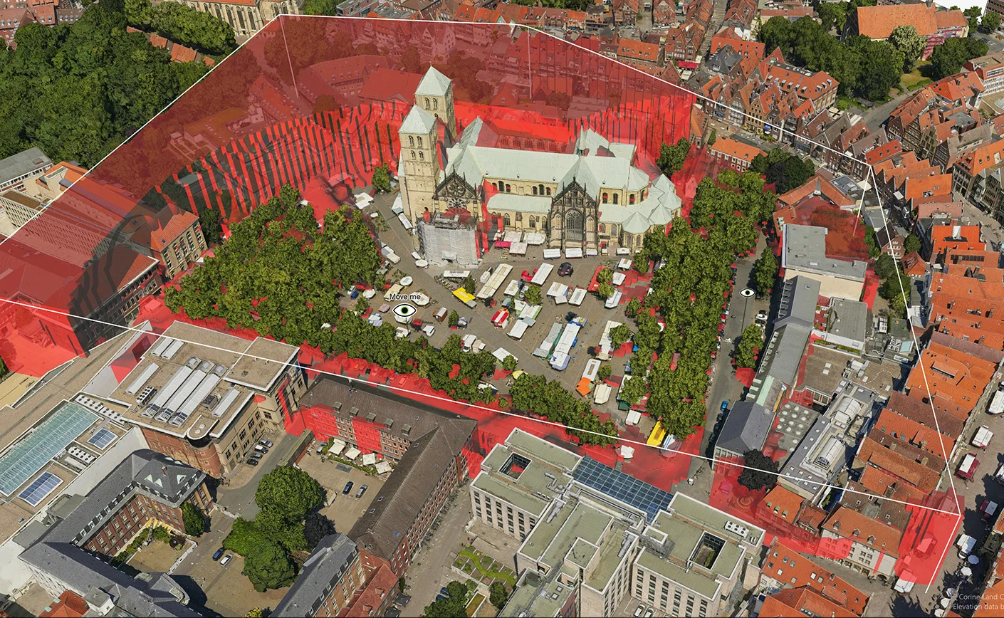
This week you can meet the Carmenta Team at two different conferences in Arlington, USA: UAV Technology USA and Counter UAS Homeland Security USA.
Read more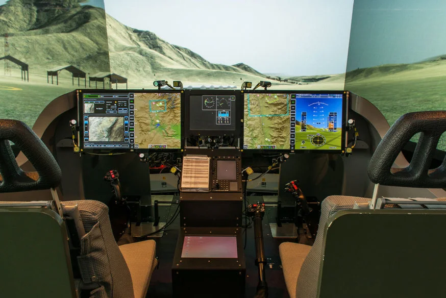
Carmenta is thrilled to announce the extension of its long-standing collaboration with the University of the Bundeswehr Munich. The renewed ten-year agreement provides continued integration of the Carmenta Engine into advanced simulation environments focused on enabling future Manned-Unmanned Teaming (MUM-T) Fast-Jet, Transport and Attack-Helicopter missions.
Read more
Determining safe landing zones is an essential part of many types of UAS missions. Two examples of such UAS missions is delivering supplies to military ops and doing emergency medical delivery.
Read more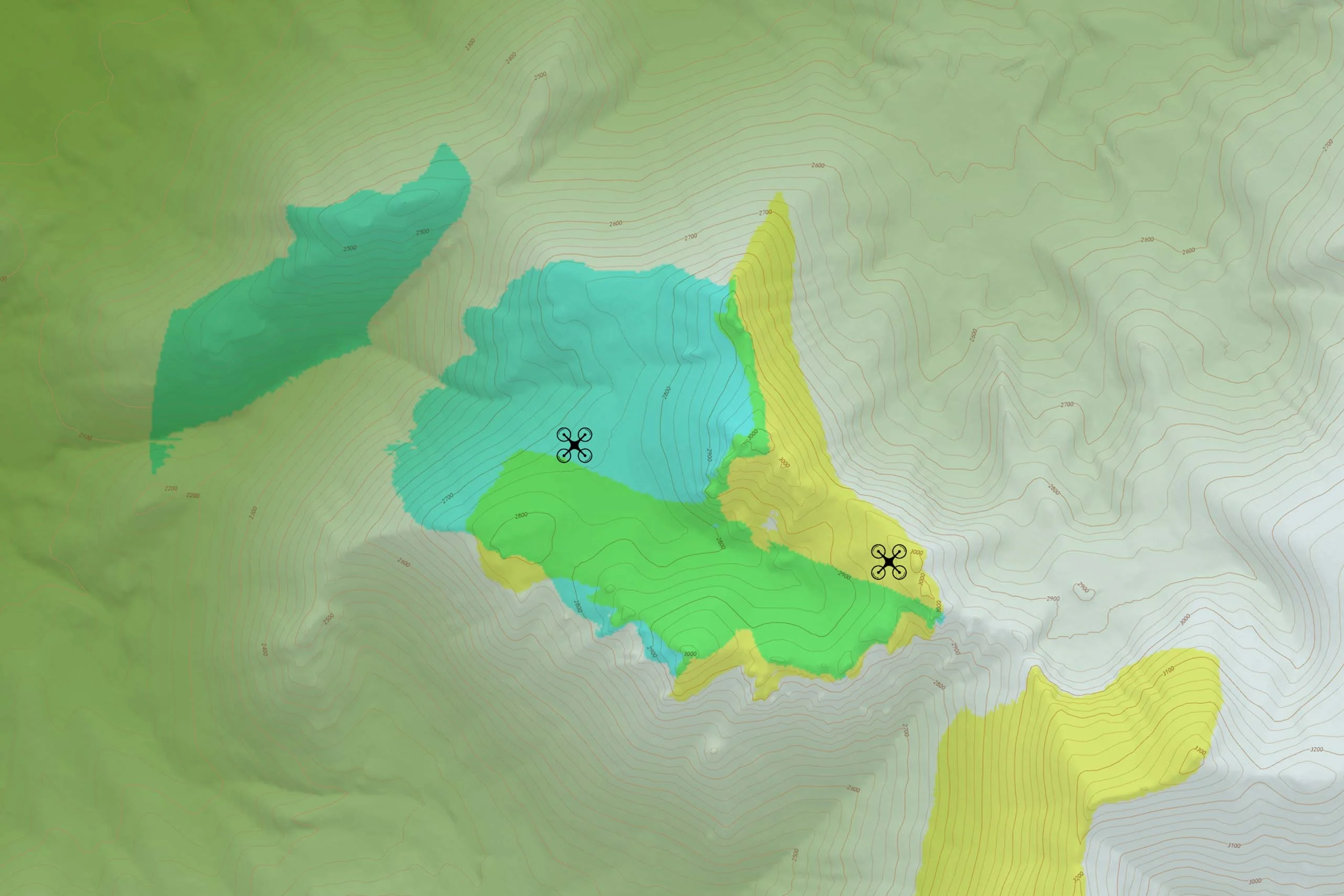
Geographical data can be used to create all sorts of map presentations as synthesized representations of reality. Adding analyses to the process can enhance our perception of this reality.
Read more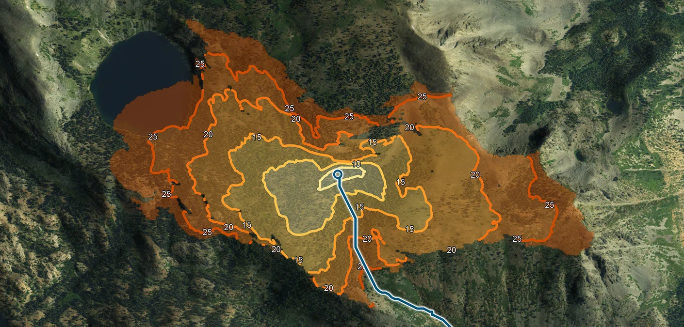
Solutions for navigating vehicle routes through the leveraging of road data have become more widely available in the last decades, and today most of us have this functionality at our fingertips with smart phones.
Read more
The EDIDP (European Defence Industrial Development Programme) project LynkEUs is the first technological and industrial contribution to the objectives of the Permanent Structured Cooperation (PESCO) Beyond Line Of Sight (BLOS) capability project.
Read more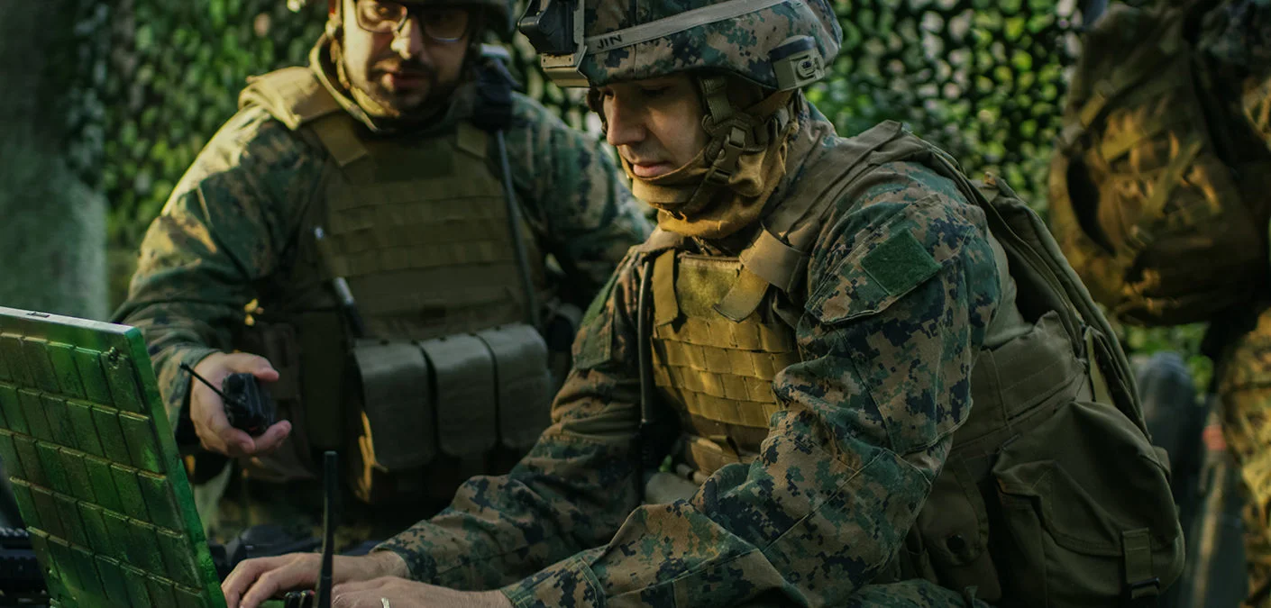
Carmenta is proud to announce that Dstl, UK MOD’s innovative science and technology contributor to the defense and security, has selected Carmenta Engine as one of its suppliers for geospatial tools.
Read more