Carmenta Engine
Extensions
Not every customer needs the same set of functionalities. To offer a cost-efficient and flexible solution, we’ve packaged capabilities into extensions, each containing a specific group of functionalities. You can choose the extensions that best match your project requirements.
Explore the full list of Carmenta extensions below.
Extensions for Carmenta Engine 5.17
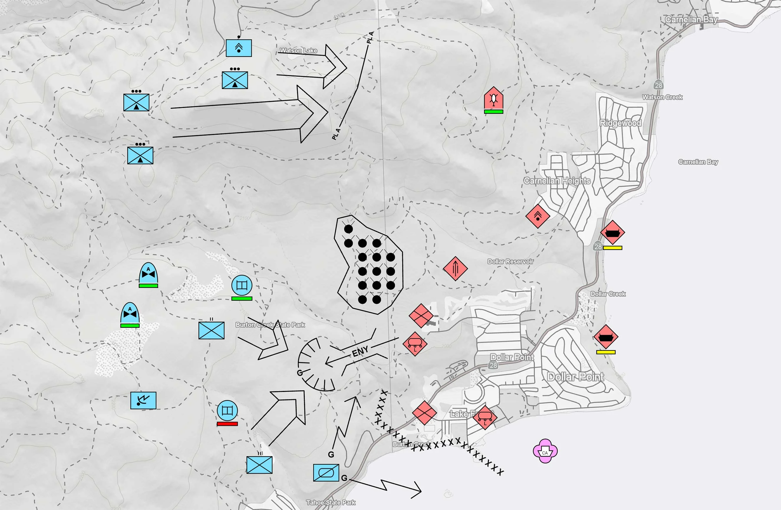
Tactical Extension
Supports tactical symbols and graphics according to the MIL-STD-2525 and STANAG 2019 APP-6 standards and contains a multitude of features that facilitate the development of C4ISR applications. For more informations see the feature Military Tactical Overlays.
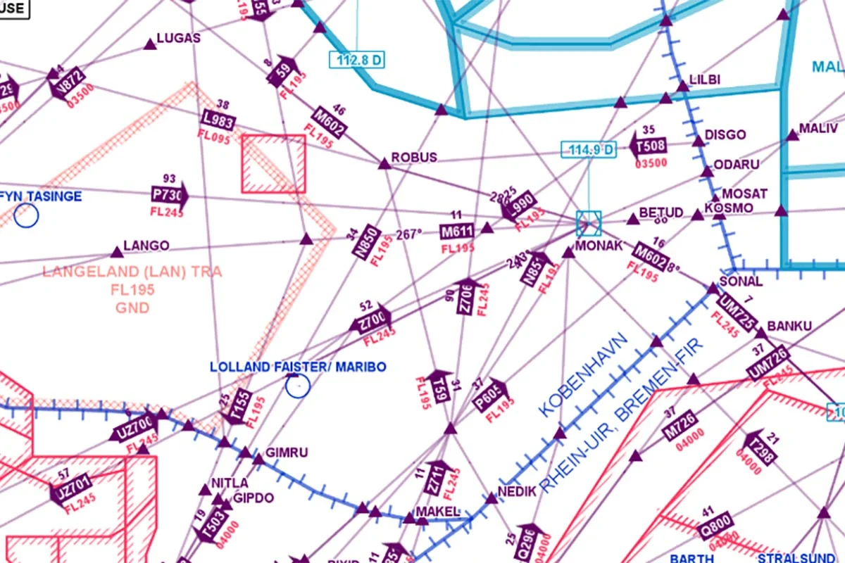
Aeronautical Extension
Reads aeronautical navigation database files on the ARINC SPECIFICATION 424-16, 424-17 and 424-18 formats, as well as the AIXM 5.1 and 5.1.1 formats. Used together with terrain analysis extension it is suitable for building aeronautical mission planning systems. For more informations see the feature Aeronautical Charts.
3D Extension
Generate realistic 3D environments using any 2D or 3D geospatial data format supported by Carmenta Engine. The 3D ground surface is generated on the fly using either elevation raster data or 3D meshes and can be textured with any combination of 2D map layers.
Tile Engine Extension
Deploy interoperable tile services based on the OGC® API – Tiles standard. This allows you to decouple the handling of background maps in your Carmenta based solutions and have your clients read background maps from a shared service.
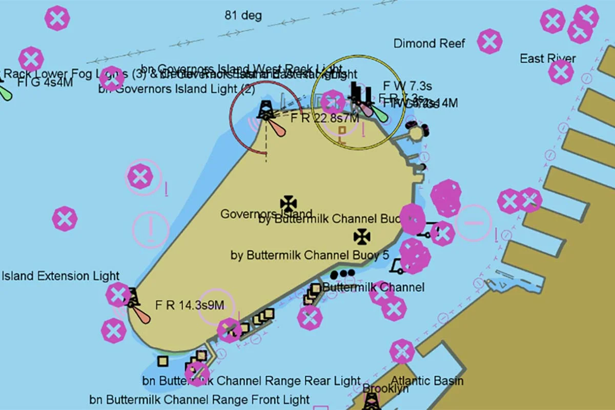
Nautical Chart Extension
Provides native, high-performance reading and rendering of maritime data according to the International Hydrographic Organisation (IHO) S-57, S-63 and S-52 standards, and adds support for reading C-MAP CM93 nautical charts and visualising them according to the IHO S-52 standard. For more informations see the feature Nautical Charts.
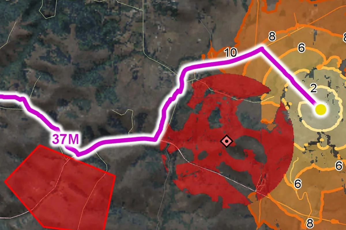
Vehicle Analysis Extension
You can calculate how ground-based manned and autonomous vehicles can interact with the terrain and the roads. This makes it possible to calculate optimal off-road routes for terrain vehicles based on road and ground conditions, operational constraints, and vehicle characteristics, and you can calculate flight paths for UAVs in a similar fashion. For more informations see the feature Terrain Vehicle Mobility.
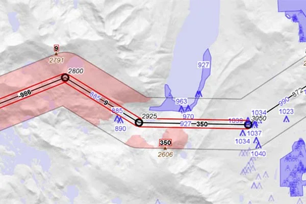
Terrain Analysis Extension
Provides a highly configurable functionality to calculate the terrain and obstacle clearance along flight routes and enables you to apply a color-coded terrain awareness visualization to both 2D maps and 3D environments. You also get access to a vertical view of defined routes that can be a key feature in a lot of aeronautical applications, as well as mission panning or battle management systems for ground-based vehicles. For more informations see the feature Terrain Vehicle Mobility.
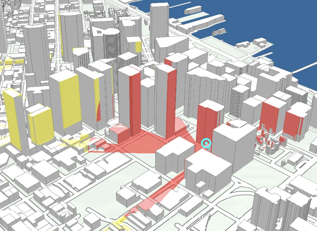
Visibility Extension
The line-of-sight calculation uses elevation data to compute the regions that have a free line of sight to the position of an observer. The computation is extremely rapid and is designed to be computed on the fly for moving objects and can easily be extended with your own algorithms for calculating radio coverage. There is also possible to calculate viewshed volumes that can be merged into a combined volume that represents airspace covered by observers. For more informations see the feature Visibility Analysis.
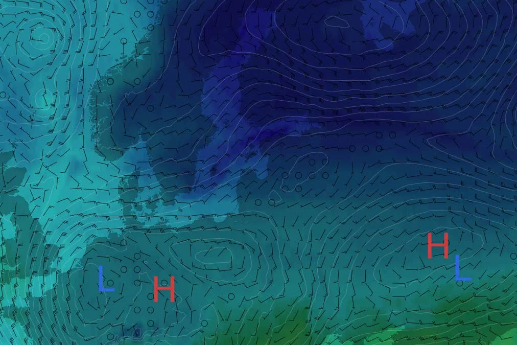
Meteorological Extension
Read meteorological data in the GRIB format, and the output can be used as any raster in Carmenta Engine, either for direct visualization, or as input to other geoprocessing operators. For more informations see the feature Meteorological Data.
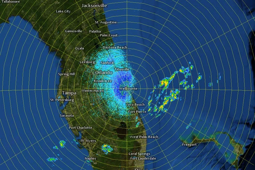
Radar Video Extension
Display radar plot overlays, radar intensity displays and other highly dynamic layers. Thanks to a highly optimized, GPU accelerated rendering pipeline, these extensions can handle millions of continuously moving objects. For more informations see the feature Radar Data.
Georeferenced Video Extension
Real time video overlays can provide a crucial advantage for UAV Ground Control Stations and other systems that manage tactical video intelligence. Overlaying a live video stream onto a map, from a UAV or other source, significantly increases the usability of the video, as everything that happens in the video is immediately georeferenced. Carmenta Engine can also create an image mosaic from the full motion video stream as it is being downlinked. For more informations see the feature Georeferenced Video.

Plot Extension
Display highly dynamic layers thanks to a highly optimized, GPU accelerated rendering pipeline, this extension can handle millions of continuously moving objects. For more informations see the feature High-Performance Rendering.

Try for free – no commitment
Are you ready to see how our products can transform your work? Request a free trial today and explore the full potential of our geospatial technology.
Our free product evaluation includes:
- 30 days unlimited access to our SDK.
- Full access to our e-mail support during the evaluation period.
- Full access to our online self-study course during the evaluation period.
Please specify which product/products you are interested in.
This form can be used to request a trial for:
- Carmenta Engine
- Carmenta Server
- Carmenta Map Builder