Terrain Vehicle Mobility
A comprehensive solution for itinerary calculation and accessibility analysis
In several systems, the mobility of off-road vehicles is a key component. Fire trucks sent to fight forest fires need to calculate the fastest route through uneven terrain. In military operations, to successfully plan a mission, an officer wants to ensure safe travel for allied vehicles while anticipating the next moves of enemy forces.
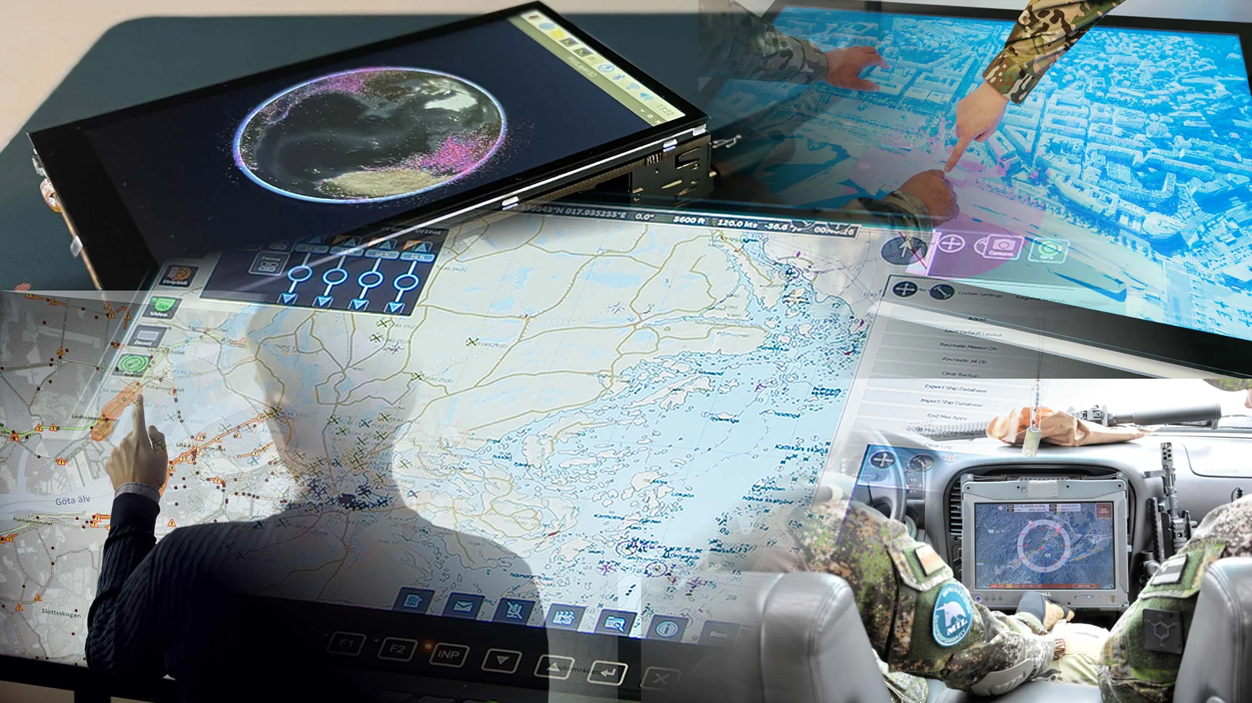
Carmenta provides highly dynamic and modular routing capabilities to meet the needs of mission-critical systems.
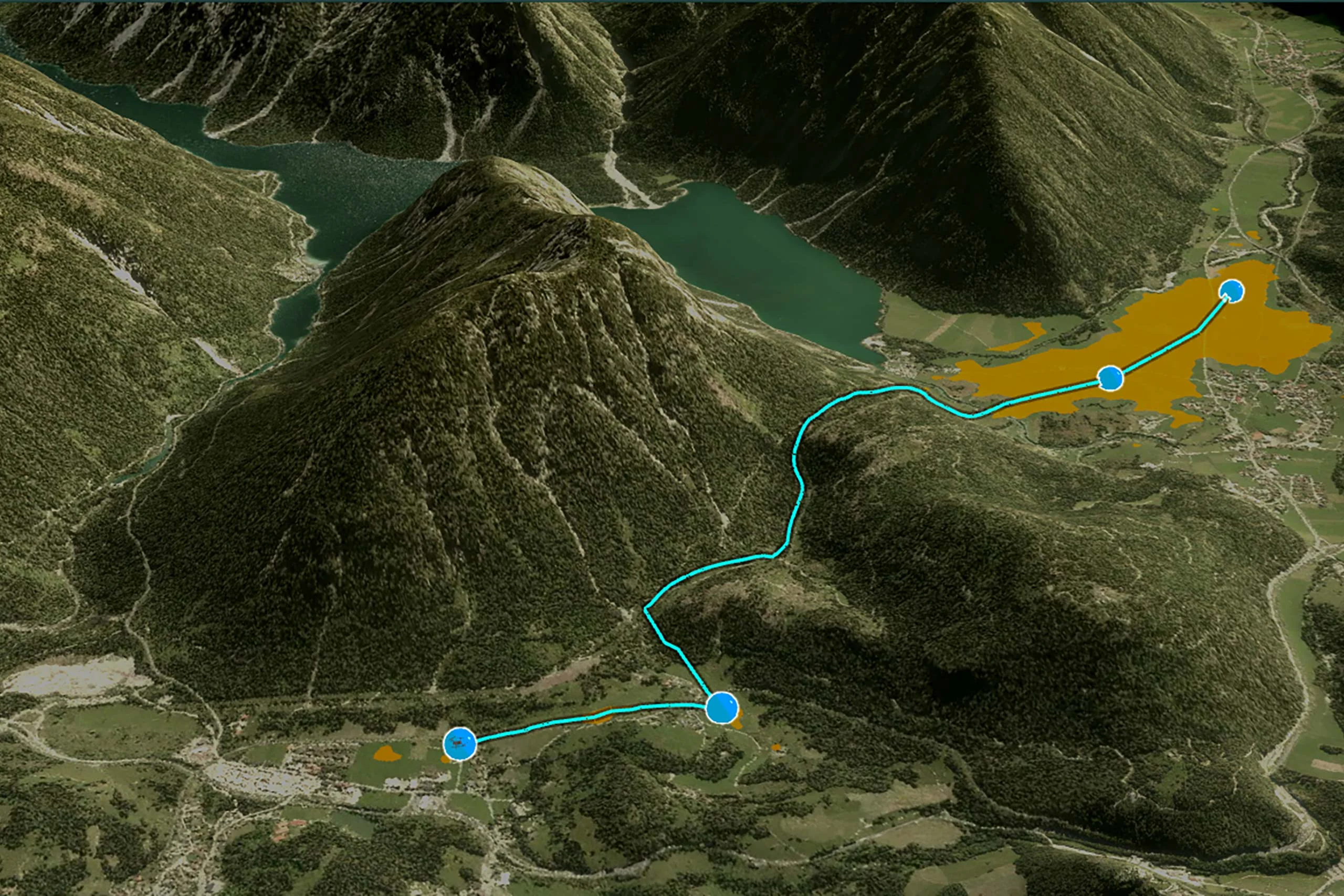
Calculate how ground-based manned and autonomous vehicles can interact with the terrain and roads. Calculate optimal off-road routes for ground vehicles based on road and ground conditions, operational constraints, and vehicle characteristics.
Combine Map Data and Operational Information
Most navigation systems in transport are oriented towards the search for optimal paths following the road network only. Cross-country navigation presents much more complex circumstances to take into account. When advancing through terrain, an optimal route also depends on the slope and the type of soil. Carmenta’s terrain vehicle analysis provides comprehensive support for defining these terrain characteristics using elevation, land cover, and road network map geographical data in any format supported by Carmenta Engine.
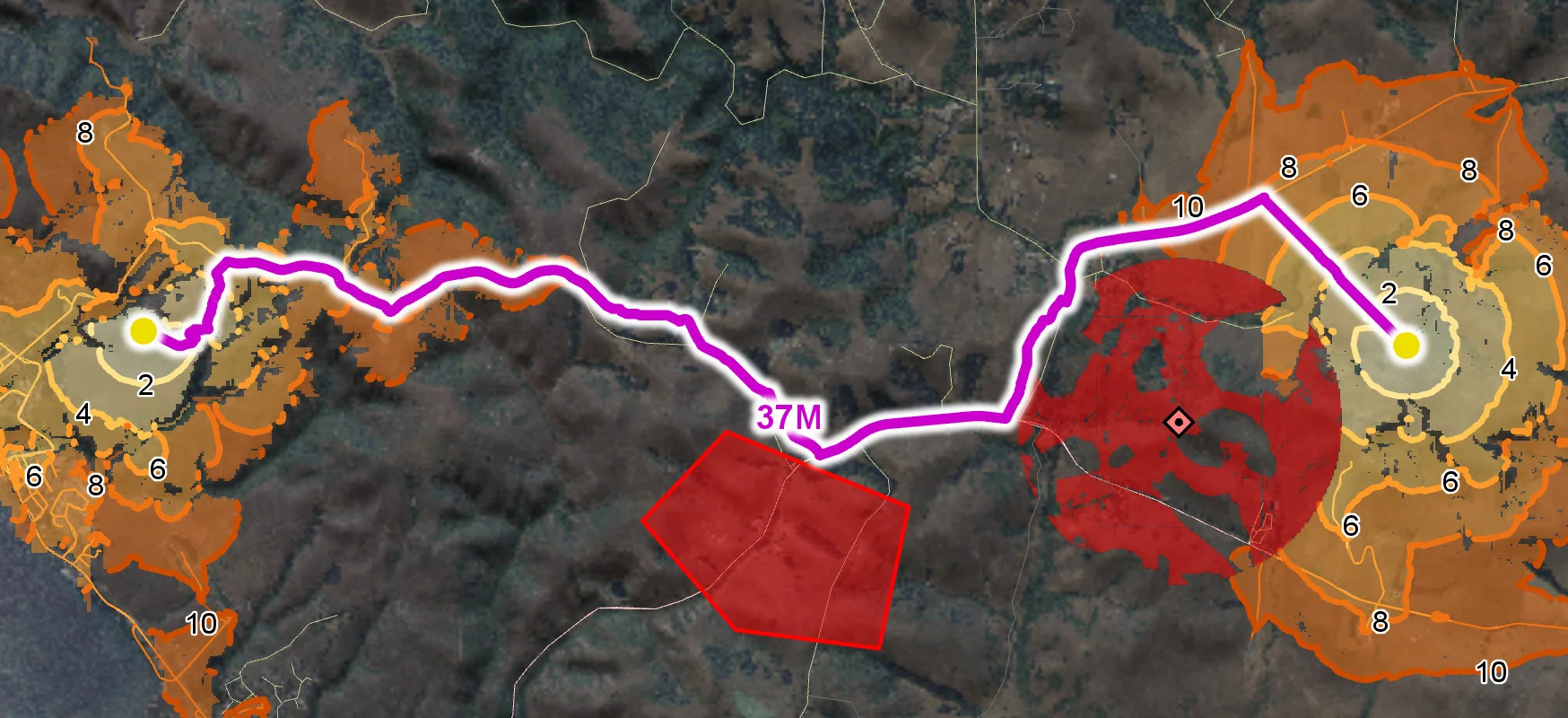
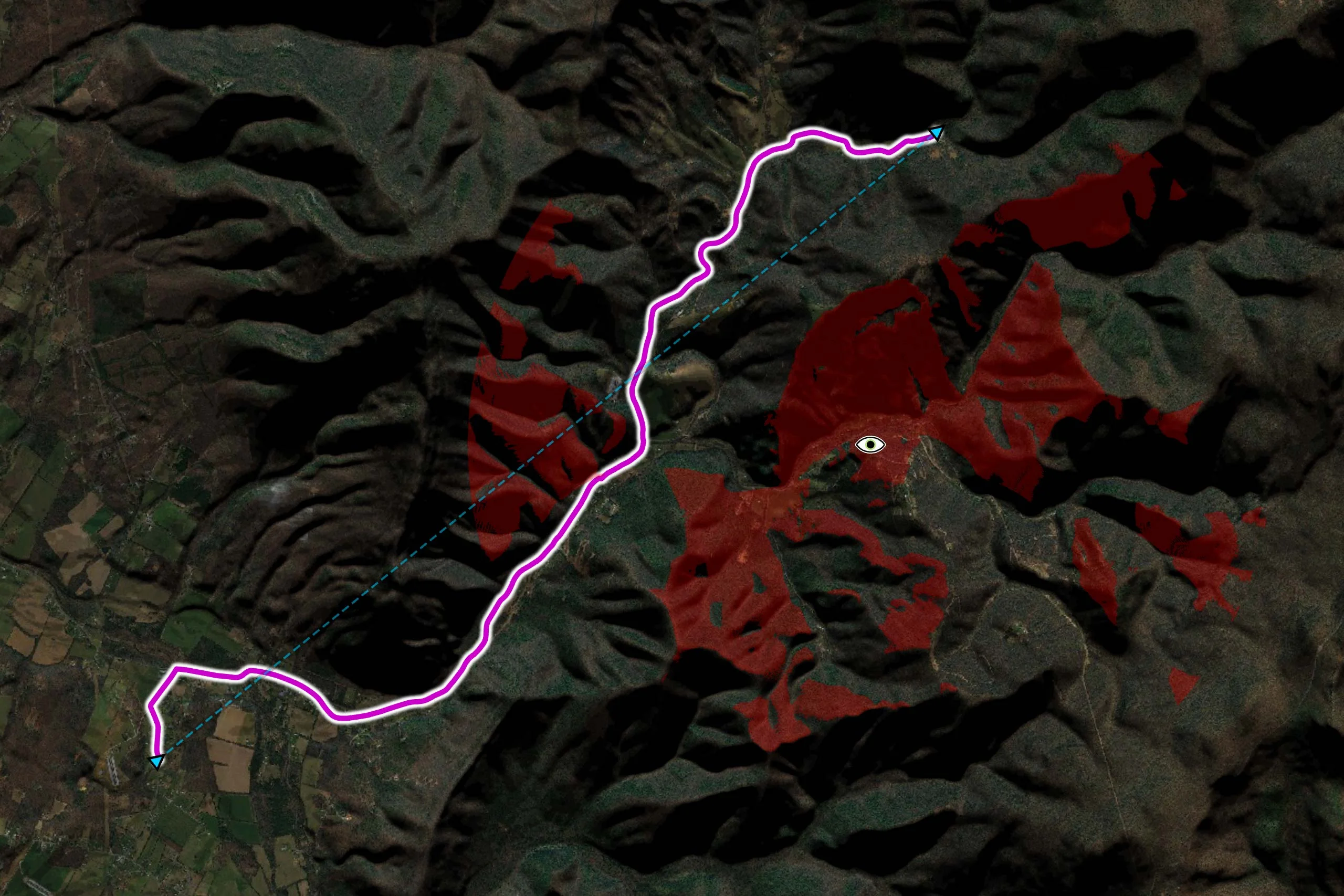
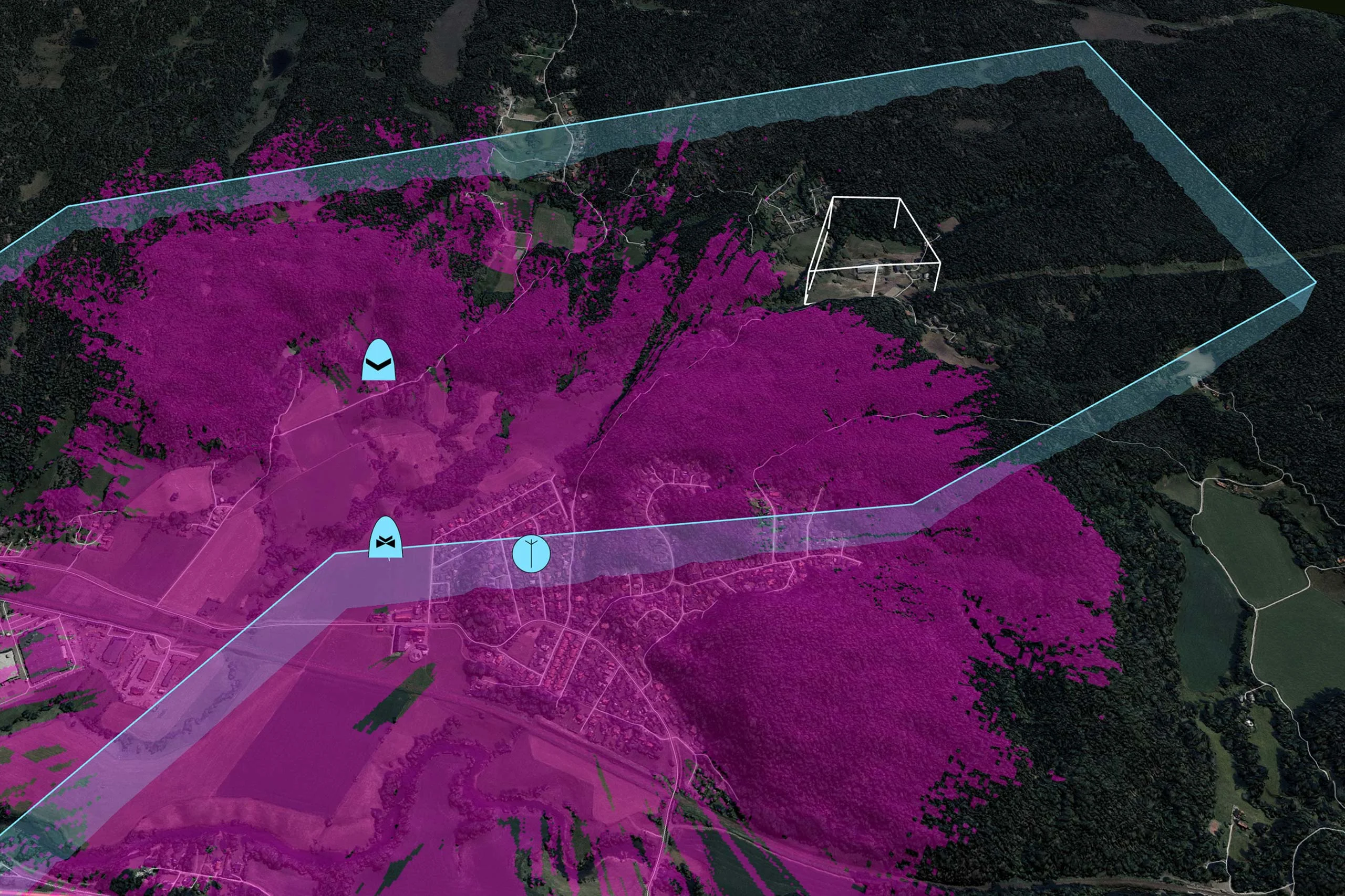
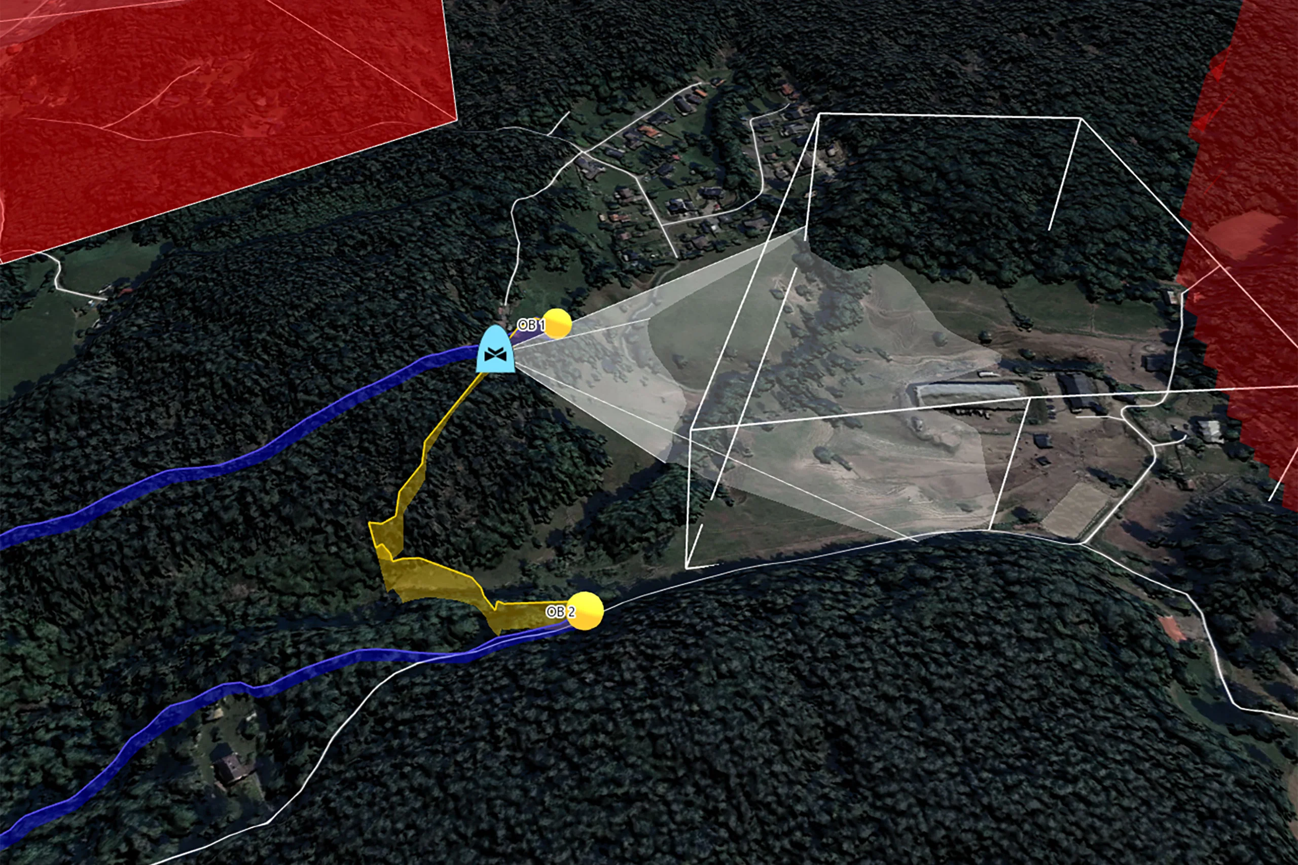
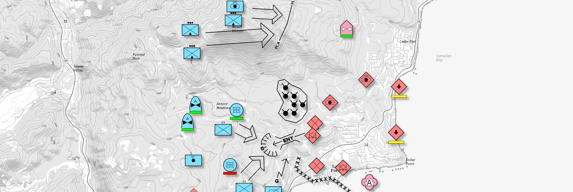
Furthermore, Carmenta’s routing module makes it simple to incorporate dynamic data about operational constraints. In numerous tactical scenarios, access to normally traversable areas can be restricted by the operator. Such restricted areas can be defined from real-time weather data, highlighting flooded fields or areas with low visibility, or they can come from an analysis of enemy line-of-sight, a too dangerous area to enter.
The routing algorithm determines which areas are inaccessible or unsafe to enter, and which areas are passable but not recommended. It then optimizes the itinerary accordingly.
The streamlined terrain vehicle model makes it easy to define characteristics, such as the maximal speed for each terrain condition or for each road, as well as dimensions, weight, and more. By combining map data, operational constraints, and vehicle types, the terrain routing calculations are tailored to the requirements of any system.
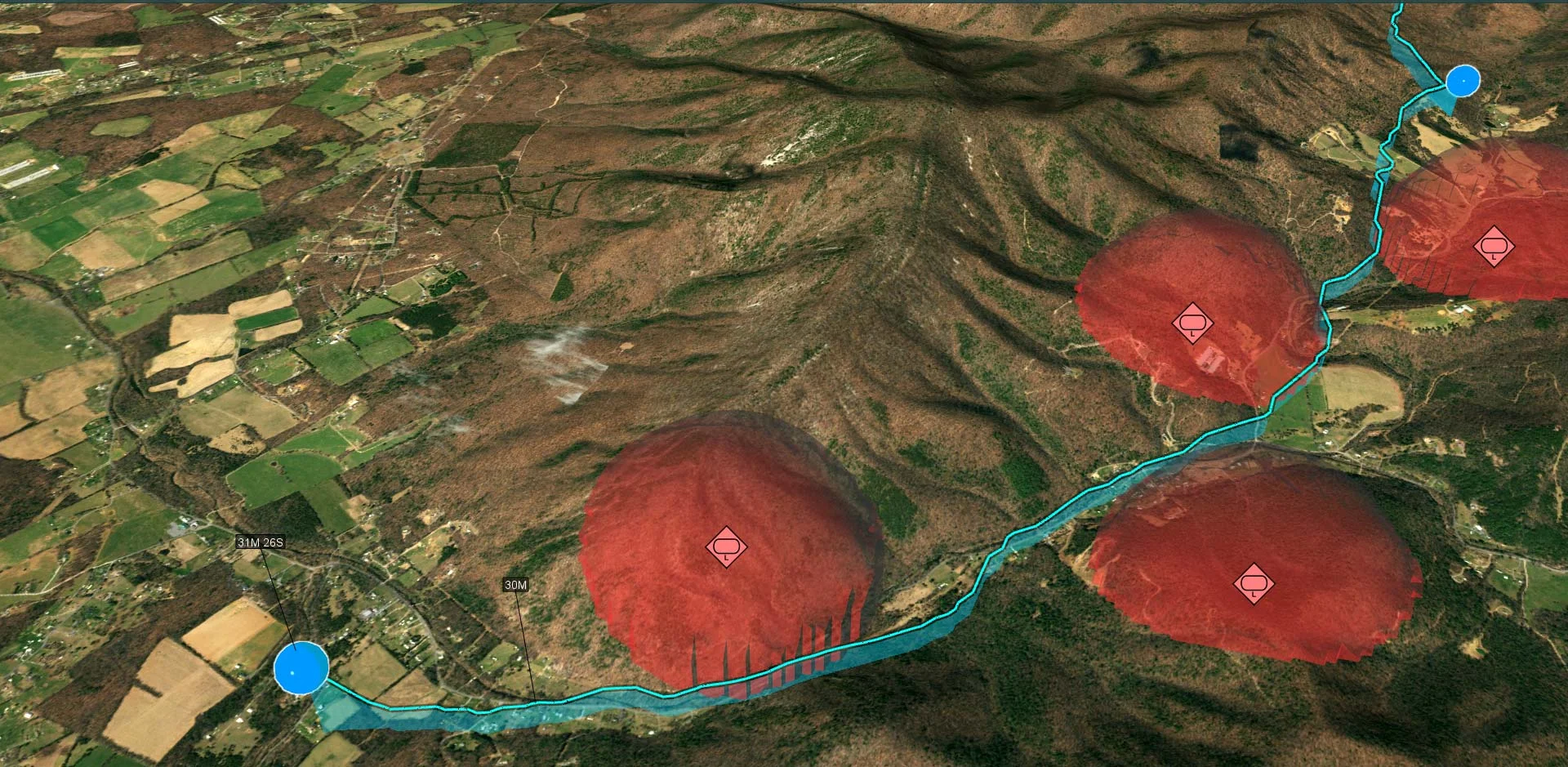
Analyze Mobility and Accessibility
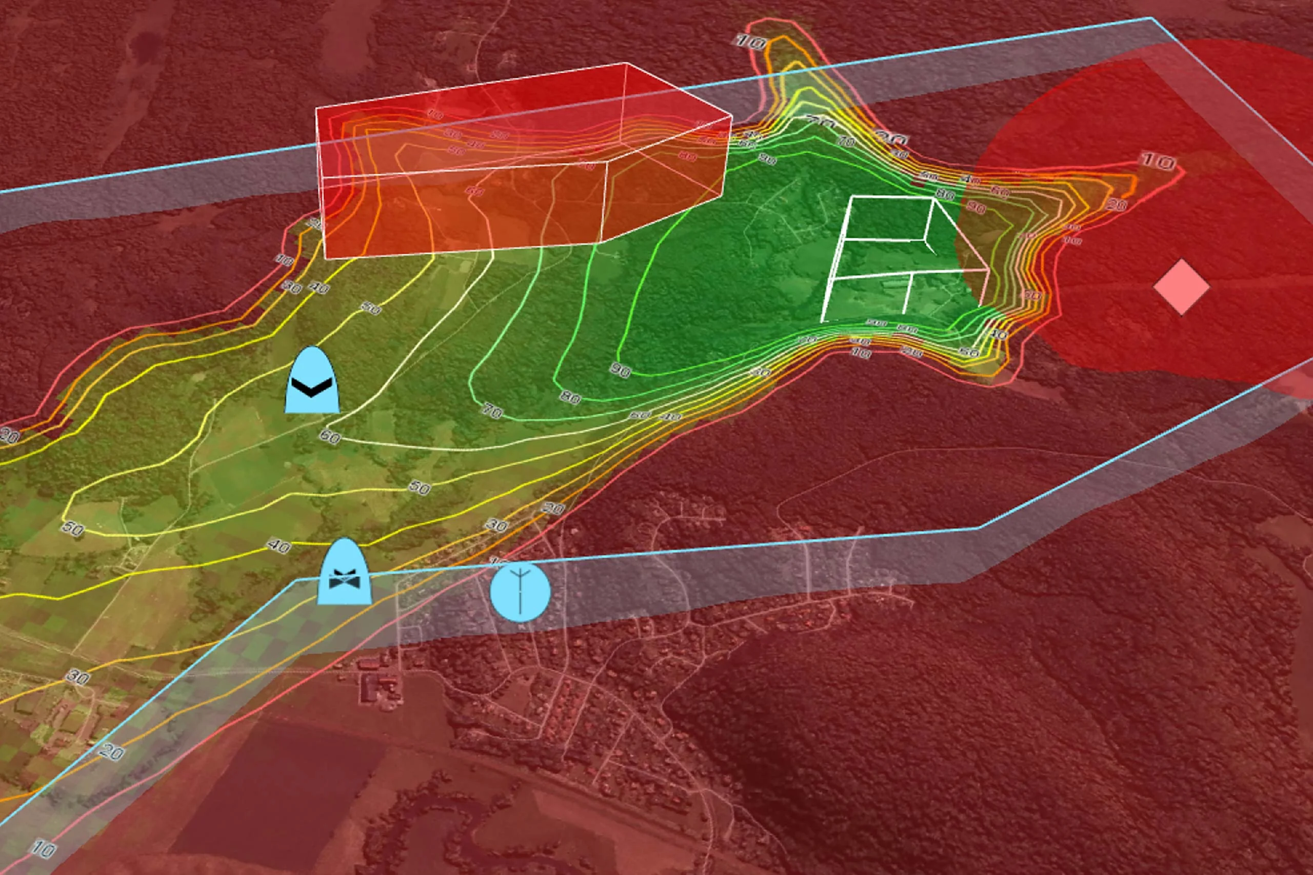
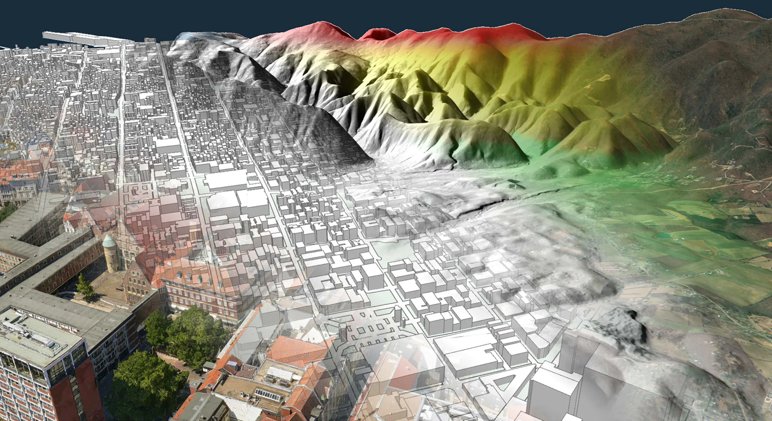
Furthermore, Carmenta’s technology enables the calculation of omnidirectional travel times from a specified starting point, resulting in so-called isochrones. Based on these calculated isochrones, an operator can determine the distance a vehicle can travel in a given time, identify the optimal points of entry to reach a target location, or make rough predictions about an enemy vehicle’s location in a certain amount of time.
The integration of isochrones as a color-coded overlay into a map makes it simple to evaluate the mobility of vehicles in a single glance.
Use Case: UGV Mobility
Achieving operational efficiency in both semi- and fully autonomous UGV routing and mission execution requires route optimization, dynamic mission planning, and real-time environmental awareness. This underscores the need for robust geospatial technologies and well-integrated autonomy stacks.
Article: AI-Powered Geospatial Intelligence
Using AI-assisted computer vision, robust, near-live navigability maps and terrain analyses – continuously adapted to any detected changes – are created using 3D reconstruction, object recognition and scene-based analysis.
Develop More in Less Time
Leveraging an SDK does not only accelerate the development process and cut costs, it also increases application robustness and reliability.
Related Features
Radio Coverage
Placement of Observers
Landing Zones
Camera Focused Planning
Geospatial Data from Any Source
Interoperability
Cross-Platform Development

High-Performance Rendering

Military Tactical Overlays
Georeferenced Video

Aeronautical Charts
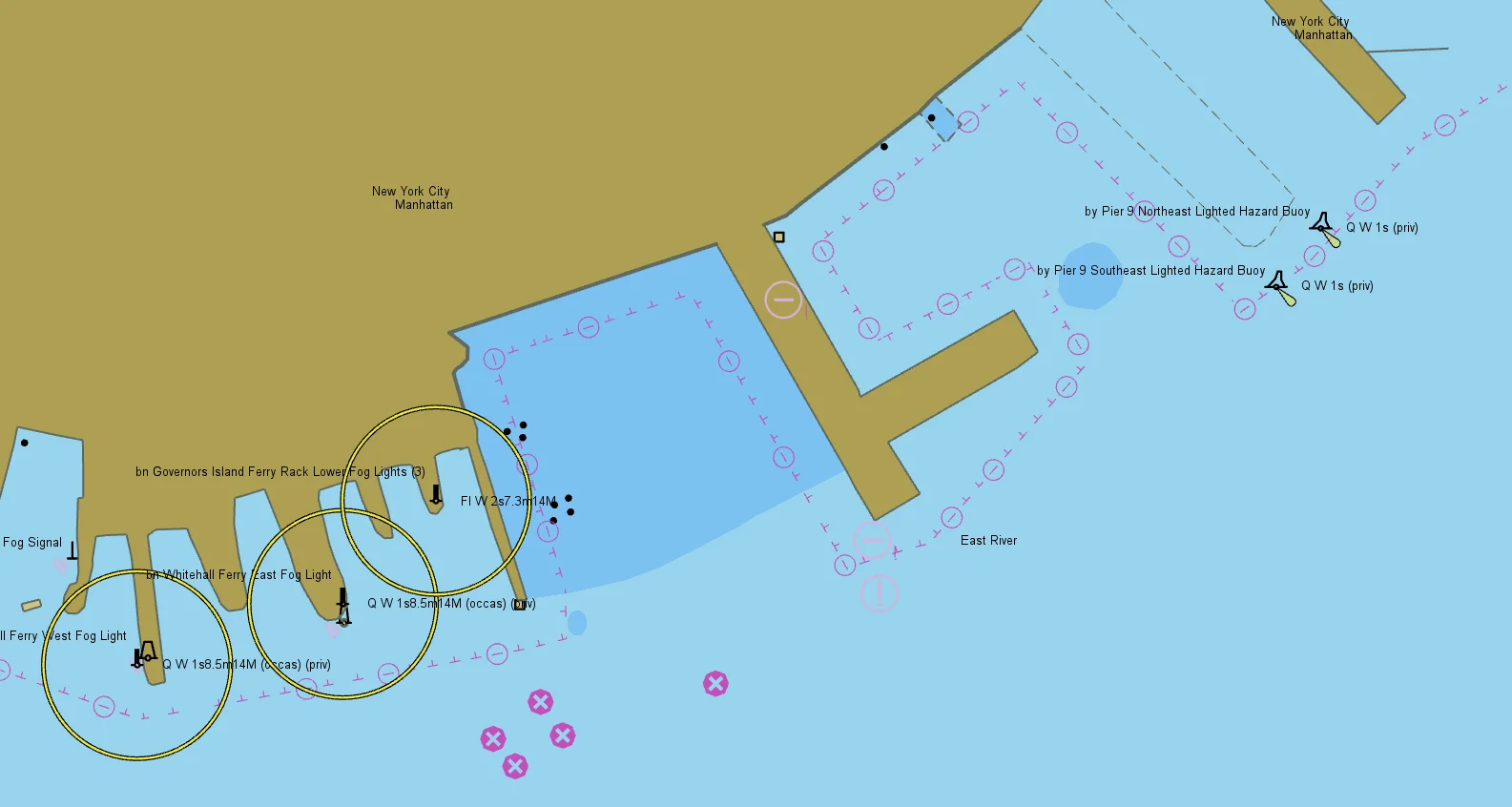
Nautical Charts
Meteorological Data

Tactical Drone Routing
Terrain Analysis
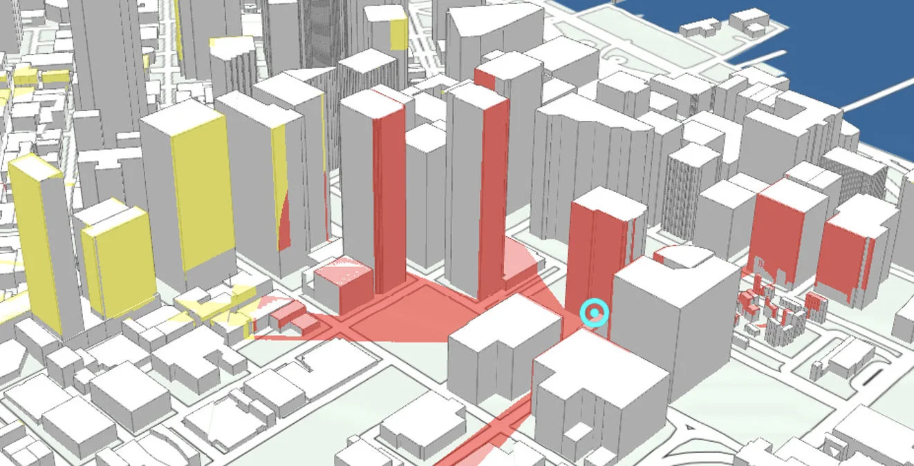
Visibility Analysis
Radar Data